Safety Score: 3,0 of 5.0 based on data from 9 authorites. Meaning we advice caution when travelling to Germany.
Travel warnings are updated daily. Source: Travel Warning Germany. Last Update: 2024-08-13 08:21:03
Touring Breitungen
Breitungen in Saxony-Anhalt with it's 513 residents is a town located in Germany about 123 mi (or 198 km) south-west of Berlin, the country's capital place.
Time in Breitungen is now 04:25 PM (Tuesday). The local timezone is named Europe / Berlin with an UTC offset of one hour. We know of 12 airports nearby Breitungen, of which 5 are larger airports. The closest airport in Germany is Erfurt Airport in a distance of 36 mi (or 58 km), South. Besides the airports, there are other travel options available (check left side).
There are several Unesco world heritage sites nearby. The closest heritage site in Germany is Collegiate Church, Castle and Old Town of Quedlinburg in a distance of 20 mi (or 32 km), North. Need some hints on where to stay? We compiled a list of available hotels close to the map centre further down the page.
Being here already, you might want to pay a visit to some of the following locations: Berga, Gorsbach, Urbach, Wallhausen and Ichstedt. To further explore this place, just scroll down and browse the available info.
Local weather forecast
Todays Local Weather Conditions & Forecast: 10°C / 49 °F
| Morning Temperature | 4°C / 40 °F |
| Evening Temperature | 9°C / 48 °F |
| Night Temperature | 7°C / 45 °F |
| Chance of rainfall | 0% |
| Air Humidity | 68% |
| Air Pressure | 1026 hPa |
| Wind Speed | Light breeze with 3 km/h (2 mph) from South-West |
| Cloud Conditions | Broken clouds, covering 64% of sky |
| General Conditions | Broken clouds |
Wednesday, 6th of November 2024
11°C (51 °F)
7°C (45 °F)
Scattered clouds, light breeze.
Thursday, 7th of November 2024
10°C (50 °F)
6°C (43 °F)
Scattered clouds, light breeze.
Friday, 8th of November 2024
7°C (45 °F)
6°C (43 °F)
Few clouds, light breeze.
Hotels and Places to Stay
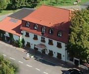
Sachsenhof Landhotel
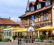
Kaiserhof
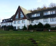
Land-gut-Hotel Barbarossa
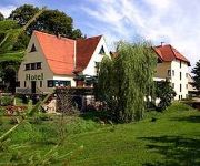
A.L. Harzhotel Fuenf Linden
Videos from this area
These are videos related to the place based on their proximity to this place.
City live @ Emmenrausch Kelbra September 2009
City in der Best of Best - Besetzung mit Toni Krahl, Fritz Puppel, Klaus Selmke, Georgi Gogow und Manfred Hennig am Stausee Kelbra zum Emmenrausch 2009. Fast alle großen Hits gespielt - nicht...
Pankow live @ Emmenrausch Kelbra September 2009 - Teil 1
André Herzberg, Jürgen Ehle, Stefan Dohanetz, Kulle Dziuk und Ingo York live am Stausee Kelbra zum Emmenrausch / Rockrausch 2009.
Pankow live @ Emmenrausch Kelbra September 2009 - Teil 2
André Herzberg, Jürgen Ehle, Stefan Dohanetz, Kulle Dziuk und Ingo York live am Stausee Kelbra zum Emmenrausch / Rockrausch 2009.
Road racing on my XVS 1100 Dragstar chopper.
På min mc ferie til Harzen fik jeg testet min kværn på "kyffen" Presset til det yderste, gik også på med pedalerne et par gange.....
Videos provided by Youtube are under the copyright of their owners.
Attractions and noteworthy things
Distances are based on the centre of the city/town and sightseeing location. This list contains brief abstracts about monuments, holiday activities, national parcs, museums, organisations and more from the area as well as interesting facts about the region itself. Where available, you'll find the corresponding homepage. Otherwise the related wikipedia article.
Roßla-Südharz
Roßla-Südharz was a Verwaltungsgemeinschaft ("collective municipality") in the Mansfeld-Südharz district, in Saxony-Anhalt, Germany. It was situated in the southern part of the Harz, west of Sangerhausen. The seat of the Verwaltungsgemeinschaft was in Roßla. It was disbanded on 1 January 2010. The Verwaltungsgemeinschaft Roßla-Südharz consisted of the following municipalities (population in 2005 between brackets):
Glasebach (Bauerngraben)
The Glasebach (Bauerngraben) is a stream of Saxony-Anhalt, Germany. It rises near Dietersdorf east of the source region of the Nasse and south of the source region of the Schöneberger Wipper, a headstream of the Wipper. The Glasebach flows through the Borntal valley and has a tributary near Agnesdorf. Finally it flows through the Bauerngraben, where it seeps into the gypsum in the southern part of the lake basin.
Bauerngraben (nature reserve)
The Bauerngraben, also called the Hungersee, is a nature reserve in Germany between Breitungen, Agnesdorf and Roßla in the South Harz. It is an intermittent lake of about 350 metres in length and 100 metres in width, into which the Glasebach disappears. A feature of this lake is its sudden disappearance from time to time, when the outlet opens due to the removal of material. The lake can then become dry for a long period. The Karst Trail runs through the area.


