Safety Score: 3,0 of 5.0 based on data from 9 authorites. Meaning we advice caution when travelling to Germany.
Travel warnings are updated daily. Source: Travel Warning Germany. Last Update: 2024-08-13 08:21:03
Delve into Westrich
Westrich in Rhineland-Palatinate is a city located in Germany about 340 mi (or 548 km) south-west of Berlin, the country's capital town.
Current time in Westrich is now 01:20 AM (Wednesday). The local timezone is named Europe / Berlin with an UTC offset of one hour. We know of 10 airports closer to Westrich, of which 3 are larger airports. The closest airport in Germany is Zweibrücken Airport in a distance of 8 mi (or 12 km), South-West. Besides the airports, there are other travel options available (check left side).
There are several Unesco world heritage sites nearby. The closest heritage site in Germany is Völklingen Ironworks in a distance of 30 mi (or 48 km), West. In need of a room? We compiled a list of available hotels close to the map centre further down the page.
Since you are here already, you might want to pay a visit to some of the following locations: Schmitshausen, Reifenberg, Biedershausen, Wallhalben and Knopp-Labach. To further explore this place, just scroll down and browse the available info.
Local weather forecast
Todays Local Weather Conditions & Forecast: 13°C / 56 °F
| Morning Temperature | 7°C / 44 °F |
| Evening Temperature | 10°C / 50 °F |
| Night Temperature | 8°C / 46 °F |
| Chance of rainfall | 0% |
| Air Humidity | 71% |
| Air Pressure | 1029 hPa |
| Wind Speed | Light breeze with 4 km/h (2 mph) from South-West |
| Cloud Conditions | Few clouds, covering 10% of sky |
| General Conditions | Sky is clear |
Thursday, 7th of November 2024
12°C (54 °F)
6°C (44 °F)
Sky is clear, gentle breeze, clear sky.
Friday, 8th of November 2024
12°C (54 °F)
7°C (44 °F)
Sky is clear, light breeze, clear sky.
Saturday, 9th of November 2024
14°C (57 °F)
7°C (44 °F)
Sky is clear, light breeze, few clouds.
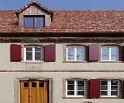
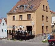
Hotels and Places to Stay
Landgrafen-Mühle
Weihermühle Landhotel
Alte Bäckerei Gästehaus
Zur Alten Scheune Hotel-Restaurant
Bärmann Gasthaus
Videos from this area
These are videos related to the place based on their proximity to this place.
Thaleischweiler-Fröschen [D] - Protestantische Kirche - Vollgeläute (Turmaufnahme)
Disposition: e' - g' - a' - h' - d" Läutedauer: 09.51 Uhr - 10.00 Uhr Informationen zu dieser Kirche findet ihr unter dem folgenden Link: http://www.thaleischweiler.de/ev-kirche/ Das Geläut...
11 Hügel Tour Road Cycling Video for Intervall Indoor Bike Training 70 Minute Full HD
11 Hügel Tour 110 Kilometer 1550 Höhenmeter max.18% Steigung German Road Cycling Video for Indoor Training 70 Minute Full HD Ideal für ein Intervall Indoor Training! Bike Trainer Video Good...
Schlamassel im Schlamm
Das Grauen hat einen Namen... Nix passiert. Der VW läuft und läuft und läuft...
Martinshöhe [D] - Pfarrkirche St. Martin - Vollgeläute (Turmaufnahme)
Disposition: es' - f' - g' - b' Läutedauer: 10.20 Uhr - 10.28 Uhr Ein katholisches Gotteshaus hatte Martinshöhe erst 1749. Da die Gemeinde wuchs, plante man eine eigene Pfarrkirche zu bauen....
Fahrt ins Weiße
Die Fahrt nach Zweibrücken war sehr abenteuerreich. Die Straßen waren durch den Schnee kaum zu sehen. Deutlicher kann man es kaum ausdrücken: Das Streusalz ist knapp!
Wiesbach (Pfalz) [D] - Pfarrkirche Mariä Himmelfahrt - Vollgeläute (Turmaufnahme)
Disposition: fis' - a' - h' Läutedauer: 08.47 Uhr - 08.58 Uhr Die heutige Pfarrkirche Mariä Himmelfahrt im pfälzischen Wiesbach wurde zwischen 1912 bis 1914 durch den Architekten Dünbier...
Timelapse - Clouds - Höheischweiler, Germany
Short Timelapse of clouds over Höheischweiler, Germany.
Videos provided by Youtube are under the copyright of their owners.
Attractions and noteworthy things
Distances are based on the centre of the city/town and sightseeing location. This list contains brief abstracts about monuments, holiday activities, national parcs, museums, organisations and more from the area as well as interesting facts about the region itself. Where available, you'll find the corresponding homepage. Otherwise the related wikipedia article.
Wallhalben (Verbandsgemeinde)
Wallhalben is a Verbandsgemeinde ("collective municipality") in the Südwestpfalz district, in Rhineland-Palatinate, Germany. The seat of the municipality is in Wallhalben. The Verbandsgemeinde Wallhalben consists of the following Ortsgemeinden ("local municipalities"): Biedershausen Herschberg Hettenhausen Knopp-Labach Krähenberg Obernheim-Kirchenarnbach Saalstadt Schauerberg Schmitshausen Wallhalben Weselberg


!['Thaleischweiler-Fröschen [D] - Protestantische Kirche - Vollgeläute (Turmaufnahme)' preview picture of video 'Thaleischweiler-Fröschen [D] - Protestantische Kirche - Vollgeläute (Turmaufnahme)'](https://img.youtube.com/vi/sPrhyXZSOHM/mqdefault.jpg)


!['Martinshöhe [D] - Pfarrkirche St. Martin - Vollgeläute (Turmaufnahme)' preview picture of video 'Martinshöhe [D] - Pfarrkirche St. Martin - Vollgeläute (Turmaufnahme)'](https://img.youtube.com/vi/FYvaRph8Dyw/mqdefault.jpg)


!['Wiesbach (Pfalz) [D] - Pfarrkirche Mariä Himmelfahrt - Vollgeläute (Turmaufnahme)' preview picture of video 'Wiesbach (Pfalz) [D] - Pfarrkirche Mariä Himmelfahrt - Vollgeläute (Turmaufnahme)'](https://img.youtube.com/vi/aXglXWUl1aU/mqdefault.jpg)


