Safety Score: 3,0 of 5.0 based on data from 9 authorites. Meaning we advice caution when travelling to Germany.
Travel warnings are updated daily. Source: Travel Warning Germany. Last Update: 2024-08-13 08:21:03
Delve into Udler
Udler in Rhineland-Palatinate with it's 312 habitants is located in Germany about 326 mi (or 525 km) south-west of Berlin, the country's capital town.
Current time in Udler is now 04:39 AM (Friday). The local timezone is named Europe / Berlin with an UTC offset of one hour. We know of 10 airports close to Udler, of which 4 are larger airports. The closest airport in Germany is Bitburg Airport in a distance of 19 mi (or 31 km), South-West. Besides the airports, there are other travel options available (check left side).
There are several Unesco world heritage sites nearby. The closest heritage site in Germany is Roman Monuments, Cathedral of St Peter and Church of Our Lady in Trier in a distance of 29 mi (or 46 km), South. We encountered 1 points of interest near this location. If you need a hotel, we compiled a list of available hotels close to the map centre further down the page.
While being here, you might want to pay a visit to some of the following locations: Saxler, Gillenfeld, Wallscheid, Brockscheid and Eckfeld. To further explore this place, just scroll down and browse the available info.
Local weather forecast
Todays Local Weather Conditions & Forecast: 0°C / 33 °F
| Morning Temperature | -3°C / 26 °F |
| Evening Temperature | 0°C / 33 °F |
| Night Temperature | 0°C / 32 °F |
| Chance of rainfall | 1% |
| Air Humidity | 78% |
| Air Pressure | 1007 hPa |
| Wind Speed | Moderate breeze with 10 km/h (6 mph) from North-East |
| Cloud Conditions | Overcast clouds, covering 88% of sky |
| General Conditions | Snow |
Saturday, 23rd of November 2024
0°C (33 °F)
2°C (36 °F)
Overcast clouds, moderate breeze.
Sunday, 24th of November 2024
8°C (46 °F)
8°C (46 °F)
Overcast clouds, moderate breeze.
Monday, 25th of November 2024
9°C (48 °F)
7°C (44 °F)
Moderate rain, moderate breeze, overcast clouds.
Hotels and Places to Stay
Sporthotel & Resort Grafenwald Daun / Vulkaneifel
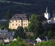
Kurfürstliches Amtshaus Dauner Burg Schloßhotel
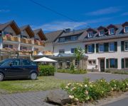
Gillenfelder Hof Landhotel
Maarberg Resort Ferienwohnungen
Schneider am Maar Eifel Selektion
Krebs Landgasthaus
Schend Landhaus
Kucher's Landhotel
Zum Siebenbachtal
Stadt Daun
Videos from this area
These are videos related to the place based on their proximity to this place.
Eckfeld, baking bread, Eifel - Germany 1080p50 Travel Channel
Eckfeld, baking bread - Germany http://www.myvideomedia.de English see below Eckfeld, ein kleines Eifeldorf mit 400 Einwohnern, wurde weltweit bekannt, als bei Ausgrabungen urzeitliche Fische,...
Boerderij Eckfeld 5 personen DE-54531-23 Duitsland Holiday Home - Belvilla Vakantiehuizen
Bekijk dit Belvilla vakantiehuis in de Eifel (Duitsland): http://www.belvilla.nl/dv/vdo/vakantiehuizen/eckfeld-5-personen-DE-54531-23 Deze modern ingerichte vakantiewoning (94m2) is gelegen...
Vulcano Brennstoffe Bilder VULKAN-Cross-Triathlon Schalkenmehren 2014
www.brennstoffe-vulcano.de: Pellets, Holzbriketts, Brennholz.
Tourenfilm Routenteam Eifel-Motorrad - Die Vulkaneifel
Dort wo die Eifel am ursprünglichsten ist, wo sich Burgen und Maare aneinander reihen, liegt die Vulkaneifel. Gemeinsam mit unseren Protagonisten vom Routenteam Eifel-Motorrad, könnt Ihr...
Romantik Schloss-Hotel Kurfürstliches Amtshaus Dauner Burg in Daun
Der Schlummer Atlas über dieses Haus: "Geschmackvoll und edel ist das Ambiente des Schloss-Hotels. Ruhig auf einem Vulkankegel über Daun gelegen, verspricht das Haus höchsten Komfort und...
F-Schlepp C42 - Twin Astir - Flugplatz Daun-Senheld
F-Schlepp eines Doppelsitzer-Segelflugzeug "Grob Twin Astir RG" durch ein 100PS Ultraleicht-Flugzeug "Comco Ikarus C42". Flugplatz Daun-Senheld. Pistenlänge nur 480m, daher liebevoll ...
Bundes BdSJ: Tooltime / Die BJT 2012 in Daun / Tag 1
Ihr seht hier den Rückblick auf den ersten Tag der BJT 2012 in Daun (Eifel) in der Diözese Trier. Hauptsächlich seht ihr hierbei den Auftritt der Band TOOLTIME, aber auch die Eröffnungsrede...
Eifelsteig 3: Daun - Manderscheid
Wandelen van Daun naar Manderscheid, een van de mooiste etappes van de Eifelsteig. We lopen o.a. langs het Totenmaar en het Schalkenmehrener Maar. Kijk op www.eifelsteig.nl. Trektocht boeken ...
Jugendfeuerwehr Daun - Kurparkfest 2013
Zum 21. Mal fand das von der Verbandsgemeindejugendpflege Daun und zahlreichen Vereinen und Institutionen veranstaltete Kurparkfest statt. Das Fest erfreut sich großer Beliebtheit bei Familien...
Videos provided by Youtube are under the copyright of their owners.
Attractions and noteworthy things
Distances are based on the centre of the city/town and sightseeing location. This list contains brief abstracts about monuments, holiday activities, national parcs, museums, organisations and more from the area as well as interesting facts about the region itself. Where available, you'll find the corresponding homepage. Otherwise the related wikipedia article.
Hoher List Observatory
The Hoher List Observatory (German: Observatorium Hoher List) is an astronomical observatory located about 60 km south of Bonn, Germany, near the town of Daun in the mountain range of Eifel. The observatory is operated by the Argelander Institute for Astronomy of the University of Bonn. Until the 1940s, Bonn astronomical observations were carried out mainly from Argelander's old observatory in Bonn itself.


