Safety Score: 3,0 of 5.0 based on data from 9 authorites. Meaning we advice caution when travelling to Germany.
Travel warnings are updated daily. Source: Travel Warning Germany. Last Update: 2024-08-13 08:21:03
Delve into Sackenheimerhöfe
Sackenheimerhöfe in Rhineland-Palatinate is a city located in Germany about 299 mi (or 481 km) south-west of Berlin, the country's capital town.
Current time in Sackenheimerhöfe is now 09:28 AM (Friday). The local timezone is named Europe / Berlin with an UTC offset of one hour. We know of 12 airports closer to Sackenheimerhöfe, of which 5 are larger airports. The closest airport in Germany is Frankfurt-Hahn Airport in a distance of 28 mi (or 45 km), South. Besides the airports, there are other travel options available (check left side).
There are several Unesco world heritage sites nearby. The closest heritage site in Germany is Upper Middle Rhine Valley in a distance of 17 mi (or 27 km), South-East. We saw 1 points of interest near this location. In need of a room? We compiled a list of available hotels close to the map centre further down the page.
Since you are here already, you might want to pay a visit to some of the following locations: Ochtendung, Lonnig, Saffig, Bassenheim and Wolken. To further explore this place, just scroll down and browse the available info.
Local weather forecast
Todays Local Weather Conditions & Forecast: 2°C / 35 °F
| Morning Temperature | -1°C / 30 °F |
| Evening Temperature | 2°C / 36 °F |
| Night Temperature | 2°C / 36 °F |
| Chance of rainfall | 1% |
| Air Humidity | 85% |
| Air Pressure | 1006 hPa |
| Wind Speed | Moderate breeze with 10 km/h (6 mph) from North-East |
| Cloud Conditions | Broken clouds, covering 81% of sky |
| General Conditions | Snow |
Saturday, 23rd of November 2024
3°C (37 °F)
4°C (39 °F)
Overcast clouds, moderate breeze.
Sunday, 24th of November 2024
11°C (52 °F)
7°C (45 °F)
Overcast clouds, moderate breeze.
Monday, 25th of November 2024
11°C (52 °F)
9°C (48 °F)
Light rain, moderate breeze, overcast clouds.
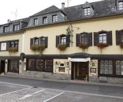
Hotels and Places to Stay
food hotel
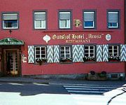
Gutshof Arosa
Zur Kupferkanne
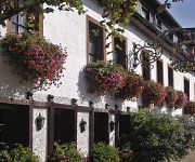
Hotel-Weinhaus Heinrich Haupt
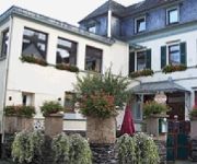
Hotel Simonis
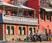
Geromont Restaurant
Kachelburg
Pistono
Traube Niederfell Gasthaus
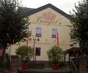
Bengel´s
Videos from this area
These are videos related to the place based on their proximity to this place.
23.10.2014 LKW brannte vollständig aus
Nahe Ochtendung geriet ein LKW in Brand. In den frühen Morgenstunden des heutigen Donnerstags geriet auf der Autobahn 48 ein LKW in Brand. Der Fahrer bemerkte das ausbrechende Feuer und ...
UAV-Befliegung der Zentraldeponie Eiterköpfe
Die Drohnentechnik kommt bei BCE zum Einsatz! Vermessung der Zentraldeponie Eiterköpfe in Ochtendung, Rheinland-Pfalz mit Hilfe eines UAV (unmanned aerial vehicle). Aus den Drohnenbildern...
Hör auf unsern Rat (Cover) by Leon
Leon covert "Hör auf unsern Rat" von Eure Mütter auf einer Hochzeit in Ochtendung (Waldorfer Höfe) am 18.8.2012. Es ist nicht anspruchsvoll, aber macht definitiv gute Laune :-)
[Sound] Bus Mercedes O 530 G (KO-MV 168) der Rhein-Mosel Verkehrsgesellschaft mbH, Koblenz
Bus: Mercedes O 530 G Kfz-Kennzeichen: KO-MV 168 Baujahr: 2003 Firma: Rhein-Mosel Verkehrsgesellschaft mbH, Koblenz Anzahl: 7 Typ im Einsatz seit: 2003 Aufgenommen auf der Linie: 353 Von: ...
[Sound] Bus MAN NÜ 323 (KO-MV 262) der Rhein-Mosel Verkehrsgesellschaft mbH, Koblenz
Bus: MAN NÜ 323 Kfz-Kennzeichen: KO-MV 262 Baujahr: 2006 Firma: Rhein-Mosel Verkehrsgesellschaft mbH, Koblenz Anzahl: -- Typ im Einsatz seit: 2005 Aufgenommen auf der Linie: 359 Von: ...
Moselsteig - Niederburg bei Kobern-Gondorf
Blick von der Niederburg auf das Moseltal und das unterhalb der Burg liegende Kobern-Gondorf. Aufgenommen anlässlich einer Wanderung auf dem Moselsteig. April 2014. Hier der Link auf den ...
Trial DM 2010 in Dreckenach
Lauf zur Deutschen Trial Meisterschaft 2010 in Dreckenach bei Kobern Gondorf.
Videos provided by Youtube are under the copyright of their owners.
Attractions and noteworthy things
Distances are based on the centre of the city/town and sightseeing location. This list contains brief abstracts about monuments, holiday activities, national parcs, museums, organisations and more from the area as well as interesting facts about the region itself. Where available, you'll find the corresponding homepage. Otherwise the related wikipedia article.
Goloring
The Goloring is an ancient earthworks monument located near Koblenz, Germany. It was created in the Bronze Age era, which dates back to the Urnfield culture. During this time a widespread solar cult is believed to have existed in Central Europe. The Goloring consists of a circular ditch of 175 metres in diameter with an outside embankment extending to 190 metres. Technically this makes the structure a henge monument, although the use of the term henge outside of Britain is sometimes disputed.
Untermosel
Untermosel is a Verbandsgemeinde ("collective municipality") in the district Mayen-Koblenz, in Rhineland-Palatinate, Germany. It is situated along the lower course of the Mosel, south-west of Koblenz. The seat of the municipality is in Kobern-Gondorf. The Verbandsgemeinde Untermosel consists of the following Ortsgemeinden ("local municipalities"): Alken Brodenbach Burgen Dieblich Hatzenport Kobern-Gondorf Lehmen Löf Macken Niederfell Nörtershausen Oberfell Winningen






!['[Sound] Bus Mercedes O 530 G (KO-MV 168) der Rhein-Mosel Verkehrsgesellschaft mbH, Koblenz' preview picture of video '[Sound] Bus Mercedes O 530 G (KO-MV 168) der Rhein-Mosel Verkehrsgesellschaft mbH, Koblenz'](https://img.youtube.com/vi/T9UTfbSnxgE/mqdefault.jpg)
!['[Sound] Bus MAN NÜ 323 (KO-MV 262) der Rhein-Mosel Verkehrsgesellschaft mbH, Koblenz' preview picture of video '[Sound] Bus MAN NÜ 323 (KO-MV 262) der Rhein-Mosel Verkehrsgesellschaft mbH, Koblenz'](https://img.youtube.com/vi/G1JI1Nb5aXU/mqdefault.jpg)


