Safety Score: 3,0 of 5.0 based on data from 9 authorites. Meaning we advice caution when travelling to Germany.
Travel warnings are updated daily. Source: Travel Warning Germany. Last Update: 2024-08-13 08:21:03
Delve into Plittersdorf
Plittersdorf in Rhineland-Palatinate is located in Germany about 312 mi (or 503 km) south-west of Berlin, the country's capital town.
Current time in Plittersdorf is now 10:59 PM (Thursday). The local timezone is named Europe / Berlin with an UTC offset of one hour. We know of 11 airports close to Plittersdorf, of which 5 are larger airports. The closest airport in Germany is Norvenich Airport in a distance of 25 mi (or 41 km), North-West. Besides the airports, there are other travel options available (check left side).
There are several Unesco world heritage sites nearby. The closest heritage site in Germany is Castles of Augustusburg and Falkenlust at Brühl in a distance of 23 mi (or 36 km), North. We encountered 2 points of interest near this location. If you need a hotel, we compiled a list of available hotels close to the map centre further down the page.
While being here, you might want to pay a visit to some of the following locations: Lind, Kirchsahr, Sierscheid, Harscheid and Honningen. To further explore this place, just scroll down and browse the available info.
Local weather forecast
Todays Local Weather Conditions & Forecast: 1°C / 33 °F
| Morning Temperature | 1°C / 33 °F |
| Evening Temperature | -2°C / 29 °F |
| Night Temperature | -3°C / 27 °F |
| Chance of rainfall | 0% |
| Air Humidity | 72% |
| Air Pressure | 1000 hPa |
| Wind Speed | Gentle Breeze with 9 km/h (5 mph) from South-East |
| Cloud Conditions | Overcast clouds, covering 100% of sky |
| General Conditions | Overcast clouds |
Friday, 22nd of November 2024
1°C (34 °F)
1°C (34 °F)
Rain and snow, moderate breeze, overcast clouds.
Saturday, 23rd of November 2024
2°C (35 °F)
3°C (37 °F)
Overcast clouds, moderate breeze.
Sunday, 24th of November 2024
9°C (47 °F)
10°C (49 °F)
Overcast clouds, fresh breeze.
Hotels and Places to Stay
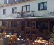
Zum Sahrtal
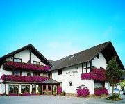
Hochthürmer-Blick Garni
Ewerts Landhotel
Keuler Landgasthaus
Strohe Gasthaus
Lang
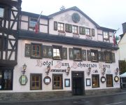
Zum Schwarzen Kreuz
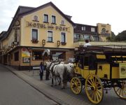
Land-gut-Hotel Zur Post
Ruland
Eifelpension Brückenschenke
Videos from this area
These are videos related to the place based on their proximity to this place.
Ahrbrück- Katharinenkapelle: Morgendämmerung (Zeitraffer) im Winter
Der Tag erwacht über der Katharinenkapelle in Ahrbrück. Erster Versuch mit der Zeitrafferfunktion (Ein Bild pro 2 Sekunden). Im Sommer muss ich mal mit Barzens' Rainer wegen des Baumes sprechen ...
Kranzniederlegung Trompetenspiel Ahrbrück-Brück
Brücker Kirmes, Trompetenspiel anlässlich der Kranzniederlegung am Ehrenmal.
Erstkommunion in Ahrbrück - Tauben fliegen
Am 2. Tag der Erstkommunion 2009 wurden vor der Kirche in Ahrbrück für alle die weißen Vögel losgelassen.
Trebuchet-Nachtschiessen: Feuerkugeln!
Nachtschiessen mit Feuerkugeln im Vorfeld zur 3. Deutschen Meisterschaft im Melonenweitschiessen in Ahrbrück-Brück.. Sehr imposant ist der Trebuchet mit 800 kg Gegengewicht.
Baumfällen auf der Ohsedraenk
Fällen eines morschen Baums in Ahrbrück, Versicherungsfall, oder nicht???? Dachbeschädigung im Rahmen.
Karnevalseröffnung Hönningen 10.11.2012: Tanz der gr. Funken
Karnevalseröffnung Hönningen 2012, Tanz der älteren Funken.
Videos provided by Youtube are under the copyright of their owners.
Attractions and noteworthy things
Distances are based on the centre of the city/town and sightseeing location. This list contains brief abstracts about monuments, holiday activities, national parcs, museums, organisations and more from the area as well as interesting facts about the region itself. Where available, you'll find the corresponding homepage. Otherwise the related wikipedia article.
Effelsberg 100-m Radio Telescope
The Effelsberg 100-m Radio Telescope is a radio telescope in the Ahrgebirge (part of the Eifel) in Bad Münstereifel, district of Euskirchen, North Rhine-Westphalia, Germany.
Ahr Hills
The Ahr Hills (German: Ahrgebirge or Ahreifel) are a range of low mountains and hills up to 623 m high and 25 kilometres long in the Eifel region of Germany, which lie roughly southwest of Bonn on the border between the German states of North Rhine-Westphalia and Rhineland-Palatinate. The forested Ahr Hills have numerous tourist destinations and the section of a Roman road with its ancient Eifel Aqueduct.


