Safety Score: 3,0 of 5.0 based on data from 9 authorites. Meaning we advice caution when travelling to Germany.
Travel warnings are updated daily. Source: Travel Warning Germany. Last Update: 2024-08-13 08:21:03
Delve into Rieschweiler
The district Rieschweiler of Nünschweiler in Rhineland-Palatinate is a district located in Germany about 343 mi south-west of Berlin, the country's capital town.
In need of a room? We compiled a list of available hotels close to the map centre further down the page.
Since you are here already, you might want to pay a visit to some of the following locations: Rieschweiler-Muehlbach, Dellfeld, Reifenberg, Walshausen and Massweiler. To further explore this place, just scroll down and browse the available info.
Local weather forecast
Todays Local Weather Conditions & Forecast: 6°C / 42 °F
| Morning Temperature | 1°C / 34 °F |
| Evening Temperature | 4°C / 39 °F |
| Night Temperature | 5°C / 40 °F |
| Chance of rainfall | 0% |
| Air Humidity | 75% |
| Air Pressure | 1031 hPa |
| Wind Speed | Light breeze with 5 km/h (3 mph) from South-West |
| Cloud Conditions | Overcast clouds, covering 100% of sky |
| General Conditions | Light rain |
Thursday, 14th of November 2024
9°C (48 °F)
3°C (38 °F)
Light rain, light breeze, broken clouds.
Friday, 15th of November 2024
8°C (47 °F)
3°C (37 °F)
Few clouds, light breeze.
Saturday, 16th of November 2024
7°C (45 °F)
3°C (38 °F)
Sky is clear, light breeze, clear sky.
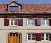
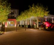
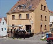
Hotels and Places to Stay
Landgrafen-Mühle
Kunz
Zur Alten Scheune Hotel-Restaurant
Weihermühle Landhotel
Dorfschenke
Alte Bäckerei Gästehaus
Bärmann Gasthaus
Videos from this area
These are videos related to the place based on their proximity to this place.
Thaleischweiler-Fröschen [D] - Protestantische Kirche - Vollgeläute (Turmaufnahme)
Disposition: e' - g' - a' - h' - d" Läutedauer: 09.51 Uhr - 10.00 Uhr Informationen zu dieser Kirche findet ihr unter dem folgenden Link: http://www.thaleischweiler.de/ev-kirche/ Das Geläut...
11 Hügel Tour Road Cycling Video for Intervall Indoor Bike Training 70 Minute Full HD
11 Hügel Tour 110 Kilometer 1550 Höhenmeter max.18% Steigung German Road Cycling Video for Indoor Training 70 Minute Full HD Ideal für ein Intervall Indoor Training! Bike Trainer Video Good...
Schlamassel im Schlamm
Das Grauen hat einen Namen... Nix passiert. Der VW läuft und läuft und läuft...
Wiesbach (Pfalz) [D] - Pfarrkirche Mariä Himmelfahrt - Vollgeläute (Turmaufnahme)
Disposition: fis' - a' - h' Läutedauer: 08.47 Uhr - 08.58 Uhr Die heutige Pfarrkirche Mariä Himmelfahrt im pfälzischen Wiesbach wurde zwischen 1912 bis 1914 durch den Architekten Dünbier...
Timelapse - Clouds - Höheischweiler, Germany
Short Timelapse of clouds over Höheischweiler, Germany.
Modenschau Samira Dreiherrenhalle Petersberg Germany 15.3.2014 T2
1 Making of Clip sowie7 Clips zeigen die Modenschau von "Samira" Brautmoden und Abendkleidung in Petersberg in der Dreherrensteinhalle. Samira Brautmoden Vinningen/Germany Verschiedene ...
nevershoutnever. 1st vid(:
yea..not really looking for any type of stardom, i know i'm not all that good(: but idc(:
Contwig-Stambach [D] - Christuskirche - Sondergeläute (Turmaufnahme)
Disposition: g' - b' - d" Die Christuskirche wurde zwischen 1963 bis 1965 des Zweibrücker Architekten Ernst Krauss erbaut. Am 16. Mai 1965 erfolgte anschließend die Einweihung der Kirche....
Videos provided by Youtube are under the copyright of their owners.
Attractions and noteworthy things
Distances are based on the centre of the city/town and sightseeing location. This list contains brief abstracts about monuments, holiday activities, national parcs, museums, organisations and more from the area as well as interesting facts about the region itself. Where available, you'll find the corresponding homepage. Otherwise the related wikipedia article.
Südwestpfalz
Südwestpfalz is a district (Kreis) in the south of Rhineland-Palatinate, Germany. Neighboring districts are (from west clockwise) Saarpfalz, the district-free city Zweibrücken, the districts Kaiserslautern and Bad Dürkheim, the district-free city Landau (the Taubensuhl/Fassendeich forest part of the city), Südliche Weinstraße, and the French département Bas-Rhin. The district-free city Pirmasens is surrounded by the district.
Zweibrücken Air Base
Zweibrücken Air Base was a NATO air base in West Germany. It was located 35 miles SSW of Kaiserslautern and 2 miles mi SE of Zweibrücken. It was assigned to the Royal Canadian Air Force (RCAF) and the United States Air Forces in Europe (USAFE) during its operational lifetime. The military facility was closed in 1991 after the Cold War ended, the site now serving as the civilian Zweibrücken Airport.
Pirmasens-Land
Pirmasens-Land is a Verbandsgemeinde ("collective municipality") in the Südwestpfalz district, in Rhineland-Palatinate, Germany. It is situated on the southwestern edge of the Palatinate forest, around Pirmasens. The seat of the municipality is in Pirmasens, itself not part of the municipality. The Verbandsgemeinde Pirmasens-Land consists of the following Ortsgemeinden ("local municipalities"): Bottenbach Eppenbrunn Hilst Kröppen Lemberg Obersimten Ruppertsweiler Schweix Trulben
Zweibrücken-Land
Zweibrücken-Land is a Verbandsgemeinde ("collective municipality") in the Südwestpfalz district, in Rhineland-Palatinate, Germany. It is situated on the southwestern edge of the Palatinate forest, around Zweibrücken. The seat of the municipality is in Zweibrücken, itself not part of the municipality. The Verbandsgemeinde Zweibrücken-Land consists of the following Ortsgemeinden ("local municipalities"):
Kirrberg (Saar)
Kirrberg (Saar) is a district of Homburg, situated in the eastern part of the Saarpfalz-Kreis and the Saarland bordering Bundesland Rhineland-Palatinate. Homburg (5 km), Zweibrücken (7 km), Saarbrücken and Kaiserslautern (both 35 km) are the closest towns. As of December 2005, 3,155 inhabitants live in Kirrberg (Saar). The chapel of Kirrberg was firstly mentioned in the year 1290 as "Capella in Kirchperch".
Zweibrücken Airport
Zweibrücken Airport, or Flughafen Zweibrücken in German, is an airport in Zweibrücken, Germany. After Frankfurt-Hahn Airport, it is the second biggest airport in Rhineland-Palatinate. It is on the site of the former Zweibrücken Air Base. In 2010 264,247 passengers used the airport.
Landstuhl Regional Medical Center
The Landstuhl Regional Medical Center (LRMC) is an overseas military hospital operated by the United States Army and the Department of Defense. LRMC is the largest military hospital outside of the continental United States. It is located near Landstuhl, Germany, and serves as the nearest treatment center for wounded soldiers coming from Iraq and Afghanistan. In addition, it serves military personnel stationed in Germany as well as their family members.
Sportpark Husterhöhe
Sportpark Husterhöhe is a multi-use stadium in Pirmasens, Germany. It is currently used mostly for football matches and is the home stadium of FK Pirmasens. The stadium is able to hold 10,000 people and opened in 2004. On 5 September 2009, the stadium hosted Germany U-20's 6-1 win over South Africa U-20.
Bruchmühlbach-Miesau (Verbandsgemeinde)
Bruchmühlbach-Miesau is a Verbandsgemeinde ("collective municipality") in the district of Kaiserslautern, Rhineland-Palatinate, Germany. The seat of the Verbandsgemeinde is in Bruchmühlbach-Miesau. The Verbandsgemeinde Bruchmühlbach-Miesau consists of the following Ortsgemeinden ("local municipalities"): Bruchmühlbach-Miesau Gerhardsbrunn Lambsborn Langwieden
Landstuhl (Verbandsgemeinde)
Landstuhl is a Verbandsgemeinde ("collective municipality") in the district of Kaiserslautern, Rhineland-Palatinate, Germany. The seat of the Verbandsgemeinde is in Landstuhl. The Verbandsgemeinde Landstuhl consists of the following Ortsgemeinden ("local municipalities"): Bann Hauptstuhl Kindsbach Landstuhl Mittelbrunn
Schönenberg-Kübelberg (Verbandsgemeinde)
Schönenberg-Kübelberg is a Verbandsgemeinde ("collective municipality") in the district of Kusel, Rhineland-Palatinate, Germany. The seat of the Verbandsgemeinde is in Schönenberg-Kübelberg. The Verbandsgemeinde Schönenberg-Kübelberg consists of the following Ortsgemeinden ("local municipalities"): Altenkirchen Brücken Dittweiler Frohnhofen Gries Ohmbach
Rodalben (Verbandsgemeinde)
Rodalben is a Verbandsgemeinde ("collective municipality") in the Südwestpfalz district, in Rhineland-Palatinate, Germany. The seat of the municipality is in Rodalben. The Verbandsgemeinde Rodalben consists of the following Ortsgemeinden ("local municipalities"): Clausen Donsieders Leimen Merzalben Münchweiler an der Rodalb
Thaleischweiler-Fröschen (Verbandsgemeinde)
Thaleischweiler-Fröschen is a Verbandsgemeinde ("collective municipality") in the Südwestpfalz district, in Rhineland-Palatinate, Germany. The seat of the municipality is in Thaleischweiler-Fröschen. The Verbandsgemeinde Thaleischweiler-Fröschen consists of the following Ortsgemeinden ("local municipalities"): Höheischweiler Höhfröschen Maßweiler Nünschweiler Petersberg Reifenberg Rieschweiler-Mühlbach
Waldfischbach-Burgalben (Verbandsgemeinde)
Waldfischbach-Burgalben is a Verbandsgemeinde ("collective municipality") in the Südwestpfalz district, in Rhineland-Palatinate, Germany. The seat of the municipality is in Waldfischbach-Burgalben. The Verbandsgemeinde Waldfischbach-Burgalben consists of the following Ortsgemeinden ("local municipalities"): Geiselberg Heltersberg Hermersberg Höheinöd Horbach Schmalenberg Steinalben
Wallhalben (Verbandsgemeinde)
Wallhalben is a Verbandsgemeinde ("collective municipality") in the Südwestpfalz district, in Rhineland-Palatinate, Germany. The seat of the municipality is in Wallhalben. The Verbandsgemeinde Wallhalben consists of the following Ortsgemeinden ("local municipalities"): Biedershausen Herschberg Hettenhausen Knopp-Labach Krähenberg Obernheim-Kirchenarnbach Saalstadt Schauerberg Schmitshausen Wallhalben Weselberg
Karlsberg Castle
Karlsberg Castle is a castle ruin on Buchenberg east of Homburg in Saarland, Germany. The castle was constructed from 1778 to 1788 in Baroque and Classical style by Johann Christian von Mannlich, architect and general building director of the dukes of Zweibrücken, by order of Charles II August, Duke of Zweibrücken. The castle was the largest country palace of Europe and served as the residence of the Duke of Zweibrücken. In 1793 the castle was destroyed by French revolutionary troops.
Husterhoeh Kaserne
Husterhoeh Kaserne was a military facility in Pirmasens, Rhineland-Palatinate, Germany. Kaserne is a German loanword that means "barracks. " It was a United States military base 1945–1994. Since then it is a German base, most of which has closed. The base still has some US military operations and German military storage.
Burg Nanstein
Burg Nanstein is a castle in Landstuhl, Rhineland-Palatinate, Germany. It was built around the year 1162 after Holy Roman Emperor Frederick I demanded its construction as additional defense for the Palatinate. In 1504, German knight Franz von Sickingen, inherited part of the castle after his father's death in the War of the Bavarian Succession, finally acquiring the entire castle in 1518. He immediately began extensive refortification to make the castle suitable for firearms.
Waldstadion Homburg
The Waldstadion Homburg is the home stadium of Oberliga Südwest club FC 08 Homburg. It has a spectator capacity of 21,813. In the three seasons — 1986–87, 1987–88 and 1989–90 — that Homburg were in the Bundesliga the average attendance was less than 8,000 per game.
Paratrooper Battalion 263 (Bundeswehr)
The Paratrooper Battalion 263 (Fallschirmjägerbataillon 263) is one of the three combat battalions of the German Army's Airborne Brigade 26, which is a part of the Special Operations Division. Paratrooper Battalion 263 is fully airmobile and can act both as air assault infantry or be dropped by parachute into the area of operations.
Homburg Central Station
Homburg Central Station (Homburg Hauptbahnhof) in a railway station in the town of Homburg in the German state of Saarland. It is a through station with four platforms and seven platform tracks and is classified by Deutsche Bahn as a station of category 3. It is located at the junction of the Homburg–Neunkirchen line and the Mannheim–Saarbrücken line. It has been the western terminus of line S1 of the Rhine-Neckar S-Bahn since 2006.
Schwalbach (Sulzbach)
Schwalbach (Sulzbach) is a river of Hesse, Germany.
Zweibrücken Central Station
Zweibrücken Central Station (Zweibrücken Hauptbahnhof) is a through station with two platforms and three platform tracks in the city of Zweibrücker in the German state of Rhineland-Palatinate. It is located not far from the city centre, on the single-track, non-electrified, Queich Valley Railway, over which Regionalbahn trains operate between Saarbrücken Central Station and Pirmasens Central Station. It also connects with Landau, although this requires a change of trains at Pirmasens Nord.
Pirmasens Nord station
Pirmasens Nord (north) station is a station opened in 1875 seven kilometres north of Pirmasens in the municipality of Thaleischweiler-Fröschen in the German state of Rhineland-Palatinate. The station is located next to the hamlet of Biebermühle, which it was named after until 1936. It is the main station within the district of Südwestpfalz.
Pirmasens Central Station
Pirmasens Central Station (Pirmasens Hauptbahnhof) is a terminal station in the town of Pirmasens, in the German state of Rhineland-Palatinate, about one kilometre from the city centre. It was opened on 25 November 1875 and is the terminus of the Biebermühl Railway (Biebermühlbahn), which was also opened in 1875 as a branch line from the Southern Palatinate Railway (Südpfalzbahn).


!['Thaleischweiler-Fröschen [D] - Protestantische Kirche - Vollgeläute (Turmaufnahme)' preview picture of video 'Thaleischweiler-Fröschen [D] - Protestantische Kirche - Vollgeläute (Turmaufnahme)'](https://img.youtube.com/vi/sPrhyXZSOHM/mqdefault.jpg)


!['Wiesbach (Pfalz) [D] - Pfarrkirche Mariä Himmelfahrt - Vollgeläute (Turmaufnahme)' preview picture of video 'Wiesbach (Pfalz) [D] - Pfarrkirche Mariä Himmelfahrt - Vollgeläute (Turmaufnahme)'](https://img.youtube.com/vi/aXglXWUl1aU/mqdefault.jpg)


!['Contwig-Stambach [D] - Christuskirche - Sondergeläute (Turmaufnahme)' preview picture of video 'Contwig-Stambach [D] - Christuskirche - Sondergeläute (Turmaufnahme)'](https://img.youtube.com/vi/NRKtcMIu2sA/mqdefault.jpg)

