Safety Score: 3,0 of 5.0 based on data from 9 authorites. Meaning we advice caution when travelling to Germany.
Travel warnings are updated daily. Source: Travel Warning Germany. Last Update: 2024-08-13 08:21:03
Delve into Niederkyll
Niederkyll in Rhineland-Palatinate is located in Germany about 331 mi (or 533 km) south-west of Berlin, the country's capital town.
Current time in Niederkyll is now 02:15 PM (Sunday). The local timezone is named Europe / Berlin with an UTC offset of one hour. We know of 11 airports close to Niederkyll, of which 5 are larger airports. The closest airport in Germany is Bitburg Airport in a distance of 28 mi (or 45 km), South. Besides the airports, there are other travel options available (check left side).
There are several Unesco world heritage sites nearby. The closest heritage site in Germany is Aachen Cathedral in a distance of 35 mi (or 57 km), North-West. Also, if you like playing golf, there is an option about 19 mi (or 30 km). away. If you need a hotel, we compiled a list of available hotels close to the map centre further down the page.
While being here, you might want to pay a visit to some of the following locations: Stadtkyll, Dahlem, Juenkerath, Schuller and Kerschenbach. To further explore this place, just scroll down and browse the available info.
Local weather forecast
Todays Local Weather Conditions & Forecast: 8°C / 47 °F
| Morning Temperature | 5°C / 41 °F |
| Evening Temperature | 9°C / 48 °F |
| Night Temperature | 7°C / 45 °F |
| Chance of rainfall | 0% |
| Air Humidity | 90% |
| Air Pressure | 1014 hPa |
| Wind Speed | Fresh Breeze with 15 km/h (9 mph) from North-East |
| Cloud Conditions | Overcast clouds, covering 100% of sky |
| General Conditions | Overcast clouds |
Monday, 25th of November 2024
10°C (50 °F)
5°C (41 °F)
Moderate rain, fresh breeze, overcast clouds.
Tuesday, 26th of November 2024
6°C (43 °F)
3°C (38 °F)
Scattered clouds, moderate breeze.
Wednesday, 27th of November 2024
5°C (41 °F)
4°C (39 °F)
Light rain, fresh breeze, overcast clouds.
Hotels and Places to Stay
Hotel am Park
Em Lade Landgasthof
Villa Kronenburg
Vulkanhotel balance & selfness
Historische Wassermühle Appartementhäuser
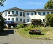
Erlebnishotel Ponyhof
Videos from this area
These are videos related to the place based on their proximity to this place.
Schützenumzug in Jünkerath 2013
Schützen- und Volksfest in Jünkerath 3D-Version: https://www.youtube.com/watch?v=DmRQHF-7Kj0.
PFT-TSP 26/06/1999 train spécial vers Junkerath (D) via la Vennbahn (video 8)
Ce jour de mois de juin, un train spécial formé de voitures K et tracté par le gros-nez du PFT 202.020 accompagnée de la 210.077 nous emmena de Trois-Ponts vers Junkerath en Allemagne,...
Mit 03 1010 durch die Eifel zur Mosel
Die 03 1010 führte einen Sonderzug aus dem Ruhrgebiet durch die Eifel zur Mosel. Unterwegs wurde in Jünkerath Wasser genommen.
B51: AS Prüm - Stadtkyll-Süd (2.5x)
Droga Krajowa B51: Prüm - Stadtkyll-Süd. Kierunek Blankenheim. Bundesstrasse B51: Prüm - Stadtkyll-Süd towards Blankenheim.
Radian Pro Hangflug in der Eifel
Ein Hangflug mit ein paar Freunden in der Eifel ,nähe Stadtkyll....Die Windgeschwindigkeit betrug ungefähr 14-20 km/h und es war eines meiner ersten Hangflüge überhaupt. Der Hang an sich...
Videos provided by Youtube are under the copyright of their owners.
Attractions and noteworthy things
Distances are based on the centre of the city/town and sightseeing location. This list contains brief abstracts about monuments, holiday activities, national parcs, museums, organisations and more from the area as well as interesting facts about the region itself. Where available, you'll find the corresponding homepage. Otherwise the related wikipedia article.
Obere Kyll
Obere Kyll is a Verbandsgemeinde ("collective municipality") in the district Vulkaneifel, in Rhineland-Palatinate, Germany. It is situated on the upper course of the river Kyll, approx. 55 km south-west of Bonn. The seat of the Verbandsgemeinde is in Jünkerath. The Verbandsgemeinde Obere Kyll consists of the following Ortsgemeinden ("local municipalities"):


