Safety Score: 3,0 of 5.0 based on data from 9 authorites. Meaning we advice caution when travelling to Germany.
Travel warnings are updated daily. Source: Travel Warning Germany. Last Update: 2024-08-13 08:21:03
Touring Dalsheim
The district Dalsheim of Nieder-Flörsheim in Rhineland-Palatinate is a subburb located in Germany about 300 mi south-west of Berlin, the country's capital place.
Need some hints on where to stay? We compiled a list of available hotels close to the map centre further down the page.
Being here already, you might want to pay a visit to some of the following locations: Bermersheim, Monsheim, Gundersheim, Gundheim and Molsheim. To further explore this place, just scroll down and browse the available info.
Local weather forecast
Todays Local Weather Conditions & Forecast: 4°C / 39 °F
| Morning Temperature | 0°C / 33 °F |
| Evening Temperature | 2°C / 36 °F |
| Night Temperature | 2°C / 36 °F |
| Chance of rainfall | 0% |
| Air Humidity | 67% |
| Air Pressure | 1023 hPa |
| Wind Speed | Moderate breeze with 13 km/h (8 mph) from East |
| Cloud Conditions | Overcast clouds, covering 100% of sky |
| General Conditions | Overcast clouds |
Sunday, 24th of November 2024
12°C (54 °F)
6°C (42 °F)
Overcast clouds, moderate breeze.
Monday, 25th of November 2024
11°C (51 °F)
8°C (47 °F)
Light rain, gentle breeze, overcast clouds.
Tuesday, 26th of November 2024
9°C (48 °F)
7°C (44 °F)
Light rain, gentle breeze, broken clouds.
Hotels and Places to Stay
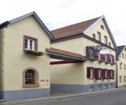
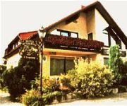
Pfalzhotel Asselheim
Gästehaus & Weingut Peth Gästehaus Jutta Peth
Schmitt Gästehaus
Kollektur
Kappelmühle Gästehäuser
Best Western Hotel Alzey
Wonnegauer Landgasthof
Videos from this area
These are videos related to the place based on their proximity to this place.
Mein schönstes Fleckchen in Monsheim
Um besondere Fleckchen im Wonnegau dreht sich eine neue Serie der Wormser Zeitung. Gästeführerin Angelika Weber-Haus zeigt die evangelische Kirche in Monsheim. Werdet ein Fan auf ...
SWR Mein Rheinland Pfalz - Die Hinkelsteinerin
Die Band Landmann aus Kriegsheim macht ein Fernseh-Bericht über Die Hinkelsteinerin und den Südlichen Wonnegau im Bereich von Monsheim-Kriegsheim (SWR - Mein Rheinland Pfalz am ...
Flörsheim-Dalsheim: Feuer und Flamme - kein Entkommen!
Am Wochenende war Weltgästeführertag - auch im Wonnegau. WZ-Reporter Markus Wolsiffer war dabei. Werdet ein Fan auf Facebook: https://www.facebook.com/wormserzeitung Folgt uns auf Twitter:.
Bravefrogs meistern Braveheartbattle in Hohen-Sülzen
Welch eine Herausforderung: das Braveheartbattle, ein Extremlauf, in Münnestadt. WZ-Reporter Markus Wolsiffer hat die Hohen-Sülzer Heimkehrer besucht. Werdet ein Fan auf Facebook: https://www.fa...
Ortsportrait von Kriegsheim bei Hierzuland im SWR-Fernsehen
Nach zwei Filmtagen, die zeitnah Mitte September 2010 stattfanden, stellten die Macher der SWR-Vorabendserie einen überaus sehenswerten Bericht über Kriegsheim zusammen. Hier einige...
09.06.2013 Großer Weinpreis von Mölsheim U17 Bundessichtungsrennen
09.06.2013 Großer Weinpreis von Mölsheim U17 Bundessichtungsrennen.
Zeit der Weinlese in Rheinhessen, Flörsheim-Dalsheim und Zell
Ich habe dieses Video mit dem Video-Editor von YouTube (http://www.youtube.com/editor) erstellt.
Chickenranch in Mölsheim Spezialitäten Restaurant Klöter
Die Gaststätte Klöter in Mölsheim ist bekannt als die Chickenranch und sollte in keinem Restaurantführer für Spezialitäten Lokale und Restaurants in der Pfalz fehlen. Das Spezialitäten...
Videos provided by Youtube are under the copyright of their owners.
Attractions and noteworthy things
Distances are based on the centre of the city/town and sightseeing location. This list contains brief abstracts about monuments, holiday activities, national parcs, museums, organisations and more from the area as well as interesting facts about the region itself. Where available, you'll find the corresponding homepage. Otherwise the related wikipedia article.
Alzey-Worms
Alzey-Worms is a district in Rhineland-Palatinate, Germany. It is bounded by (from the east and clockwise) the district Groß-Gerau, the city of Worms and the districts of Bad Dürkheim, Donnersbergkreis, Bad Kreuznach and Mainz-Bingen.
Bad Dürkheim (district)
Bad Dürkheim is a district in Rhineland-Palatinate, Germany. It is bounded by (from the west and clockwise) the districts of Kaiserslautern, Donnersbergkreis and Alzey-Worms, the city of Worms, the Rhein-Pfalz-Kreis, the city of Neustadt/Weinstraße, the districts of Südliche Weinstraße, the city of Landau (the Taubensuhl/Fassendeich forest part of the city), the district Südwestpfalz, and the city of Kaiserslautern.
House of Leiningen
Leiningen is the name of an old German family whose lands lay principally in Alsace, Lorraine and the Palatinate. The first count of Leiningen about whom anything certain is known was a certain Emich II (d. before 1138), whose family became extinct in the male line when Count Frederick, a Minnesinger, died about 1220.
Alzey-Land
Alzey-Land is a Verbandsgemeinde ("collective municipality") in the district Alzey-Worms, Rhineland-Palatinate, Germany. It is located around the town Alzey, which is the seat of Alzey-Land, but not part of the Verbandsgemeinde. Alzey-Land consists of the following Ortsgemeinden ("local municipalities"):
Grünstadt-Land
Grünstadt-Land is a Verbandsgemeinde ("collective municipality") in the district of Bad Dürkheim, in Rhineland-Palatinate, Germany. It is situated on the north-eastern edge of the Palatinate forest. It is located around the town Grünstadt, which is the seat of Grünstadt-Land, but not part of the Verbandsgemeinde. Grünstadt-Land consists of the following Ortsgemeinden ("local municipalities"):
Worms Cathedral
Cathedral of St Peter is a church in Worms, southern Germany. It was the seat of the Catholic Prince-Bishopric of Worms until its extinction in 1800. It is a basilica with four round towers, two large domes, and a choir at each end. The interior is built in red sandstone. Only the ground plan and the lower part of the western towers belong to the original building consecrated in 1110.
Monsheim (Verbandsgemeinde)
Monsheim is a Verbandsgemeinde ("collective municipality") in the district Alzey-Worms, Rhineland-Palatinate, Germany. The seat of the Verbandsgemeinde is in Monsheim. The Verbandsgemeinde Monsheim consists of the following Ortsgemeinden ("local municipalities"): Flörsheim-Dalsheim Hohen-Sülzen Mölsheim Mörstadt Monsheim Offstein
Westhofen (Verbandsgemeinde)
Westhofen is a Verbandsgemeinde ("collective municipality") in the district Alzey-Worms, Rhineland-Palatinate, Germany. The seat of the Verbandsgemeinde is in Westhofen. The Verbandsgemeinde Westhofen consists of the following Ortsgemeinden ("local municipalities"): Bechtheim Bermersheim Dittelsheim-Heßloch Frettenheim Gundersheim Gundheim Hangen-Weisheim Hochborn Monzernheim
Freinsheim (Verbandsgemeinde)
Freinsheim is a Verbandsgemeinde ("collective municipality") in the district of Bad Dürkheim, Rhineland-Palatinate, Germany. The seat of the Verbandsgemeinde is in Freinsheim. The Verbandsgemeinde Freinsheim consists of the following Ortsgemeinden ("local municipalities"): Bobenheim am Berg Dackenheim Erpolzheim Freinsheim Herxheim am Berg Kallstadt Weisenheim am Berg
Hettenleidelheim (Verbandsgemeinde)
Hettenleidelheim is a Verbandsgemeinde ("collective municipality") in the district of Bad Dürkheim, Rhineland-Palatinate, Germany. The seat of the Verbandsgemeinde is in Hettenleidelheim. The Verbandsgemeinde Hettenleidelheim consists of the following Ortsgemeinden ("local municipalities"): Altleiningen Carlsberg Hettenleidelheim Tiefenthal
Heßheim (Verbandsgemeinde)
Heßheim is a Verbandsgemeinde ("collective municipality") in the district Rhein-Pfalz-Kreis, in Rhineland-Palatinate, Germany. The seat of the Verbandsgemeinde is in Heßheim. The Verbandsgemeinde Heßheim consists of the following Ortsgemeinden ("local municipalities"): seat of the Verbandsgemeinde
Göllheim (Verbandsgemeinde)
Göllheim is a Verbandsgemeinde ("collective municipality") in the Donnersbergkreis, in Rhineland-Palatinate, Germany. The seat of the Verbandsgemeinde is in Göllheim. The Verbandsgemeinde Göllheim consists of the following Ortsgemeinden ("local municipalities"): Albisheim Biedesheim Bubenheim Dreisen Einselthum Göllheim Immesheim Lautersheim Ottersheim Rüssingen Standenbühl Weitersweiler
Eisenberg (Verbandsgemeinde)
Eisenberg is a Verbandsgemeinde ("collective municipality") in the Donnersbergkreis, in Rhineland-Palatinate, Germany. The seat of the Verbandsgemeinde is in Eisenberg. The Verbandsgemeinde Eisenberg consists of the following Ortsgemeinden ("local municipalities"): Eisenberg Kerzenheim
Guntersblum (Verbandsgemeinde)
Guntersblum is a Verbandsgemeinde ("collective municipality") in the district Mainz-Bingen in Rhineland-Palatinate, Germany. The seat of the Verbandsgemeinde is in Guntersblum.
Neuleiningen castle
Neuleiningen Castle is a castle ruin on the eastern outskirts of the Palatinate Forest in the state of Rhineland-Palatinate in Germany in the municipality of Neuleiningen in the Bad Dürkheim district. It was built from 1238-41 by Count Friedrich III of Leiningen. The French destroyed it in 1690 and it has been in ruins since.
Battenberg Castle
Battenberg Castle is a castle ruin near Battenberg in Rhineland-Palatinate, Germany.
Worms Synagogue
The Worms Synagogue, also known as Rashi Shul, is an 11th century synagogue located in Worms, Germany.
Jewish Cemetery, Worms
The Jewish Cemetery in Worms or Heiliger Sand, in Worms, Germany, is usually called the oldest surviving Jewish cemetery in Europe, although the Jewish burials in the Jewish sections of the Roman catacombs predate it by a millennium. The Jewish community of Worms was established by the early eleventh century, and the oldest tombstone still legible dates from 1058/59. The cemetery was closed in 1911, when a new cemetery was inaugurated. Some family burials continued until the late 1930s.
Wormatia-Stadion
EWR-Arena (called Wormatia-Stadion until 2011) is a multi-use stadium in Worms, Germany. It is currently used mostly for football matches and is the home of Wormatia Worms. The stadium has a capacity of 5,724 people. It opened in 1927 and was renovated in 2008 when Wormatia Worms were promoted into Regionalliga Süd.
Worms Central Station
Worms Central Station (Worms Hauptbahnhof) is, along with Worms Brücke station and Worms Pfeddersheim station, one of three operational passenger stations in the Rhenish Hesse city of Worms, Germany. The station with is its pedestrian underpass is also an essential link between the eastern and the western parts of central Worms. Every day it is used by about 15,000 people.
887th Tactical Missile Squadron
The 887th Tactical Missile Squadron is an inactive United States Air Force unit. It was last assigned to the 38th Tactical Missile Wing and stationed at Sembach Air Base, West Germany. It was inactivated on 25 September 1966.
University of Applied Sciences Worms
The University of Applied Sciences Worms is a public university located in Worms, Germany. It was founded in 1978. The University of Applied Sciences Worms comprises faculties of business, tourism/transportation, and informatics. A common feature of all degree programs is a practical approach to the respective subjects, a relatively short average duration of study, and the international orientation.
Frankenthal Central Station
Frankenthal Central Station (Frankenthal Hauptbahnhof) is the central station for the city of Frankenthal in the German state of Rhineland-Palatinate and is located on the Mainz–Ludwigshafen railway. It is classified by Deutsche Bahn as a category 4 station. Besides Frankenthal Hauptbahnhof the only other station in Frankenthal is Flomersheim. Another station is planned as Frankenthal Süd.


