Safety Score: 3,0 of 5.0 based on data from 9 authorites. Meaning we advice caution when travelling to Germany.
Travel warnings are updated daily. Source: Travel Warning Germany. Last Update: 2024-08-13 08:21:03
Delve into Dhron
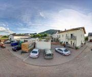
The district Dhron of Müstert in Rhineland-Palatinate is a district located in Germany about 336 mi south-west of Berlin, the country's capital town.
In need of a room? We compiled a list of available hotels close to the map centre further down the page.
Since you are here already, you might want to pay a visit to some of the following locations: Neumagen-Dhron, Piesport, Minheim, Kowerich and Klausen. To further explore this place, just scroll down and browse the available info.
Local weather forecast
Todays Local Weather Conditions & Forecast: 11°C / 52 °F
| Morning Temperature | 8°C / 46 °F |
| Evening Temperature | 10°C / 49 °F |
| Night Temperature | 9°C / 48 °F |
| Chance of rainfall | 0% |
| Air Humidity | 80% |
| Air Pressure | 1016 hPa |
| Wind Speed | Moderate breeze with 11 km/h (7 mph) from North-East |
| Cloud Conditions | Overcast clouds, covering 100% of sky |
| General Conditions | Overcast clouds |
Monday, 25th of November 2024
13°C (55 °F)
7°C (44 °F)
Moderate rain, moderate breeze, scattered clouds.
Tuesday, 26th of November 2024
7°C (45 °F)
4°C (39 °F)
Few clouds, gentle breeze.
Wednesday, 27th of November 2024
7°C (44 °F)
6°C (42 °F)
Light rain, moderate breeze, overcast clouds.
Hotels and Places to Stay
Gästehaus Martina Pension
Sektstuuf St. Laurentius
Alexanderhof Gästehaus
Gästehaus Marietta
Brauneberger Hof Hotel & Weingut
Lekker Hotel-Restaurant
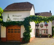
Weingut Gästehaus
Weinhaus Simon
Moselsteig
Pension Ostermann
Videos from this area
These are videos related to the place based on their proximity to this place.
Fronleichnam Schiffsprozession 2011 - Mosel
2011 führte die Etappe vom Altar in Trittenheim nach Neumagen, wo dann auch die Segnung der Boote stattfand.
Schiffsprozession Fronleichnam 2010 - Mosel
Jedes Jahr zu Fronleichnam, findet auf der Mosel zwischen Neumagen-Drohn und Trittenheim, eine Fronleichnam Prozession übers Wasser statt. Am Ziel angekommen findet eine Schiffssegnung statt.
Videos provided by Youtube are under the copyright of their owners.
Attractions and noteworthy things
Distances are based on the centre of the city/town and sightseeing location. This list contains brief abstracts about monuments, holiday activities, national parcs, museums, organisations and more from the area as well as interesting facts about the region itself. Where available, you'll find the corresponding homepage. Otherwise the related wikipedia article.
Bernkastel-Wittlich
Bernkastel-Wittlich is a district in Rhineland-Palatinate, Germany. It is bounded by (from the north and clockwise) the districts of Vulkaneifel, Cochem-Zell, Rhein-Hunsrück, Birkenfeld, Trier-Saarburg and Bitburg-Prüm.
Ruwer (Verbandsgemeinde)
Ruwer is a Verbandsgemeinde with 18,014 inhabitants (Dez. 2008) on the river Ruwer near Trier in Rhineland-Palatinate, Germany. It is famous for the wine from the wine-growing region Mosel, which previously was called Mosel-Saar-Ruwer, and which was founded by the Romans. The administrative seat (formerly located in Ruwer, which was an independent municipality until it was incorporated into the city Trier) is located in Waldrach since November 2005.
Cusanusstift
The Cusanusstift (St. Nikolaus-Hospital) is a historic building in Bernkastel-Kues, Germany. It was founded by Nicholas of Cusa in 1458. It contains a world-famous library and a wine museum.
Salm (Moselle)
The Salm is a 63 km-long river in western Germany, a left-bank tributary to the river Moselle. It rises in the Eifel, near the village of Salm, south of Gerolstein. The Salm flows generally south, through Großlittgen, Dreis, and Salmtal. It passes west of Wittlich. It empties into the Moselle in Klüsserath.
Wittlich-Land
Wittlich-Land is a Verbandsgemeinde ("collective municipality") in the district Bernkastel-Wittlich, in Rhineland-Palatinate, Germany. It is located around the town Wittlich, which is the seat of Wittlich-Land, but not part of the Verbandsgemeinde. Wittlich-Land consists of the following Ortsgemeinden ("local municipalities"):
Bernkastel-Kues (Verbandsgemeinde)
Bernkastel-Kues is a Verbandsgemeinde ("collective municipality") in the district Bernkastel-Wittlich, in Rhineland-Palatinate, Germany. The seat of the Verbandsgemeinde is in Bernkastel-Kues. The Verbandsgemeinde lies on both banks of the river Moselle, between Trier and Koblenz. The entire Verbandsgemeinde is 249 square kilometers large and has 27000 inhabitants.
Fell Exhibition Slate Mine
The Fell Exhibition Slate Mine is a former slate mine in Germany located about 20 km east from Trier and about 60 km east of Luxembourg (city) near the villages Fell and Thomm. The exhibition mine can be visited every day from April to October. The Exhibition Mine consists of two typical roof slate mines from the early 20th century, situated one above the other, a slate mining trail and a small mining museum.
Feller Bach
The Feller Bach is a right tributary of the Moselle River in Rhineland-Palatinate. Its source is in the Hunsrück mountains. It flows through the villages Lorscheid, Fell and Riol. It joins the Moselle in Riol. At the left there is the Thommer Bach in the Nossernvalley with the Fell Exhibition Slate Mine.
Hinzert concentration camp
Hinzert (SS-Sonderlager Hinzert or Konzentrationslager/KZ Hinzert) was a German concentration camp located in Rhineland-Palatinate, Germany, 30 km from the Luxembourg border. Between 1939 and 1945, 13,600 political prisoners between the ages of 13 and 80 were imprisoned at Hinzert. Many were in transit towards larger concentration camps where most would be killed. However, a significant number of prisoners were executed at Hinzert.
Neumagen-Dhron (Verbandsgemeinde)
Neumagen-Dhron is a former Verbandsgemeinde ("collective municipality") in the district Bernkastel-Wittlich, in Rhineland-Palatinate, Germany. Its seat of administration was in Neumagen-Dhron. It was disbanded on 1 January 2012. The Verbandsgemeinde Neumagen-Dhron consisted of the following Ortsgemeinden ("local municipalities"): Minheim Neumagen-Dhron Piesport
Thalfang am Erbeskopf
Thalfang am Erbeskopf is a Verbandsgemeinde ("collective municipality") in the district Bernkastel-Wittlich, in Rhineland-Palatinate, Germany. Its seat of administration is in Thalfang. The Verbandsgemeinde Thalfang am Erbeskopf consists of the following Ortsgemeinden ("local municipalities"):
Schweich an der Römischen Weinstraße
Schweich an der Römischen Weinstraße is a Verbandsgemeinde ("collective municipality") in the district Trier-Saarburg, in Rhineland-Palatinate, Germany. The seat of the Verbandsgemeinde is in Schweich. The Verbandsgemeinde Schweich an der Römischen Weinstraße consists of the following Ortsgemeinden ("local municipalities"):
Schloss Veldenz
Schloss Veldenz in the Mosel Valley region is a Castle ruin about 1.5 km southeast of Veldenz.
Schloss Lieser
Schloss Lieser (Castle of Lieser) in the Mosel valley nearby Bernkastel-Kues is one of the most striking buildings within the village of Lieser, Germany.
Graach Gate
The Graach Gate is the last remaining town gate of the German town of Bernkastel-Kues. The name Graach refers to the neighbouring village of Graach connected by a narrow road to the gate. Currently the building is used as a museum of local history.
Lieser (river)
The Lieser is a small river in Rhineland-Palatinate, Germany, a left tributary of the Moselle. It rises in the Eifel, near Boxberg, north of Daun. The Lieser flows south through Daun, Manderscheid and Wittlich. It flows into the Moselle west of the village of Lieser.
Trier-Föhren Airport
Trier-Föhren Airport is an airport serving Trier, a city in Rhineland-Palatinate, Germany. It located in Föhren, 8 nautical miles northeast of Trier and approximately 340 miles southwest of Berlin. The airport supports general aviation, with no commercial airline service available. Charter services and a full selection of amenities are available.
Battle of Clausen
The Battle of Clausen (or Klausen) was fought on 20 October 1735 near the town of Klausen (usually spelled in histories with 'C' instead of 'K'), which was then in the Electorate of Trier and part of the Holy Roman Empire, and is now in the German state of Rhineland-Palatinate. French forces under the command of Marshal François de Franquetot de Coigny were defeated in an attempt to dislodge imperial troops under the command of Friedrich Heinrich von Seckendorff.
Hochmosel Bridge
The Hochmosel Bridge (German: Hochmoselbrücke or "High Moselle Bridge") is a highway bridge under construction that traverses the Moselle valley near Ürzig and Zeltingen-Rachtig in Rheinland-Pfalz, Germany. The bridge is part of a new highway connection, the "Hochmoselübergang" or Federal Highway 50 (Bundesstrasse 50), to facilitate traffic between Belgian and Dutch harbors and the greater Frankfurt area.
Wittlich Central Station
Wittlich Central Station (Wittlich Hauptbahnhof) is a railway station for the city of Wittlich in the German state of Rhineland-Palatinate and is on the Koblenz–Trier line (Moselle line). Until the closure of the Wengerohr–Daun and Wengerohr–Bernkastel-Kues lines, it was a junction station and a regional rail node. Today it is the only station in Wittlich. The station is located in the district of Wengerohr and the station was called Wengerohr station until 27 September 1987.
Ilgenbach
Ilgenbach is a river of Baden-Württemberg, Germany.
Röderbach (Aschaff)
Röderbach is a river of Bavaria, Germany.
Frohnbach
Frohnbach is a river of Hesse, Germany.
Weingut Joh. Jos. Prüm
Weingut Joh. Jos. Prüm is a German wine grower and producer based in Bernkastel-Wehlen, in the wine-growing region of Mosel, Germany.
Weingut Fritz Haag
Weingut Fritz Haag is a German wine grower and producer based in Brauneberg, in the wine-growing region of Mosel, Germany.


