Safety Score: 3,0 of 5.0 based on data from 9 authorites. Meaning we advice caution when travelling to Germany.
Travel warnings are updated daily. Source: Travel Warning Germany. Last Update: 2024-08-13 08:21:03
Touring Burgalben
The district Burgalben of Moschelmühle in Rhineland-Palatinate is a subburb located in Germany about 337 mi south-west of Berlin, the country's capital place.
Need some hints on where to stay? We compiled a list of available hotels close to the map centre further down the page.
Being here already, you might want to pay a visit to some of the following locations: Donsieders, Hoeheinoed, Waldfischbach-Burgalben, Hermersberg and Steinalben. To further explore this place, just scroll down and browse the available info.
Local weather forecast
Todays Local Weather Conditions & Forecast: 14°C / 58 °F
| Morning Temperature | 6°C / 42 °F |
| Evening Temperature | 14°C / 58 °F |
| Night Temperature | 8°C / 46 °F |
| Chance of rainfall | 4% |
| Air Humidity | 63% |
| Air Pressure | 1010 hPa |
| Wind Speed | Fresh Breeze with 13 km/h (8 mph) from North-East |
| Cloud Conditions | Broken clouds, covering 68% of sky |
| General Conditions | Moderate rain |
Tuesday, 26th of November 2024
8°C (47 °F)
6°C (44 °F)
Light rain, moderate breeze, overcast clouds.
Wednesday, 27th of November 2024
8°C (47 °F)
8°C (47 °F)
Moderate rain, fresh breeze, overcast clouds.
Thursday, 28th of November 2024
5°C (42 °F)
1°C (34 °F)
Moderate rain, gentle breeze, few clouds.
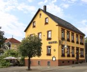
Hotels and Places to Stay
Zum Schwan
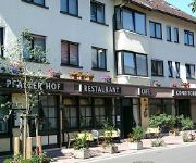
Schokoladengießer Pfälzer Hof
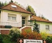
Zum Grünen Kranz
Weihermühle Landhotel
Hinkelstall
Best Western City
Alt Pirmasens
Villa Bruderfels Garni
Videos from this area
These are videos related to the place based on their proximity to this place.
Die Bahn - Der Clip (1) Pirmasens 2015
Gleise von gestern, die Regionalbahn von heute und der Fehrbacher Tunnel (Kaiser-Wilhelm-Tunnel) zwischen Bahnhof Pirmasens und Bahnhof Pirmasens-Nord (Biebermühle)
QM Area Pirmasens 2015
QM Area Pirmasens Nach Abzug der Amerikaner Anfang der 90er Jahre im letzten Jahrhundert ist die Quartermaster Area Pirmasens ein verlassener, vergessener Ort. Es gibt sie noch... Lost Places.
HAGEHA mit integrierten Fototage Modenschau Pirmasens Germany 1.11.2014 T9
Am 1.11.2014 präsentierte Harald Kröher auf der Bühne in der Halle 6 eine Modenschau mit vielen Models. Auch die "Misses Rheinland-Pfalz" Karin Wadle war mit dabei. Kleidung kam vom Mode...
HAGEHA mit integrierten Fototage Talk mit Harald Kröher Pirmasens Germany 29.10.2014 T8
Hier mal ein kpl. kleiner Film von der Talk-Runde am 29.10.2014 mit 3 Personen und Harald Kröher. http://www.cewe.de/ http://www.dvf-fotografie.de/ http://www.hageha-messe.de/ http://www.fototage-.
Autosalon Pirmasens 2014 Germany Clip 19 Bodypainting mit Ralf Leidinger
Autosalon Pirmasens mit Events wie hier: Bodypainting Ralf Leidinger Auch Antenne Pirmasens war mit dabei. Ein lokaler, informativer Radiosender sowie live stream um aktuelles und gute Musik...
HAGEHA mit integrierten Fototage Ausstellung 3 Pirmasens Germany 29.10.2014
Wasgauhalle Pirmasens -Messe HAGEHA - integrierte Fototage, hier Hauptausstellung 1 links: http://www.hageha-messe.de/ http://www.fototage-pirmasens.de/
Puppenspiel Waldorfkindergarten Pirmasens
Die Vorschulkinder des Waldorfkindergartens Pirmasens präsentierten Ihr Puppenspiel mit selbst gebastelten Püppchen.
HAGEHA mit integrierten Fototage, Eröffnung Pirmasens Germany 29.10.2014 T18
Wasgauhalle Pirmasens -Messe HAGEHA - integrierte Fototage, hier Hauptausstellung 1 links: http://www.hageha-messe.de/ http://www.fototage-pirmasens.de/
HAGEHA mit integrierten Fototage UKULELENORCHESTER Pirmasens Germany 29.10.2014
Hageha Pirmasens. Auch jugendliche können die Messe mit solchen Instrumenten bereichern. Hier das Ukulelen Orchester aus Kaiserslautern. link in Facebook: u'kl - Ukulelenorchester Kaiserslautern ...
Autosalon Pirmasens 2014 Germany Clip 16
Und weiter gehts im Clip mit Autos und Autos.... Auch Antenne Pirmasens war mit dabei. Ein lokaler, informativer Radiosender sowie live stream um aktuelles und gute Musik übers Netz zu hören:...
Videos provided by Youtube are under the copyright of their owners.
Attractions and noteworthy things
Distances are based on the centre of the city/town and sightseeing location. This list contains brief abstracts about monuments, holiday activities, national parcs, museums, organisations and more from the area as well as interesting facts about the region itself. Where available, you'll find the corresponding homepage. Otherwise the related wikipedia article.
Palatinate (region)
The Palatinate, historically also Rhenish Palatinate, is a region in south-western Germany. It occupies more than a quarter of the German federal state (Bundesland) of Rhineland-Palatinate (Rheinland-Pfalz). Historically in union with Bavaria, Palatinate itself covers 5,451.23 km sq in area.
Ramstein Air Base
Ramstein Air Base is a United States Air Force base in Rhineland-Palatinate, a state of Germany. It serves as headquarters for the US Air Forces in Europe (USAFE) and is also a North Atlantic Treaty Organization installation. Ramstein is located near town of Ramstein-Miesenbach, in the rural district of Kaiserslautern. The east gate of Ramstein Air Base is about 10 miles from Kaiserslautern (locally referred to by Americans as "K-Town").
Ramstein air show disaster
The Ramstein air show disaster is the second-deadliest air show incident (following that in 2002 at Sknyliv). It took place in front of about 300,000 people on Sunday August 28, 1988, in Ramstein, West Germany, near the city of Kaiserslautern at the US Ramstein Air Base airshow Flugtag '88. Aircraft of the Italian Air Force display team collided during their display, crashing to the ground. 67 spectators and 3 pilots died.
Südwestpfalz
Südwestpfalz is a district (Kreis) in the south of Rhineland-Palatinate, Germany. Neighboring districts are (from west clockwise) Saarpfalz, the district-free city Zweibrücken, the districts Kaiserslautern and Bad Dürkheim, the district-free city Landau (the Taubensuhl/Fassendeich forest part of the city), Südliche Weinstraße, and the French département Bas-Rhin. The district-free city Pirmasens is surrounded by the district.
Dahner Felsenland
Dahner Felsenland is a Verbandsgemeinde ("collective municipality") in the Südwestpfalz district, in Rhineland-Palatinate, Germany. It is situated in the Palatinate forest, approx. 15 km southeast of Pirmasens, and 25 km west of Landau. Its seat of administration is in its central town, Dahn. The area is known for its red sandstone cliffs, many of them crowned with ruined castles. The Verbandsgemeinde Dahner Felsenland consists of the following Ortsgemeinden ("local municipalities"):
Pirmasens-Land
Pirmasens-Land is a Verbandsgemeinde ("collective municipality") in the Südwestpfalz district, in Rhineland-Palatinate, Germany. It is situated on the southwestern edge of the Palatinate forest, around Pirmasens. The seat of the municipality is in Pirmasens, itself not part of the municipality. The Verbandsgemeinde Pirmasens-Land consists of the following Ortsgemeinden ("local municipalities"): Bottenbach Eppenbrunn Hilst Kröppen Lemberg Obersimten Ruppertsweiler Schweix Trulben
Kaiserslautern University of Technology
The University of Kaiserslautern (German Technische Universität Kaiserslautern) is a university in Kaiserslautern, Germany. It was founded in 1970 and is organized into 12 faculties.
German Research Centre for Artificial Intelligence
Deutsches Forschungszentrum für Künstliche Intelligenz (DFKI), lit. German Research Center for Artificial Intelligence, is one of the world's largest nonprofit contract research institutes in the field of innovative software technology based on artificial intelligence (AI) methods. DFKI was founded in 1988. Today it is based in Kaiserslautern, Saarbrücken, Bremen and Berlin. Companies figuring among the DFKI-shareholders include Microsoft, SAP, BMW and Daimler.
Landstuhl Regional Medical Center
The Landstuhl Regional Medical Center (LRMC) is an overseas military hospital operated by the United States Army and the Department of Defense. LRMC is the largest military hospital outside of the continental United States. It is located near Landstuhl, Germany, and serves as the nearest treatment center for wounded soldiers coming from Iraq and Afghanistan. In addition, it serves military personnel stationed in Germany as well as their family members.
Sportpark Husterhöhe
Sportpark Husterhöhe is a multi-use stadium in Pirmasens, Germany. It is currently used mostly for football matches and is the home stadium of FK Pirmasens. The stadium is able to hold 10,000 people and opened in 2004. On 5 September 2009, the stadium hosted Germany U-20's 6-1 win over South Africa U-20.
Landstuhl (Verbandsgemeinde)
Landstuhl is a Verbandsgemeinde ("collective municipality") in the district of Kaiserslautern, Rhineland-Palatinate, Germany. The seat of the Verbandsgemeinde is in Landstuhl. The Verbandsgemeinde Landstuhl consists of the following Ortsgemeinden ("local municipalities"): Bann Hauptstuhl Kindsbach Landstuhl Mittelbrunn
Ramstein-Miesenbach (Verbandsgemeinde)
Ramstein-Miesenbach is a Verbandsgemeinde ("collective municipality") in the district of Kaiserslautern, Rhineland-Palatinate, Germany. The seat of the Verbandsgemeinde is in Ramstein-Miesenbach. The Verbandsgemeinde Ramstein-Miesenbach consists of the following Ortsgemeinden ("local municipalities"): Hütschenhausen Kottweiler-Schwanden Niedermohr Ramstein-Miesenbach
Rodalben (Verbandsgemeinde)
Rodalben is a Verbandsgemeinde ("collective municipality") in the Südwestpfalz district, in Rhineland-Palatinate, Germany. The seat of the municipality is in Rodalben. The Verbandsgemeinde Rodalben consists of the following Ortsgemeinden ("local municipalities"): Clausen Donsieders Leimen Merzalben Münchweiler an der Rodalb
Thaleischweiler-Fröschen (Verbandsgemeinde)
Thaleischweiler-Fröschen is a Verbandsgemeinde ("collective municipality") in the Südwestpfalz district, in Rhineland-Palatinate, Germany. The seat of the municipality is in Thaleischweiler-Fröschen. The Verbandsgemeinde Thaleischweiler-Fröschen consists of the following Ortsgemeinden ("local municipalities"): Höheischweiler Höhfröschen Maßweiler Nünschweiler Petersberg Reifenberg Rieschweiler-Mühlbach
Waldfischbach-Burgalben (Verbandsgemeinde)
Waldfischbach-Burgalben is a Verbandsgemeinde ("collective municipality") in the Südwestpfalz district, in Rhineland-Palatinate, Germany. The seat of the municipality is in Waldfischbach-Burgalben. The Verbandsgemeinde Waldfischbach-Burgalben consists of the following Ortsgemeinden ("local municipalities"): Geiselberg Heltersberg Hermersberg Höheinöd Horbach Schmalenberg Steinalben
Wallhalben (Verbandsgemeinde)
Wallhalben is a Verbandsgemeinde ("collective municipality") in the Südwestpfalz district, in Rhineland-Palatinate, Germany. The seat of the municipality is in Wallhalben. The Verbandsgemeinde Wallhalben consists of the following Ortsgemeinden ("local municipalities"): Biedershausen Herschberg Hettenhausen Knopp-Labach Krähenberg Obernheim-Kirchenarnbach Saalstadt Schauerberg Schmitshausen Wallhalben Weselberg
Ramstein High School
Ramstein American High School (also commonly referred to as RHS) is a Department of Defense Dependents Schools (DoDDS) high school in the Kaiserslautern district which serves the European portion of DoDDS. Their mascot is the Royale, a lion with a crown. Ramstein American High School is located on Ramstein Air Base (RAB) which is just outside of Kaiserslautern, Germany.
Humberg Tower
The Humberg Tower is an observation tower on the Humberg hill, 425 metres (1,400 feet) high, to the south of the city of Kaiserslautern. The idea of building a tower on the Humberg (already in those days a favourite hill among the citizens of Kaiserslautern, for its view) was taken up in 1896. For this purpose, inhabitants of the city founded the Humberg Association, with the aim of financing the building of an observation tower.
Husterhoeh Kaserne
Husterhoeh Kaserne was a military facility in Pirmasens, Rhineland-Palatinate, Germany. Kaserne is a German loanword that means "barracks. " It was a United States military base 1945–1994. Since then it is a German base, most of which has closed. The base still has some US military operations and German military storage.
Burg Nanstein
Burg Nanstein is a castle in Landstuhl, Rhineland-Palatinate, Germany. It was built around the year 1162 after Holy Roman Emperor Frederick I demanded its construction as additional defense for the Palatinate. In 1504, German knight Franz von Sickingen, inherited part of the castle after his father's death in the War of the Bavarian Succession, finally acquiring the entire castle in 1518. He immediately began extensive refortification to make the castle suitable for firearms.
316th Air Division
The 316th Airlift Division (316th AD) is an inactive United States Air Force organization. Its last assignment was with the United States Air Forces in Europe, assigned to Seventeenth Air Force, being stationed at Ramstein Air Base, Germany. It was inactivated on 1 May 1991.
Wartenberg (Donau)
Wartenberg is a mountain in Baden-Württemberg, Germany.
Kaiserslautern Central Station
Kaiserslautern Central Station (Kaiserslautern Hauptbahnhof) is a through-station in the German city of Kaiserslautern and one of seven stations in the city. It is a stop on the Rhine-Neckar S-Bahn and Deutsche Bahn’s Intercity-Express network and a hub for all the regional trains of the western Palatinate. On 10 June 2007, the Rhealys high-speed rail consortium established a service with a stop in Kaiserslautern, reducing travel time to Paris to two and a half hours.
Pirmasens Nord station
Pirmasens Nord (north) station is a station opened in 1875 seven kilometres north of Pirmasens in the municipality of Thaleischweiler-Fröschen in the German state of Rhineland-Palatinate. The station is located next to the hamlet of Biebermühle, which it was named after until 1936. It is the main station within the district of Südwestpfalz.
Pirmasens Central Station
Pirmasens Central Station (Pirmasens Hauptbahnhof) is a terminal station in the town of Pirmasens, in the German state of Rhineland-Palatinate, about one kilometre from the city centre. It was opened on 25 November 1875 and is the terminus of the Biebermühl Railway (Biebermühlbahn), which was also opened in 1875 as a branch line from the Southern Palatinate Railway (Südpfalzbahn).


