Safety Score: 3,0 of 5.0 based on data from 9 authorites. Meaning we advice caution when travelling to Germany.
Travel warnings are updated daily. Source: Travel Warning Germany. Last Update: 2024-08-13 08:21:03
Discover Merkeshausen
Merkeshausen in Rhineland-Palatinate is a town in Germany about 347 mi (or 559 km) south-west of Berlin, the country's capital city.
Current time in Merkeshausen is now 02:43 AM (Friday). The local timezone is named Europe / Berlin with an UTC offset of one hour. We know of 12 airports near Merkeshausen, of which 5 are larger airports. The closest airport in Germany is Bitburg Airport in a distance of 9 mi (or 15 km), South-East. Besides the airports, there are other travel options available (check left side).
There are several Unesco world heritage sites nearby. The closest heritage site in Germany is Roman Monuments, Cathedral of St Peter and Church of Our Lady in Trier in a distance of 22 mi (or 36 km), South-East. Also, if you like playing golf, there is an option about 21 mi (or 33 km). away. Looking for a place to stay? we compiled a list of available hotels close to the map centre further down the page.
When in this area, you might want to pay a visit to some of the following locations: Hamm, Echtershausen, Altscheid, Niederweiler and Mauel. To further explore this place, just scroll down and browse the available info.
Local weather forecast
Todays Local Weather Conditions & Forecast: 2°C / 35 °F
| Morning Temperature | -2°C / 28 °F |
| Evening Temperature | 1°C / 34 °F |
| Night Temperature | 1°C / 33 °F |
| Chance of rainfall | 0% |
| Air Humidity | 74% |
| Air Pressure | 1008 hPa |
| Wind Speed | Fresh Breeze with 14 km/h (9 mph) from East |
| Cloud Conditions | Broken clouds, covering 56% of sky |
| General Conditions | Rain and snow |
Saturday, 23rd of November 2024
2°C (36 °F)
2°C (36 °F)
Overcast clouds, moderate breeze.
Sunday, 24th of November 2024
9°C (48 °F)
9°C (48 °F)
Overcast clouds, moderate breeze.
Monday, 25th of November 2024
10°C (51 °F)
8°C (46 °F)
Moderate rain, fresh breeze, overcast clouds.
Hotels and Places to Stay
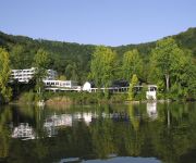
Dorint Seehotel & Resort
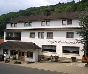
Theis-Mühle
Nimstal
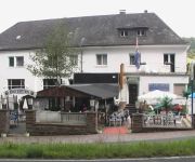
Wirtz Landhaus
Videos from this area
These are videos related to the place based on their proximity to this place.
Eifel Golf,Golfclub Südeifel,
Willkommen im Golfclub für Jedermann. Bei uns soll sich jeder wohlfühlen. Deshalb bieten wir ein wohliges Ambiente und besondere Angebote für die ganze Familie. Ob Profi, Anfänger oder...
Suzuki V-Strom Adventure, Eifel, 11-13 juni 2010 0004
Suzuki V-Strom Adventure 11-13 juni 2010 Stukje "offroad" of althans een modder/stenenpad altijd leuk na een beetje regen. opgenomen met muvi dv cam.
Mein Jakobsweg - 2.4 - Von Prüm nach Waxweiler
Auf den Spuren der Jakobspilger von Köln aus durch die Eifel und durch Frankreich - eine animierte Bilderfolge - siehe auch http://meinjakobsweg-info.de Wegstrecke in Google Maps: http://maps.g...
Landwirtschaftssimulator 2011 -| Maishäckseln in der Eifel |- HD
Sorry für die Laggs wir waren zu 5. auf einer 6000er Leitung und ich hab nur ne 700er Leitung :D Download Map: http://ul.to/m0c9vun5 MFG Kickertz ;)
Manderscheid | Sehenswürdigkeiten | Rhein-Eifel.TV
http://www.rhein-eifel.tv/manderscheid.htm - Geschichte der Stadt Manderscheid mit ihren Sehenswürdigkeiten wie die Burgen, das Maarmuseum und die Kirche. Manderscheid liegt auf einer Anhöhe...
Wasserlauf Rittersdorf LGB-Gartenbahn von Miniland-Daleiden
Vorläufer von Miniland-Daleiden war die Gartenbahnanlage in Rittersdorf, bei Bitburg. Jetzt besteht und wird im Moment umgebaut und erweitert: homepage: www.miniland-daleiden.de.
Nim(m)s Rad 2010
Raderlebnistag im Nimstal in der Eifel. Zwischen Rommersheim und Rittersdorf gehörte die Landstraße am Pfingstmontag den Radfahrern. Impressionen von der Erlebnisstation in Bickendorf.
Videos provided by Youtube are under the copyright of their owners.
Attractions and noteworthy things
Distances are based on the centre of the city/town and sightseeing location. This list contains brief abstracts about monuments, holiday activities, national parcs, museums, organisations and more from the area as well as interesting facts about the region itself. Where available, you'll find the corresponding homepage. Otherwise the related wikipedia article.
Bitburg-Prüm
The Eifelkreis Bitburg-Prüm is a district in Rhineland-Palatinate, Germany. It is bounded by (from the west and clockwise) Luxembourg, Belgium and the districts of Euskirchen, Vulkaneifel, Bernkastel-Wittlich and Trier-Saarburg.


