Safety Score: 3,0 of 5.0 based on data from 9 authorites. Meaning we advice caution when travelling to Germany.
Travel warnings are updated daily. Source: Travel Warning Germany. Last Update: 2024-08-13 08:21:03
Discover Nockenthal
The district Nockenthal of Mackenrodt in Rhineland-Palatinate is a subburb in Germany about 330 mi south-west of Berlin, the country's capital city.
If you need a hotel, we compiled a list of available hotels close to the map centre further down the page.
While being here, you might want to pay a visit to some of the following locations: Roetsweiler-Nockenthal, Siesbach, Oberbrombach, Hettenrodt and Kirschweiler. To further explore this place, just scroll down and browse the available info.
Local weather forecast
Todays Local Weather Conditions & Forecast: 8°C / 47 °F
| Morning Temperature | 6°C / 43 °F |
| Evening Temperature | 4°C / 39 °F |
| Night Temperature | 3°C / 37 °F |
| Chance of rainfall | 0% |
| Air Humidity | 68% |
| Air Pressure | 1027 hPa |
| Wind Speed | Light breeze with 3 km/h (2 mph) from South-West |
| Cloud Conditions | Scattered clouds, covering 30% of sky |
| General Conditions | Scattered clouds |
Saturday, 16th of November 2024
8°C (46 °F)
2°C (36 °F)
Few clouds, light breeze.
Sunday, 17th of November 2024
5°C (40 °F)
4°C (39 °F)
Light rain, moderate breeze, overcast clouds.
Monday, 18th of November 2024
3°C (38 °F)
-1°C (30 °F)
Rain and snow, fresh breeze, broken clouds.
Hotels and Places to Stay
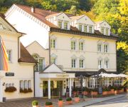
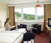
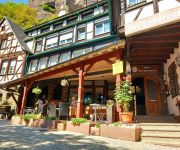
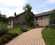
Parkhotel
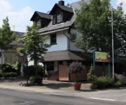
Gartenhotel Hunsrücker Fass
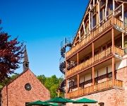
Kloster Marienhöh Mountains | Lifestyle | Family
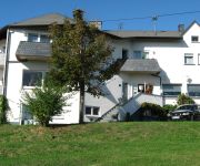
Diamanthotel Handelshof
Kristall Berghotel
Opal
City Garni
Schloßschenke Oberstein
Pilgerhaus Klosterhotel Marienhöh
Videos from this area
These are videos related to the place based on their proximity to this place.
Frankfurt-Saarbrücken: Bahnfahrt durch eine grüne Hölle.Train ride through a green hell
Fahrt mit einem Expresszug von Frankfurt nach Saarbrücken quer durch das Bundesland Rheinland/Pfalz. Überwiegend durch das Tal des Flusses „Nahe" und durch eine teilweise unberührte Landschaft...
Museum of Minerals Idar-Oberstein, Germany
The Museum of Minerals. Idar-Oberstein, Germany http://fossilcorals.blogspot.com.es/
Idarer Edelsteinmarkt 2012 - Das Kurzvideo
Das war ein ganz besonderer Auftakt! Am 9. Juni 2012 fand der erste Idarer Edelsteinmarkt auf dem Schleiferplatz von 11 bis 19 Uhr statt. Ein grandioser Beginn mit viel positiver Resonanz....
RECARTNEY Coming up live ! 141
EUROPE'S FINEST PAUL MCCARTNEY&BEATLES TRIBUTE SHOW @ PADDOCK CLUB HAHN HUNSRÜCK.
Videos provided by Youtube are under the copyright of their owners.
Attractions and noteworthy things
Distances are based on the centre of the city/town and sightseeing location. This list contains brief abstracts about monuments, holiday activities, national parcs, museums, organisations and more from the area as well as interesting facts about the region itself. Where available, you'll find the corresponding homepage. Otherwise the related wikipedia article.
Birkenfeld (district)
Birkenfeld is a district (Landkreis) in Rhineland-Palatinate, Germany. Its seat is the town of Birkenfeld. It is bounded by (from the south and clockwise) the districts of Sankt Wendel, Trier-Saarburg, Bernkastel-Wittlich, Rhein-Hunsrück, Bad Kreuznach and Kusel.
Environment Campus Birkenfeld
The Environment Campus Birkenfeld (Umwelt-Campus Birkenfeld) is a branch of the Hochschule Trier in the state of Rhineland-Palatinate, Germany. It is close to the small town of Birkenfeld in Rhineland-Palatinate, close to the border of Saarland, Luxembourg, Belgium and France. There are 2,350 students enrolled in two departments. There are a total of 50 professors teaching in both departments (Environmental Planning / Environmental Technology and Environment Business / Environment Law).
Schmidtburg
Schmidtburg is a ruin of a former castle next to Schneppenbach in Germany. The castle was built up in 926, and was destroyed during the War of the Grand Alliance (1688–1697) by French troops in 1688.
Lichtenberg Castle (Palatinate)
Lichtenberg Castle has a length of 425m and is the biggest castle ruin in Germany. It is located near Thallichtenberg in the district of Kusel in Rhineland-Palatinate.
Ellweiler
Ellweiler is an Ortsgemeinde – a municipality belonging to a Verbandsgemeinde, a kind of collective municipality – in the Birkenfeld district in Rhineland-Palatinate, Germany. It belongs to the Verbandsgemeinde of Birkenfeld, whose seat is in the like-named town.
Baumholder (Verbandsgemeinde)
Baumholder is a Verbandsgemeinde ("collective municipality") in the district of Birkenfeld, in Rhineland-Palatinate, Germany. The seat of the Verbandsgemeinde is in Baumholder. The Verbandsgemeinde Baumholder consists of the following Ortsgemeinden ("local municipalities"): Baumholder Berglangenbach Berschweiler bei Baumholder Eckersweiler Fohren-Linden Frauenberg Hahnweiler Heimbach Leitzweiler Mettweiler Reichenbach Rohrbach Rückweiler
Birkenfeld (Verbandsgemeinde)
Birkenfeld is a Verbandsgemeinde ("collective municipality") in the district of Birkenfeld, in Rhineland-Palatinate, Germany. The seat of the Verbandsgemeinde is in Birkenfeld. The Verbandsgemeinde Birkenfeld consists of the following Ortsgemeinden ("local municipalities"):
Herrstein (Verbandsgemeinde)
Herrstein is a Verbandsgemeinde ("collective municipality") in the district of Birkenfeld, in Rhineland-Palatinate, Germany. The seat of the Verbandsgemeinde is in Herrstein. The Verbandsgemeinde Herrstein consists of the following Ortsgemeinden ("local municipalities"):
Rhaunen (Verbandsgemeinde)
Rhaunen is a Verbandsgemeinde ("collective municipality") in the district of Birkenfeld, in Rhineland-Palatinate, Germany. The seat of the Verbandsgemeinde is in Rhaunen. The Verbandsgemeinde Rhaunen consists of the following Ortsgemeinden ("local municipalities"):
Reichweiler
Reichweiler is an Ortsgemeinde – a municipality belonging to a Verbandsgemeinde, a kind of collective municipality – in the Kusel district in Rhineland-Palatinate, Germany. It belongs to the Verbandsgemeinde of Kusel, whose seat is in the like-named town.
Erbeskopf
The Erbeskopf in the Hunsrück in Germany is a mountain with a height of 816 m. It forms the highest point in the state of Rhineland-Palatinate, as well as the highest point of German territory on the left bank of the Rhine.
Baumholder Army Airfield
Baumholder Army Airfield is a small military airfield in support of the United States Army facilities in Baumholder, Germany. It has a single runway in the 07/25 direction which is 16 meters (52 feet) wide and 572 meters (1,877 feet) long. It is located just north-east of the town of Reichenbach.
Hoppstädten-Weiersbach Airfield
Hoppstädten-Weiersbach Airfield is a general aviation airport in Hoppstädten-Weiersbach, Germany. It has two parallel runways in the 06/24 direction; one asphalt and one grass. Despite this, no left (L) or right (R) markings are used. During the cold war, it was known as Boehmer Army Airfield and was used by the US Army which had aircraft based there from 1956 till 1973 and used it as a maintenance facility thereafter. It was nicknamed Happy Valley.
Idar-Oberstein station
Idar-Oberstein station serves the town of Idar-Oberstein in the German state of Rhineland-Palatinate. It is on the Nahe Valley Railway and is classified by Deutsche Bahn as a category 4 station. It is regularly served by Regional-Express and Regionalbahn services and in the past it was served by freight traffic. The station is located in the centre of Idar-Oberstein.
Türkismühle station
Türkismühle station is a station in the municipality of Nohfelden in the German state of the Saarland. The station is located on the Nahe Valley Railway (Nahetalbahn) and is the terminus of the Hochwald Railway, which formerly ran as far as Trier and the former Westrich Railway to Kusel. It was opened on 26 May 1860 during the extension of the Nahe Valley Railway from Idar-Oberstein to Neunkirchen.


