Safety Score: 3,0 of 5.0 based on data from 9 authorites. Meaning we advice caution when travelling to Germany.
Travel warnings are updated daily. Source: Travel Warning Germany. Last Update: 2024-08-13 08:21:03
Discover Leimen
Leimen in Rhineland-Palatinate with it's 993 citizens is a city in Germany about 333 mi (or 536 km) south-west of Berlin, the country's capital city.
Local time in Leimen is now 10:12 PM (Tuesday). The local timezone is named Europe / Berlin with an UTC offset of one hour. We know of 12 airports in the vicinity of Leimen, of which 5 are larger airports. The closest airport in Germany is Zweibrücken Airport in a distance of 17 mi (or 28 km), West. Besides the airports, there are other travel options available (check left side).
There are several Unesco world heritage sites nearby. The closest heritage site in Germany is Speyer Cathedral in a distance of 31 mi (or 49 km), East. Looking for a place to stay? we compiled a list of available hotels close to the map centre further down the page.
When in this area, you might want to pay a visit to some of the following locations: Merzalben, Heltersberg, Schmalenberg, Hinterweidenthal and Trippstadt. To further explore this place, just scroll down and browse the available info.
Local weather forecast
Todays Local Weather Conditions & Forecast: 10°C / 49 °F
| Morning Temperature | 2°C / 36 °F |
| Evening Temperature | 7°C / 45 °F |
| Night Temperature | 7°C / 44 °F |
| Chance of rainfall | 0% |
| Air Humidity | 72% |
| Air Pressure | 1025 hPa |
| Wind Speed | Calm with 3 km/h (2 mph) from North-East |
| Cloud Conditions | Broken clouds, covering 78% of sky |
| General Conditions | Broken clouds |
Wednesday, 6th of November 2024
13°C (56 °F)
7°C (44 °F)
Few clouds, calm.
Thursday, 7th of November 2024
11°C (53 °F)
6°C (43 °F)
Few clouds, light breeze.
Friday, 8th of November 2024
11°C (52 °F)
6°C (43 °F)
Sky is clear, light breeze, clear sky.
Hotels and Places to Stay
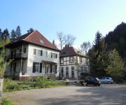
Villa Romantica
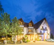
Zum Schwan Landgasthof
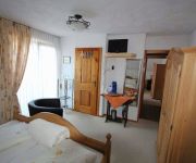
Land-gut-Hotel Hotel Felsentor
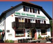
Hauensteiner Hof Cafe Restaurant Dorfstübel
Johanniskreuz
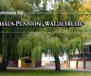
Waldesruhe Gasthaus Pension
Videos from this area
These are videos related to the place based on their proximity to this place.
Waschtal bei Hinterweidenthal/Pfalz Südwestdeutschland 1-2015
vom Bahnhof Hinterweidenthal befindet sich ein Radweg bis nach Münchweiler. Durch den B10 Ausbau wurde auch dieser zum Teil erneuert. Der Clip zeigt die Eisenbahnbrücke sowie den ...
SEHENSWUERDIGKEITEN,Trippstadt, Pfälzerwald, Karlstalschlucht, Brunnenstollen, Skulpturen
SEHENSWUERDIGKEITEN,Trippstadt, Pfäzerwald, Karlstalschlucht, Brunnenstollen, Kunstwerke, Skulpturen, Klugsche Mühle, Unterhammer, Finsterbrunnertal, Jakobsweg, Planwagenfahrt, Meiserhof, ...
Karlstalschlucht - Trippstadt + Umgebung | Pfalz
Diese Tour haben wir selbst geplant und sie war wunderschön Start: Klug'sche Mühle | Unterhammer | Eisenschmelz | Finsterbrunnen | Karlstalschlucht | Oberhammer | Großer Rothenberg ...
RESTAURANT Pfäzer Gastlichkeit Trippstadt Sägmühle
RESTAURANT Pfälzer Gastlichkeit Trippstadt Sägmühle, Sonntag Buffet mit Wildgerichten und Wild aus der Region. Stammessen Montag bis Samstag.
LAGE Freizeitzentrum Campingplatz Sägmühle, Trippstadt, Biosphärenreservat, Pfäzerwald
LAGE Freizeitzentrum Campingplatz Sägmühle, Trippstadt, Biosphärenreservat, Pfäzerwald.
FESTE im Freizeitzentrum Campingplatz Sägmühle in Trippstadt und in der Stadt Trippstadt
FESTE im Freizeitzentrum Campingplatz Sägmühle in Trippstadt und in der Stadt Trippstadt, mitten im Pfäzerwald, Biosphärenreservat.
KINDER Betreuung im Freizeitzentrum Campingplatz Sägmühle, Trippstadt, Pfälzerwald
KINDERBetreuung, Freizeitzentrum, Campingplatz, Sägmühle, Trippstadt, Pfälzerwald, Biosphärenreservat, Naturschutzgebiet.
MTB-Ahrtalbiker unterwegs im Pfälzer Wald
Unterwegs im Mountainbikepark Pfälzer Wald nur 30km von Tour 2.
Videos provided by Youtube are under the copyright of their owners.
Attractions and noteworthy things
Distances are based on the centre of the city/town and sightseeing location. This list contains brief abstracts about monuments, holiday activities, national parcs, museums, organisations and more from the area as well as interesting facts about the region itself. Where available, you'll find the corresponding homepage. Otherwise the related wikipedia article.
Wartenberg (Donau)
Wartenberg is a mountain in Baden-Württemberg, Germany.


