Safety Score: 3,0 of 5.0 based on data from 9 authorites. Meaning we advice caution when travelling to Germany.
Travel warnings are updated daily. Source: Travel Warning Germany. Last Update: 2024-08-13 08:21:03
Delve into Lasel
Lasel in Rhineland-Palatinate with it's 355 habitants is a town located in Germany about 343 mi (or 551 km) south-west of Berlin, the country's capital town.
Time in Lasel is now 01:16 AM (Sunday). The local timezone is named Europe / Berlin with an UTC offset of one hour. We know of 10 airports closer to Lasel, of which 5 are larger airports. The closest airport in Germany is Bitburg Airport in a distance of 13 mi (or 20 km), South. Besides the airports, there are other travel options available (check left side).
There are several Unesco world heritage sites nearby. The closest heritage site in Germany is Roman Monuments, Cathedral of St Peter and Church of Our Lady in Trier in a distance of 26 mi (or 42 km), South. Also, if you like the game of golf, there is an option about 18 mi (or 30 km). away. In need of a room? We compiled a list of available hotels close to the map centre further down the page.
Since you are here already, you might want to pay a visit to some of the following locations: Wawern, Nimsreuland, Nimshuscheid, Feuerscheid and Heisdorf. To further explore this place, just scroll down and browse the available info.
Local weather forecast
Todays Local Weather Conditions & Forecast: 8°C / 47 °F
| Morning Temperature | 5°C / 40 °F |
| Evening Temperature | 8°C / 47 °F |
| Night Temperature | 7°C / 45 °F |
| Chance of rainfall | 0% |
| Air Humidity | 90% |
| Air Pressure | 1015 hPa |
| Wind Speed | Fresh Breeze with 14 km/h (9 mph) from North-East |
| Cloud Conditions | Overcast clouds, covering 100% of sky |
| General Conditions | Overcast clouds |
Monday, 25th of November 2024
10°C (50 °F)
5°C (41 °F)
Moderate rain, fresh breeze, overcast clouds.
Tuesday, 26th of November 2024
6°C (42 °F)
2°C (36 °F)
Broken clouds, moderate breeze.
Wednesday, 27th of November 2024
5°C (41 °F)
4°C (39 °F)
Light rain, fresh breeze, overcast clouds.
Hotels and Places to Stay
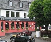
Am Wenzelbach Landhotel
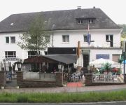
Nimstal
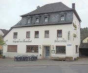
Vogtshof von Wetteldorf
Videos from this area
These are videos related to the place based on their proximity to this place.
Malbergweich Juli-2009
Wir möchten Euch hier in einem Kurzfilm unser schönes Dorf in der Eifel vorstellen. Kamera: Panasonic DMC-TZ7.
Mein Jakobsweg - 2.4 - Von Prüm nach Waxweiler
Auf den Spuren der Jakobspilger von Köln aus durch die Eifel und durch Frankreich - eine animierte Bilderfolge - siehe auch http://meinjakobsweg-info.de Wegstrecke in Google Maps: http://maps.g...
Landwirtschaftssimulator 2011 -| Maishäckseln in der Eifel |- HD
Sorry für die Laggs wir waren zu 5. auf einer 6000er Leitung und ich hab nur ne 700er Leitung :D Download Map: http://ul.to/m0c9vun5 MFG Kickertz ;)
Nim(m)s Rad 2010
Raderlebnistag im Nimstal in der Eifel. Zwischen Rommersheim und Rittersdorf gehörte die Landstraße am Pfingstmontag den Radfahrern. Impressionen von der Erlebnisstation in Bickendorf.
Theis Mühle - Urlaub in der Südeifel | ARVANDO
Hotel-Restaurant "Theis-Mühle" Familiäre Gastlichkeit Inmitten des Naturpark Südeifel, nur wenige Meter vom Stausee Bitburg entfernt. Zentral, aber ruhig. In unmittelbarer Nähe beginnen...
Karpfen fangen einmal anders
Auch Fische können sich mit einer Ohrfeige wehren :-) (ab min. 4:05) Bei AngelDirWas werden einige überzählige Karpfen per Hand abgefischt. Weiheranlage www.angeldirwas.de Nimshuscheid ...
2011_09 25 Afdaling auto met caravan, Prum Duitsland
Waldcamping Prum (Duitsland) afdaling 5% met caravan Vakantie september 2011)
Videos provided by Youtube are under the copyright of their owners.


