Safety Score: 3,0 of 5.0 based on data from 9 authorites. Meaning we advice caution when travelling to Germany.
Travel warnings are updated daily. Source: Travel Warning Germany. Last Update: 2024-08-13 08:21:03
Discover Kersch
Kersch in Rhineland-Palatinate is a place in Germany about 352 mi (or 567 km) south-west of Berlin, the country's capital city.
Current time in Kersch is now 12:11 PM (Monday). The local timezone is named Europe / Berlin with an UTC offset of one hour. We know of 11 airports near Kersch, of which 4 are larger airports. The closest airport in Germany is Bitburg Airport in a distance of 11 mi (or 17 km), North. Besides the airports, there are other travel options available (check left side).
There are several Unesco world heritage sites nearby. The closest heritage site in Germany is Roman Monuments, Cathedral of St Peter and Church of Our Lady in Trier in a distance of 5 mi (or 8 km), South-East. If you need a hotel, we compiled a list of available hotels close to the map centre further down the page.
While being here, you might want to pay a visit to some of the following locations: Trierweiler, Rosport, Newel, Ralingen and Aach. To further explore this place, just scroll down and browse the available info.
Local weather forecast
Todays Local Weather Conditions & Forecast: 13°C / 55 °F
| Morning Temperature | 11°C / 52 °F |
| Evening Temperature | 9°C / 49 °F |
| Night Temperature | 8°C / 46 °F |
| Chance of rainfall | 8% |
| Air Humidity | 70% |
| Air Pressure | 1008 hPa |
| Wind Speed | Fresh Breeze with 15 km/h (10 mph) from North |
| Cloud Conditions | Overcast clouds, covering 99% of sky |
| General Conditions | Moderate rain |
Tuesday, 26th of November 2024
7°C (45 °F)
4°C (39 °F)
Light rain, gentle breeze, clear sky.
Wednesday, 27th of November 2024
8°C (46 °F)
4°C (39 °F)
Light rain, fresh breeze, overcast clouds.
Thursday, 28th of November 2024
5°C (41 °F)
1°C (34 °F)
Overcast clouds, light breeze.
Hotels and Places to Stay
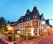
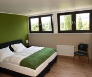
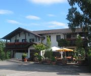
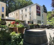
Eurener Hof
Ralinger Hof Landgasthof
Wiesengrund Zum
Schroeders Stadtwaldhotel
Ambiente
Keisers Hotel Garni
Kockelsberg Berghotel
Igeler Säule
Albachmühle Waldhotel Landgasthof
Römerbrücke
Videos from this area
These are videos related to the place based on their proximity to this place.
Westernshop online Westernbekleidung Minden Westernhüte Minden Lonesome Pine Western-Online-Shop
Sind Sie auf der Suche nach dem passenden Outfit für Ihre nächste Western- oder Country-Party? Dann sind Sie bei uns richtig. Hier finden Sie fast alles, was das Herz der Western-Fans höher...
Picknick mit Käfer - SlowMosel
SlowMosel ist die individuellste und schönste Form, das vielfältige Angebot der Region Mosel unbeschwert entdecken zu können. mehr unter www.slowmosel.de In tourism SlowMosel is the most...
B49: L Grenze - Trier (2.5x)
Droga Krajowa B49: granica z Luksemburgiem - Trier (Trewir). Kierunek Trier (Trewir). Bundesstrasse B49: L border - Trier towards Trier.
TB20 Flight
Video registration from a flight from EHLE (lelystad) in the Netherlands to EDRT (Trier) in Germany.
DeuLux 2012 - Impressionen
Wir bedanken uns beim 1.666 LäuferInnen im Ziel, davon 1.397 im Bitburger 10 km-Hauptlauf. Super, dass ihr uns auch im Regen die Treue gehalten habt! Mehr auf www.deulux-lauf.de.
Unser Langsur - Diashow des CVL
Wir zeigen hier eine Auswahl von Fotos, die in den Jahren 2009 bis 2011 ausschließlich in Langsur, an der Holzbrücke in Langsur-Metzdorf und am Kletterfelsen in Igel-Liersberg in Zusammenhang...
A64 + B52 + A602: L Grenze - AD Moseltal (2.5x)
Autostrada A64 oraz Droga B52 i Autostrada A602: granica z Luksemburgiem - (4) Dreieck Moseltal. Kierunek Koblenz (Koblencja) Autobahn A64, Bundesstrasse B52 and Autobahn A602: L border -...
Videos provided by Youtube are under the copyright of their owners.
Attractions and noteworthy things
Distances are based on the centre of the city/town and sightseeing location. This list contains brief abstracts about monuments, holiday activities, national parcs, museums, organisations and more from the area as well as interesting facts about the region itself. Where available, you'll find the corresponding homepage. Otherwise the related wikipedia article.
Trier-Land
Trier-Land is a Verbandsgemeinde ("collective municipality") in the Trier-Saarburg district, in Rhineland-Palatinate, Germany. It is situated on the border with Luxembourg, north and west of Trier. The seat of the municipality is in Trier, itself not part of the municipality. The Verbandsgemeinde Trier-Land consists of the following Ortsgemeinden ("local municipalities"): Aach Franzenheim Hockweiler Igel Kordel Langsur Newel Ralingen Trierweiler Welschbillig
Born, Luxembourg
Born is a village on the River Sauer in the commune of Mompach, in eastern Luxembourg. It lies on the N10, 14 km south of Echternach and 8 km north of Wasserbillig. Only 5 minutes drive from the E44 motorway from Luxembourg City to Trier, it is popular with tourists and day-trippers who enjoy walking, cycling or fishing along the grassy banks of the river. As of 2001, Born has a population of 340.
Born Castle
Born Castle (French: Château de Born) is located in the centre of the little village of Born some 8 km (5 mi) north of Wasserbillig in south-eastern Luxembourg. It has a history dating from 1286 when the Lords of Born lived there. In particular, they were associated with the families of Hattstein, Faust d'Aschaffenbourg and de Villers. Today's castle was built on the old site in the 18th century and is privately owned.


