Safety Score: 3,0 of 5.0 based on data from 9 authorites. Meaning we advice caution when travelling to Germany.
Travel warnings are updated daily. Source: Travel Warning Germany. Last Update: 2024-08-13 08:21:03
Delve into Kell am See
Kell am See in Rhineland-Palatinate is a town located in Germany about 349 mi (or 561 km) south-west of Berlin, the country's capital town.
Time in Kell am See is now 09:12 AM (Monday). The local timezone is named Europe / Berlin with an UTC offset of one hour. We know of 11 airports closer to Kell am See, of which 4 are larger airports. The closest airport in Germany is Bitburg Airport in a distance of 24 mi (or 39 km), North-West. Besides the airports, there are other travel options available (check left side).
There are several Unesco world heritage sites nearby. The closest heritage site in Germany is Roman Monuments, Cathedral of St Peter and Church of Our Lady in Trier in a distance of 12 mi (or 19 km), North-West. In need of a room? We compiled a list of available hotels close to the map centre further down the page.
Since you are here already, you might want to pay a visit to some of the following locations: Waldweiler, Schillingen, Grimburg, Mandern and Heddert. To further explore this place, just scroll down and browse the available info.
Local weather forecast
Todays Local Weather Conditions & Forecast: 12°C / 53 °F
| Morning Temperature | 10°C / 49 °F |
| Evening Temperature | 9°C / 48 °F |
| Night Temperature | 6°C / 43 °F |
| Chance of rainfall | 10% |
| Air Humidity | 72% |
| Air Pressure | 1008 hPa |
| Wind Speed | Moderate breeze with 12 km/h (8 mph) from North-East |
| Cloud Conditions | Overcast clouds, covering 85% of sky |
| General Conditions | Moderate rain |
Tuesday, 26th of November 2024
6°C (43 °F)
3°C (38 °F)
Light rain, gentle breeze, few clouds.
Wednesday, 27th of November 2024
7°C (44 °F)
3°C (38 °F)
Light rain, moderate breeze, overcast clouds.
Thursday, 28th of November 2024
4°C (39 °F)
0°C (32 °F)
Overcast clouds, light breeze.
Hotels and Places to Stay
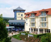
Parkhotel Weiskirchen
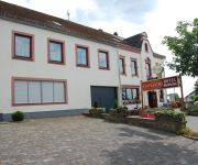
Typisch Hotel Brasserie
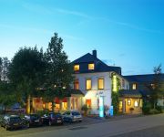
Zur Post Hotel & Restaurant
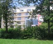
Seehotel
Massem Gasthaus-Pension-Metzgerei
Videos from this area
These are videos related to the place based on their proximity to this place.
Hierzuland Farschweiler
SWR Landesschau Rheinland-Pfalz am 25. April 2013. Thema: Kuhbach in Farschweiler Das Dorf in der Region Trier hat 800 Einwohner und liegt im Hunsrückhochwald. Die Lebensader des Dorfes ist ...
Zeitraffer Himmel über Trierer Moseltal
Aufnahmeort von Osburg im April 2013. Ich habe 3972 Fotos vom Dach aus mit einer Ricoh CX3 fotografiert.
AC / DC THUNDERSTRUCK OSBURN COVER OSBURGER KIRMES 2014 MIT FEUERWERK
Abschluss unseres Open Air anlässlich der Osburger Kirmes 2014 - AC/DC Thunderstruck mit Feuerwerk ;-) Danke an alle, die bei 5 Grad im Mai (!) mit uns gefeiert haben!!! Eure Band Osburn.
High Forest Rallye Festival 2010
Ein wenig Action vom 2010er High Forest Rallye Festival in Hermeskeil.
HermeskeilWP1Onboard
Der Neue im Team beim Schottertest... Erster Schottertest unseres Kadetts für die F-3. Leider ging uns auf WP 4 die Bremsleitung flöten.
Weiskirchen Heilklimatischer Kurort Autofahrt, Weiher-Klinik Saarland Germany T4
Hier ein Autofahrtclip von meinem Aufenthalt in der Reha Allgemeiner Text: Unterhalb der Hochwaldklinik befindet sich der Kurparkweiher von Weiskirchen. Durch die vielen gefiederten Tiere...
Hochwaldkliniken Weiskirchen Heilklimatischer Kurort der Premium Class**** T2
Eingangsbereich 1 und ein Rundgang im unteren Bereich, ausserhalb der Rehaklinik, für interressierte oder schon dagewesene. Hier in den Hochwald-Kliniken war mein Anreisetag der 22.7.2014....
Hochwald-Kliniken Weiskirchen Saarland Germany Autofahrt Saarschleife-Weiskirchen T16r
Saarburg bei Regen besucht. Danach auf dem Rückweg die kleine Saarschleife bei Hamm besichtigt. Und hier im Clip gehts zurück nach Weiskirchen. link über Saarburg: http://de.wikipedia.org/wiki/...
Videos provided by Youtube are under the copyright of their owners.
Attractions and noteworthy things
Distances are based on the centre of the city/town and sightseeing location. This list contains brief abstracts about monuments, holiday activities, national parcs, museums, organisations and more from the area as well as interesting facts about the region itself. Where available, you'll find the corresponding homepage. Otherwise the related wikipedia article.
Kell am See (Verbandsgemeinde)
Kell am See is a Verbandsgemeinde ("collective municipality") in the district Trier-Saarburg, in Rhineland-Palatinate, Germany. The seat of the Verbandsgemeinde is in Kell am See. The Verbandsgemeinde Kell am See consists of the following Ortsgemeinden ("local municipalities"): Baldringen Greimerath Heddert Hentern Kell am See Lampaden Mandern Paschel Schillingen Schömerich Vierherrenborn Waldweiler
Rösterkopf
The Rösterkopf in the Osburger Hochwald is a mountain with a height of 708 m.


