Safety Score: 3,0 of 5.0 based on data from 9 authorites. Meaning we advice caution when travelling to Germany.
Travel warnings are updated daily. Source: Travel Warning Germany. Last Update: 2024-08-13 08:21:03
Delve into Kaschenbach
Kaschenbach in Rhineland-Palatinate with it's 49 habitants is located in Germany about 351 mi (or 565 km) south-west of Berlin, the country's capital town.
Current time in Kaschenbach is now 08:14 AM (Friday). The local timezone is named Europe / Berlin with an UTC offset of one hour. We know of 11 airports close to Kaschenbach, of which 4 are larger airports. The closest airport in Germany is Bitburg Airport in a distance of 6 mi (or 10 km), North-East. Besides the airports, there are other travel options available (check left side).
There are several Unesco world heritage sites nearby. The closest heritage site in Germany is Roman Monuments, Cathedral of St Peter and Church of Our Lady in Trier in a distance of 11 mi (or 18 km), South-East. Also, if you like playing golf, there is an option about 32 mi (or 51 km). away. If you need a hotel, we compiled a list of available hotels close to the map centre further down the page.
While being here, you might want to pay a visit to some of the following locations: Niederweis, Alsdorf, Wolsfeld, Gilzem and Irrel. To further explore this place, just scroll down and browse the available info.
Local weather forecast
Todays Local Weather Conditions & Forecast: 3°C / 37 °F
| Morning Temperature | -2°C / 29 °F |
| Evening Temperature | 3°C / 37 °F |
| Night Temperature | 1°C / 35 °F |
| Chance of rainfall | 0% |
| Air Humidity | 74% |
| Air Pressure | 1008 hPa |
| Wind Speed | Fresh Breeze with 13 km/h (8 mph) from East |
| Cloud Conditions | Broken clouds, covering 79% of sky |
| General Conditions | Broken clouds |
Saturday, 23rd of November 2024
3°C (38 °F)
3°C (38 °F)
Overcast clouds, moderate breeze.
Sunday, 24th of November 2024
10°C (49 °F)
10°C (50 °F)
Light rain, moderate breeze, overcast clouds.
Monday, 25th of November 2024
11°C (51 °F)
8°C (46 °F)
Moderate rain, fresh breeze, overcast clouds.
Hotels and Places to Stay
Eden au Lac
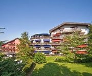
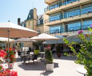
Romantik Hotel Bel Air Sport & Wellness
Koch-Schilt
Europa
Ralinger Hof Landgasthof
Eifelstern
Youtel Jugendhotel
Wirtz Landhaus
Videos from this area
These are videos related to the place based on their proximity to this place.
DAS FREEMAN TOR - Trailer
Trailer for Udo "Ufo" Everhardt's Heinz Fiction epic feature film DAS FREEMAN TOR. The no-budget adventures of Dave Freeman took 10 years in the making alone. Prepare to be amazed by multiple...
Teufelsschlucht - Teuflische Acht - Luxemburger Schweiz
Wanderung in der luxemburger Schweiz in der Nähe der Teufelsschucht im Naturpark delux. Hier der ▻ Link auf den Blogbeitrag http://goo.gl/zyqMma.
Irreler Wasserfälle
Kastelse Kayak Klub River: Prüm, Irreler Wasserfälle Water level: 85 cm Website: www.kastelsekayakklub.be Facebook: www.facebook.com/KastelseKayakKlub Youtube: ...
Camping Nimseck Irrel Overzicht
Een deel van de Camping Nimseck een korte overzicht netjes en schoon.
Videos provided by Youtube are under the copyright of their owners.
Attractions and noteworthy things
Distances are based on the centre of the city/town and sightseeing location. This list contains brief abstracts about monuments, holiday activities, national parcs, museums, organisations and more from the area as well as interesting facts about the region itself. Where available, you'll find the corresponding homepage. Otherwise the related wikipedia article.
Nims (river)
The Nims is a river in Rhineland-Palatinate, Germany, left tributary of the Prüm. Its total length is 59 km. The Nims originates in the Eifel hills, east of the town of Prüm. It flows south through Schönecken, Seffern, and through the western quarters of Bitburg. The Nims joins the Prüm in Irrel.
Irrel (Verbandsgemeinde)
Irrel is a Verbandsgemeinde ("collective municipality") in the district Bitburg-Prüm, in Rhineland-Palatinate, Germany. The seat of the Verbandsgemeinde is in Irrel. The Verbandsgemeinde Irrel consists of the following Ortsgemeinden ("local municipalities"):


