Safety Score: 3,0 of 5.0 based on data from 9 authorites. Meaning we advice caution when travelling to Germany.
Travel warnings are updated daily. Source: Travel Warning Germany. Last Update: 2024-08-13 08:21:03
Explore Vogelweh
The district Vogelweh of Kaiserslautern in Rhineland-Palatinate is located in Germany about 325 mi south-west of Berlin, the country's capital.
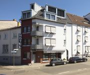
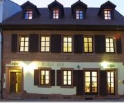
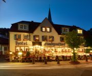
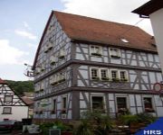
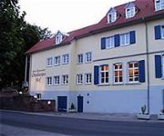
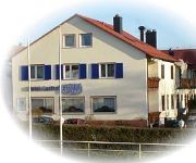
If you need a place to sleep, we compiled a list of available hotels close to the map centre further down the page.
Depending on your travel schedule, you might want to pay a visit to some of the following locations: Otterbach, Katzweiler, Stelzenberg, Mehlbach and Schneckenhausen. To further explore this place, just scroll down and browse the available info.
Local weather forecast
Todays Local Weather Conditions & Forecast: 4°C / 39 °F
| Morning Temperature | 4°C / 39 °F |
| Evening Temperature | 5°C / 41 °F |
| Night Temperature | 4°C / 40 °F |
| Chance of rainfall | 1% |
| Air Humidity | 85% |
| Air Pressure | 1015 hPa |
| Wind Speed | Moderate breeze with 10 km/h (6 mph) from North-East |
| Cloud Conditions | Overcast clouds, covering 100% of sky |
| General Conditions | Light rain |
Monday, 18th of November 2024
6°C (43 °F)
7°C (44 °F)
Moderate rain, moderate breeze, overcast clouds.
Tuesday, 19th of November 2024
7°C (45 °F)
3°C (37 °F)
Rain and snow, fresh breeze, overcast clouds.
Wednesday, 20th of November 2024
2°C (36 °F)
-1°C (31 °F)
Light snow, fresh breeze, broken clouds.
Hotels and Places to Stay
SAKS Urban Design Hotel
Zollamt Design Hotel
Blechhammer
Altstadthotel
Barbarossahof
Burgschänke
Blaues Haus
Otterberger Hof
Fröhlich
Best Western Hotel Kaiserslautern
Videos from this area
These are videos related to the place based on their proximity to this place.
1984 Kaiserslautern Vogelweh McDonalds Drive
Christmas in Kaiserslautern, Germany 1984. Special thanks to Mom and Dad for saving these memories to tape and letting me share them with all of you who remember this time in Germany. You can...
Integrierte Leitstelle Kaiserslautern
Die Stadt Kaiserslautern betreibt im Auftrag des Landes Rheinland-Pfalz die Integrierte Leitstelle Kaiserslautern. Sie ist die Führungseinrichtung bei Feuerwehr-, Rettungsdienst-, Katastrophenschu...
Fangesang: Olé rot-weiß (1. FC Kaiserslautern)
Fangesang des 1. FC Kaiserslautern. Aufgenommen nach dem 3:2 Sieg gegen den TSV 1860 München am 1. Spieltag der Saison 2014/15. Durch die Lautstärke wurde das Mikrofon leider an seine ...
Japan in Deutschland: Japanischer Garten Kaiserslautern
Ich war unterwegs im japanischen Garten Kaiserslautern. Es lohnt sich auf jeden Fall, dort vorbei zu schauen. Was ich gesehen und auch was ich dort gegessen habe, seht ihr hier^^ Besucht mich...
Eid Feier 2014 Kaiserslautern
Islam nation in kaiserslautern with more than 35 nationalities in Eid-Prayer https://www.facebook.com/izkl.de https://www.facebook.com/izkl.de.
Opel Kadett-C-Treffen 1991 in Kaiserslautern
Mit freundlicher Genehmigung von http://www.kadett-c-club-kaiserslautern-ev.de.
Die SWKcard der Stadtwerke Kaiserslautern
Die ganz-schön-viele-Freizeit-Aktivitäten-günstiger-Karte! - Gärten günstiger erleben - Mit Ihrer SWKcard erhalten Sie exklusive Vorteile bei unseren Kooperationspartnern. Genießen...
22.11.2014 TV Saarlouis II - 1. FC Kaiserslautern (8:3)
Hockey 4. Verbandsliga RPS Herren Saison 2014/15 am 22.11.2014 in Kaiserslautern.
Videos provided by Youtube are under the copyright of their owners.
Attractions and noteworthy things
Distances are based on the centre of the city/town and sightseeing location. This list contains brief abstracts about monuments, holiday activities, national parcs, museums, organisations and more from the area as well as interesting facts about the region itself. Where available, you'll find the corresponding homepage. Otherwise the related wikipedia article.
Palatinate (region)
The Palatinate, historically also Rhenish Palatinate, is a region in south-western Germany. It occupies more than a quarter of the German federal state (Bundesland) of Rhineland-Palatinate (Rheinland-Pfalz). Historically in union with Bavaria, Palatinate itself covers 5,451.23 km sq in area.
Ramstein Air Base
Ramstein Air Base is a United States Air Force base in Rhineland-Palatinate, a state of Germany. It serves as headquarters for the US Air Forces in Europe (USAFE) and is also a North Atlantic Treaty Organization installation. Ramstein is located near town of Ramstein-Miesenbach, in the rural district of Kaiserslautern. The east gate of Ramstein Air Base is about 10 miles from Kaiserslautern (locally referred to by Americans as "K-Town").
Ramstein air show disaster
The Ramstein air show disaster is the second-deadliest air show incident (following that in 2002 at Sknyliv). It took place in front of about 300,000 people on Sunday August 28, 1988, in Ramstein, West Germany, near the city of Kaiserslautern at the US Ramstein Air Base airshow Flugtag '88. Aircraft of the Italian Air Force display team collided during their display, crashing to the ground. 67 spectators and 3 pilots died.
Kaiserslautern (district)
Kaiserslautern is a district (Kreis) in the south of Rhineland-Palatinate, Germany. Neighboring districts are (from west clockwise) Kusel, Saarpfalz-Kreis, Donnersbergkreis, Bad Dürkheim and Südwestpfalz. The city of Kaiserslautern is almost fully enclosed by, but not belonging to the district.
Fritz-Walter-Stadion
The Fritz-Walter-Stadion is the home to the Bundesliga club 1. FC Kaiserslautern and is located in the city of Kaiserslautern, Rhineland-Palatinate, Germany. It is also one of the stadia used in the 2006 World Cup. It is named after Fritz Walter, who played for the Kaiserslautern club throughout his career and was captain of the Germany national football team that won the 1954 FIFA World Cup in the "Legend of Bern".
Kaiserslautern-Süd
Kaiserslautern-Süd is a Verbandsgemeinde ("collective municipality") in the district of Kaiserslautern, in Rhineland-Palatinate, Germany. It is situated in the Palatinate forest, approx. 10 km south of Kaiserslautern, which is the seat of the municipality, but not part of it. The Verbandsgemeinde Kaiserslautern-Süd consists of the following Ortsgemeinden ("local municipalities"): Krickenbach Linden Queidersbach Schopp Stelzenberg
Kaiserslautern University of Technology
The University of Kaiserslautern (German Technische Universität Kaiserslautern) is a university in Kaiserslautern, Germany. It was founded in 1970 and is organized into 12 faculties.
Kaiserslautern Town Hall
The Town Hall Kaiserslautern(Das Rathaus) was the tallest town hall in Germany at its inauguration in 1968. It has 25 floors above ground, from which the three uppermost are only used as storage or for operational devices. The height of the building, which has four elevators and in which most administrative units of Kaiserslautern are, amounts to 84 metres. On the 21st floor there is a cafe with a good view over the town.
German Research Centre for Artificial Intelligence
Deutsches Forschungszentrum für Künstliche Intelligenz (DFKI), lit. German Research Center for Artificial Intelligence, is one of the world's largest nonprofit contract research institutes in the field of innovative software technology based on artificial intelligence (AI) methods. DFKI was founded in 1988. Today it is based in Kaiserslautern, Saarbrücken, Bremen and Berlin. Companies figuring among the DFKI-shareholders include Microsoft, SAP, BMW and Daimler.
38th Combat Support Wing
The 38th Combat Support Wing (38 CSW) is an inactive wing of the United States Air Force. Its last assignment was with Third Air Force (Air Forces Europe), being inactivated on 1 May 2007 at Ramstein Air Base, Germany. The mission of the 38 CSW was to enhance support to USAFE geographically separated units. The Wing's origins date to 1948 as the 38th Bombardment Wing. It's operational group, the 38th Bombardment Group, was one of the first U.S.
Hochspeyer (Verbandsgemeinde)
Hochspeyer is a Verbandsgemeinde ("collective municipality") in the district of Kaiserslautern, Rhineland-Palatinate, Germany. The seat of the Verbandsgemeinde is in Hochspeyer. The Verbandsgemeinde Hochspeyer consists of the following Ortsgemeinden ("local municipalities"): Fischbach Frankenstein Hochspeyer
Otterbach (Verbandsgemeinde)
Otterbach is a Verbandsgemeinde ("collective municipality") in the district of Kaiserslautern, Rhineland-Palatinate, Germany. The seat of the Verbandsgemeinde is in Otterbach. The Verbandsgemeinde Otterbach consists of the following Ortsgemeinden ("local municipalities"): Frankelbach Hirschhorn Katzweiler Mehlbach Olsbrücken Otterbach
Otterberg (Verbandsgemeinde)
Otterberg is a Verbandsgemeinde in the district of Kaiserslautern, Rhineland-Palatinate, Germany. The seat of the Verbandsgemeinde is in Otterberg. The Verbandsgemeinde Otterberg consists of the following Ortsgemeinden ("local municipalities"): Heiligenmoschel Niederkirchen Otterberg Schallodenbach
Weilerbach (Verbandsgemeinde)
Weilerbach is a Verbandsgemeinde ("collective municipality") in the district of Kaiserslautern, Rhineland-Palatinate, Germany. The seat of the Verbandsgemeinde is in Weilerbach. The Verbandsgemeinde Weilerbach consists of the following Ortsgemeinden ("local municipalities"): Erzenhausen Eulenbis Kollweiler Mackenbach Reichenbach-Steegen Rodenbach Schwedelbach
Battle of Kaiserslautern
The Battle of Kaiserslautern (28-30 November 1793) was a battle of the War of the First Coalition (part of the French Revolutionary Wars), fought near the German city of Kaiserslautern. It resulted in a victory of the Prussian army under the Duke of Brunswick against the French Army of the Moselle led by Lazare Hoche.
Humberg Tower
The Humberg Tower is an observation tower on the Humberg hill, 425 metres (1,400 feet) high, to the south of the city of Kaiserslautern. The idea of building a tower on the Humberg (already in those days a favourite hill among the citizens of Kaiserslautern, for its view) was taken up in 1896. For this purpose, inhabitants of the city founded the Humberg Association, with the aim of financing the building of an observation tower.
316th Air Division
The 316th Airlift Division (316th AD) is an inactive United States Air Force organization. Its last assignment was with the United States Air Forces in Europe, assigned to Seventeenth Air Force, being stationed at Ramstein Air Base, Germany. It was inactivated on 1 May 1991.
822d Tactical Missile Squadron
The 822d Tactical Missile Squadron is an inactive United States Air Force unit. Its last assignment was with the 38th Tactical Missile Wing, based at Sembach Air Base, West Germany. It was inactivated on 25 September 1966.
823d Tactical Missile Squadron
The 823d Tactical Missile Squadron is an inactive United States Air Force unit. Its last assignment was with the 38th Tactical Missile Wing, based at Sembach Air Base, West Germany. It was inactivated on 25 September 1966.
Siegelbach
Siegelbach is located just northwest of the city of Kaiserslautern, in the heart of Germany's Rheinland-Pfalz. The village, with its 2,600 inhabitants, is included in the urban district of Kaiserslautern, as incorporated in 1969. The Arms of Siegelbach can be viewed at this site: Ralf Hartemink: "Siegelbach", Deutsche Wappen (Gemeindewappen/Kreiswappen) German Civic Heraldry, Heraldry of the World, http://www. ngw. nl/int/dld/s/siegelba. htm, retrieved 28 Aug 2009.
Kaiserslautern Central Station
Kaiserslautern Central Station (Kaiserslautern Hauptbahnhof) is a through-station in the German city of Kaiserslautern and one of seven stations in the city. It is a stop on the Rhine-Neckar S-Bahn and Deutsche Bahn’s Intercity-Express network and a hub for all the regional trains of the western Palatinate. On 10 June 2007, the Rhealys high-speed rail consortium established a service with a stop in Kaiserslautern, reducing travel time to Paris to two and a half hours.
Sembach Kaserne
Sembach Kaserne (formerly Sembach Air Base) is a United States Army installation in Sembach, Germany, near Kaiserslautern, and is about 19 miles (30 km) east of Ramstein Air Base. Prior to October 2010, it was a United States Air Force installation, and prior to 1995, it was an active military airfield known as Sembach Air Base (former ICAO ETAS).
587th Tactical Missile Group
The 587th Tactical Missile Group is an inactive United States Air Force unit. It was last assigned to the 38th Tactical Missile Wing and stationed at Sembach Air Base, West Germany. It was inactivated on 25 September 1962.
Hochspeyerbach
The Hochspeyerbach is a 21 km long river in the Palatinate forest in Rhineland-Palatinate and a left tributary of the Speyerbach.
University of Applied Sciences Kaiserslautern
The University of Applied Sciences Kaiserslautern is a Fachhochschule (University of Applied Sciences) located in Kaiserslautern, Germany. With 5600 students (as of November 2011), it is one of the largest Universities of Applied Sciences in the state of Rhineland-Palatinate. It comprises three campuses in Kaiserslautern, Pirmasens and Zweibrücken.


