Safety Score: 3,0 of 5.0 based on data from 9 authorites. Meaning we advice caution when travelling to Germany.
Travel warnings are updated daily. Source: Travel Warning Germany. Last Update: 2024-08-13 08:21:03
Explore Herbstmühle
Herbstmühle in Rhineland-Palatinate with it's 29 inhabitants is a city in Germany about 356 mi (or 573 km) south-west of Berlin, the country's capital.
Local time in Herbstmühle is now 03:47 PM (Thursday). The local timezone is named Europe / Berlin with an UTC offset of one hour. We know of 10 airports in the vicinity of Herbstmühle, of which 5 are larger airports. The closest airport in Germany is Bitburg Airport in a distance of 16 mi (or 26 km), East. Besides the airports, there are other travel options available (check left side).
There are several Unesco world heritage sites nearby. The closest heritage site in Germany is Roman Monuments, Cathedral of St Peter and Church of Our Lady in Trier in a distance of 25 mi (or 41 km), South-East. Also, if you like golfing, there is an option about 20 mi (or 32 km). away. If you need a place to sleep, we compiled a list of available hotels close to the map centre further down the page.
Depending on your travel schedule, you might want to pay a visit to some of the following locations: Koxhausen, Berscheid, Scheitenkorb, Rodershausen and Karlshausen. To further explore this place, just scroll down and browse the available info.
Local weather forecast
Todays Local Weather Conditions & Forecast: 1°C / 33 °F
| Morning Temperature | 1°C / 34 °F |
| Evening Temperature | -1°C / 30 °F |
| Night Temperature | -3°C / 27 °F |
| Chance of rainfall | 3% |
| Air Humidity | 82% |
| Air Pressure | 1002 hPa |
| Wind Speed | Moderate breeze with 11 km/h (7 mph) from East |
| Cloud Conditions | Overcast clouds, covering 100% of sky |
| General Conditions | Snow |
Friday, 22nd of November 2024
0°C (33 °F)
1°C (33 °F)
Broken clouds, fresh breeze.
Saturday, 23rd of November 2024
2°C (36 °F)
2°C (36 °F)
Overcast clouds, moderate breeze.
Sunday, 24th of November 2024
8°C (46 °F)
8°C (47 °F)
Overcast clouds, moderate breeze.
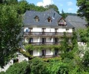
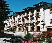
Hotels and Places to Stay
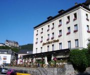
Grand Hotel de Vianden
Hotel Belle-Vue
Petry Logis
Hôtel - Restaurant Victor Hugo
Hotel Heintz
Auberge du Chateau
Videos from this area
These are videos related to the place based on their proximity to this place.
Ardennes Luxembourg tourism video: Vianden Castle/ Château, Clervaux & Esch sur Sûre
Europe Video Production tourism video: Ardennes of Luxembourg tourism video: Vianden Castle / Chateau de Vianden, Clervaux & Esch sur Sûre close to Belgium - Luxemburg travel film.
From Fairy Tale Land back to World War II Houghtaling's photos around Vianden, Luxembourg
Preview of Houghtaling's blog at TravelPod. Read the full blog here: http://www.travelpod.com/travel-blog-entries/houghtaling/1/1252109942/tpod.html This blog preview was made by TravelPod...
Rando-Moto.be 10 juin 2012 DEUTSCH-LUXEMBURGISCHE NATURPARK (HD)
Rando-Moto.be 10 juin 2012 DEUTSCH-LUXEMBURGISCHE NATURPARK (HD) http://www.rando-moto.be A fond la passion !
Wees stil voor het aangezicht van God
Het blijft een prachtig lied. In tekst en muziek. Met plezier uitgevoerd tijdens de sing-in, georganiseerd door Beter-UIT Vakantiepark Walsdorf. Deze sing-in werd gehouden in de Trinitarier...
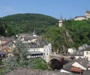
Château Vianden in den Luxemburger Ardennen
Wie ein Adlerhorst thront Château Vianden über dem gleichnamigen Ort in den Luxemburger Ardennen.
Videos provided by Youtube are under the copyright of their owners.
Attractions and noteworthy things
Distances are based on the centre of the city/town and sightseeing location. This list contains brief abstracts about monuments, holiday activities, national parcs, museums, organisations and more from the area as well as interesting facts about the region itself. Where available, you'll find the corresponding homepage. Otherwise the related wikipedia article.
Bivels
Bivels is a little village in the commune of Putscheid in north-eastern Luxembourg. It is part of the canton of Vianden in the district of Diekirch. As of 2001, it had 74 inhabitants. The village is located about 3 km north of Vianden along a 7 km long artificial lake. Once a poor farming village, it now benefits from the nearby hydroelectric power plant. In the 1960s when the dam was built, the lower part of the village was flooded.


