Safety Score: 3,0 of 5.0 based on data from 9 authorites. Meaning we advice caution when travelling to Germany.
Travel warnings are updated daily. Source: Travel Warning Germany. Last Update: 2024-08-13 08:21:03
Delve into Bruchmühlbach
The district Bruchmühlbach of Hauptstuhl in Rhineland-Palatinate is a district located in Germany about 338 mi south-west of Berlin, the country's capital town.
In need of a room? We compiled a list of available hotels close to the map centre further down the page.
Since you are here already, you might want to pay a visit to some of the following locations: Bruchmuhlbach-Miesau, Lambsborn, Martinshohe, Rosenkopf and Hutschenhausen. To further explore this place, just scroll down and browse the available info.
Local weather forecast
Todays Local Weather Conditions & Forecast: 0°C / 33 °F
| Morning Temperature | -3°C / 27 °F |
| Evening Temperature | 1°C / 33 °F |
| Night Temperature | 1°C / 34 °F |
| Chance of rainfall | 1% |
| Air Humidity | 82% |
| Air Pressure | 1010 hPa |
| Wind Speed | Fresh Breeze with 14 km/h (9 mph) from North-East |
| Cloud Conditions | Broken clouds, covering 68% of sky |
| General Conditions | Light snow |
Saturday, 23rd of November 2024
3°C (37 °F)
3°C (38 °F)
Light snow, moderate breeze, overcast clouds.
Sunday, 24th of November 2024
10°C (51 °F)
10°C (50 °F)
Overcast clouds, fresh breeze.
Monday, 25th of November 2024
11°C (52 °F)
8°C (46 °F)
Light rain, fresh breeze, overcast clouds.
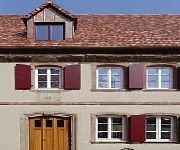
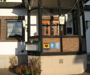
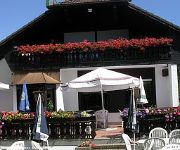
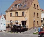
Hotels and Places to Stay
Landgrafen-Mühle
Pfälzer Stuben Hotel-Restaurant
Landgut Jungfleisch
Alte Bäckerei Gästehaus
Raisch
Videos from this area
These are videos related to the place based on their proximity to this place.
Nanzdietschweiler [D] - Martinskirche - Vollgeläute (Turmaufnahme)
Disposition: gis' - h' - cis" - e" Läutedauer: 09.53 Uhr - 10.02 Uhr Die protestantische Martinskirche im Nanzdietschweiler Ortsteil Dietschweiler entstand in einer zweijährigen Bauzeit...
Umbau City-El auf Headway LiFePO4 Akku´s
Hier wurde Martin´s City El auf die o.g. Akku´s umgerüstet. Winston raus, Headway rein..... Da er noch einen zweiten Satz gleicher Größe hat und diese dazuschalten kann ist seine Reichweite...
Nanzdietschweiler [D] - Pfarrkirche Herz Jesu - Vollgeläute
Disposition: a' - cis" - e" Läutedauer: 09.46 Uhr - 10.00 Uhr Die Pläne zum Bau einer eigenen katholischen Kirchengemeinde für die Nanzdietschweiler Katholiken waren 1907 voll im Gange....
UMX P-51d on a foggy day over Germany
Second time out flying my little UMX war-bird. They really do fly like larger planes with the AS3X system. I haven't flown planes in quite some time. I guess its like riding a bike because...
Hütschenhausen ´s Schneemann grillen morgens um 5.00 Uhr am 2.12.2012.MOV
Manchmal hat Mann sie halt nicht alle oder ?? Erst Schwenker morgens um 4 und dann den Schneemann aus dem ersten Schnee gegrillt ! Video kommt nochmal dann aber vertont !
Kaiserslautern soccer fans react to Germany's goal in the Euro Cup
A huge screen is set up on the marktplatz in Kaiserslautern, Germany for fans to watch Germany play Greece in the 2012 Euro Cup. If you are in the area, don't miss the games by coming downtown...
The idiotic Warrior 2
hier dreht ma wieder eien ganz spezielle figur druch dei in meienr klasse hab habt spaß^^ teil 2 :P.
Videos provided by Youtube are under the copyright of their owners.
Attractions and noteworthy things
Distances are based on the centre of the city/town and sightseeing location. This list contains brief abstracts about monuments, holiday activities, national parcs, museums, organisations and more from the area as well as interesting facts about the region itself. Where available, you'll find the corresponding homepage. Otherwise the related wikipedia article.
Ramstein Air Base
Ramstein Air Base is a United States Air Force base in Rhineland-Palatinate, a state of Germany. It serves as headquarters for the US Air Forces in Europe (USAFE) and is also a North Atlantic Treaty Organization installation. Ramstein is located near town of Ramstein-Miesenbach, in the rural district of Kaiserslautern. The east gate of Ramstein Air Base is about 10 miles from Kaiserslautern (locally referred to by Americans as "K-Town").
Ramstein air show disaster
The Ramstein air show disaster is the second-deadliest air show incident (following that in 2002 at Sknyliv). It took place in front of about 300,000 people on Sunday August 28, 1988, in Ramstein, West Germany, near the city of Kaiserslautern at the US Ramstein Air Base airshow Flugtag '88. Aircraft of the Italian Air Force display team collided during their display, crashing to the ground. 67 spectators and 3 pilots died.
Potzbergturm
The Potzbergturm is a 53.5-metre-high lookout and transmitting tower on the Potzberg at Föckelberg, Rhineland-Palatinate, Germany. It was built between 13 October 1951 and 2 December 1951 and consists of a 35-metre-high bricked tower with a footprint of 4 by 7 metres, on which are 18.5-metre-high radio towers. The Potzbergturm was inaugurated on 13 July 1952.
Zweibrücken-Land
Zweibrücken-Land is a Verbandsgemeinde ("collective municipality") in the Südwestpfalz district, in Rhineland-Palatinate, Germany. It is situated on the southwestern edge of the Palatinate forest, around Zweibrücken. The seat of the municipality is in Zweibrücken, itself not part of the municipality. The Verbandsgemeinde Zweibrücken-Land consists of the following Ortsgemeinden ("local municipalities"):
Kirrberg (Saar)
Kirrberg (Saar) is a district of Homburg, situated in the eastern part of the Saarpfalz-Kreis and the Saarland bordering Bundesland Rhineland-Palatinate. Homburg (5 km), Zweibrücken (7 km), Saarbrücken and Kaiserslautern (both 35 km) are the closest towns. As of December 2005, 3,155 inhabitants live in Kirrberg (Saar). The chapel of Kirrberg was firstly mentioned in the year 1290 as "Capella in Kirchperch".
Landstuhl Regional Medical Center
The Landstuhl Regional Medical Center (LRMC) is an overseas military hospital operated by the United States Army and the Department of Defense. LRMC is the largest military hospital outside of the continental United States. It is located near Landstuhl, Germany, and serves as the nearest treatment center for wounded soldiers coming from Iraq and Afghanistan. In addition, it serves military personnel stationed in Germany as well as their family members.
Bruchmühlbach-Miesau (Verbandsgemeinde)
Bruchmühlbach-Miesau is a Verbandsgemeinde ("collective municipality") in the district of Kaiserslautern, Rhineland-Palatinate, Germany. The seat of the Verbandsgemeinde is in Bruchmühlbach-Miesau. The Verbandsgemeinde Bruchmühlbach-Miesau consists of the following Ortsgemeinden ("local municipalities"): Bruchmühlbach-Miesau Gerhardsbrunn Lambsborn Langwieden
Landstuhl (Verbandsgemeinde)
Landstuhl is a Verbandsgemeinde ("collective municipality") in the district of Kaiserslautern, Rhineland-Palatinate, Germany. The seat of the Verbandsgemeinde is in Landstuhl. The Verbandsgemeinde Landstuhl consists of the following Ortsgemeinden ("local municipalities"): Bann Hauptstuhl Kindsbach Landstuhl Mittelbrunn
Ramstein-Miesenbach (Verbandsgemeinde)
Ramstein-Miesenbach is a Verbandsgemeinde ("collective municipality") in the district of Kaiserslautern, Rhineland-Palatinate, Germany. The seat of the Verbandsgemeinde is in Ramstein-Miesenbach. The Verbandsgemeinde Ramstein-Miesenbach consists of the following Ortsgemeinden ("local municipalities"): Hütschenhausen Kottweiler-Schwanden Niedermohr Ramstein-Miesenbach
Altenglan (Verbandsgemeinde)
Altenglan is a Verbandsgemeinde ("collective municipality") in the district of Kusel, Rhineland-Palatinate, Germany. The seat of the Verbandsgemeinde is in Altenglan. The Verbandsgemeinde Altenglan consists of the following Ortsgemeinden ("local municipalities"): Altenglan Bedesbach Bosenbach Elzweiler Erdesbach Föckelberg Horschbach Neunkirchen am Potzberg Niederalben Niederstaufenbach Oberstaufenbach Rammelsbach Rathsweiler Rutsweiler am Glan Ulmet
Glan-Münchweiler (Verbandsgemeinde)
Glan-Münchweiler is a Verbandsgemeinde ("collective municipality") in the district of Kusel, Rhineland-Palatinate, Germany. The seat of the Verbandsgemeinde is in Glan-Münchweiler. The Verbandsgemeinde Glan-Münchweiler consists of the following Ortsgemeinden ("local municipalities"): Börsborn Glan-Münchweiler Henschtal Herschweiler-Pettersheim Hüffler Krottelbach Langenbach Matzenbach Nanzdietschweiler Quirnbach Rehweiler Steinbach am Glan
Kusel (Verbandsgemeinde)
Kusel is a Verbandsgemeinde ("collective municipality") in the district of Kusel, Rhineland-Palatinate, Germany. The seat of the Verbandsgemeinde is in Kusel. The Verbandsgemeinde Kusel consists of the following Ortsgemeinden ("local municipalities"):
Schönenberg-Kübelberg (Verbandsgemeinde)
Schönenberg-Kübelberg is a Verbandsgemeinde ("collective municipality") in the district of Kusel, Rhineland-Palatinate, Germany. The seat of the Verbandsgemeinde is in Schönenberg-Kübelberg. The Verbandsgemeinde Schönenberg-Kübelberg consists of the following Ortsgemeinden ("local municipalities"): Altenkirchen Brücken Dittweiler Frohnhofen Gries Ohmbach
Waldmohr (Verbandsgemeinde)
Waldmohr is a Verbandsgemeinde ("collective municipality") in the district of Kusel, Rhineland-Palatinate, Germany. The seat of the Verbandsgemeinde is in Waldmohr. The Verbandsgemeinde Waldmohr consists of the following Ortsgemeinden ("local municipalities"): Breitenbach Dunzweiler
Wallhalben (Verbandsgemeinde)
Wallhalben is a Verbandsgemeinde ("collective municipality") in the Südwestpfalz district, in Rhineland-Palatinate, Germany. The seat of the municipality is in Wallhalben. The Verbandsgemeinde Wallhalben consists of the following Ortsgemeinden ("local municipalities"): Biedershausen Herschberg Hettenhausen Knopp-Labach Krähenberg Obernheim-Kirchenarnbach Saalstadt Schauerberg Schmitshausen Wallhalben Weselberg
Ramstein High School
Ramstein American High School (also commonly referred to as RHS) is a Department of Defense Dependents Schools (DoDDS) high school in the Kaiserslautern district which serves the European portion of DoDDS. Their mascot is the Royale, a lion with a crown. Ramstein American High School is located on Ramstein Air Base (RAB) which is just outside of Kaiserslautern, Germany.
Karlsberg Castle
Karlsberg Castle is a castle ruin on Buchenberg east of Homburg in Saarland, Germany. The castle was constructed from 1778 to 1788 in Baroque and Classical style by Johann Christian von Mannlich, architect and general building director of the dukes of Zweibrücken, by order of Charles II August, Duke of Zweibrücken. The castle was the largest country palace of Europe and served as the residence of the Duke of Zweibrücken. In 1793 the castle was destroyed by French revolutionary troops.
Burg Nanstein
Burg Nanstein is a castle in Landstuhl, Rhineland-Palatinate, Germany. It was built around the year 1162 after Holy Roman Emperor Frederick I demanded its construction as additional defense for the Palatinate. In 1504, German knight Franz von Sickingen, inherited part of the castle after his father's death in the War of the Bavarian Succession, finally acquiring the entire castle in 1518. He immediately began extensive refortification to make the castle suitable for firearms.
Waldstadion Homburg
The Waldstadion Homburg is the home stadium of Oberliga Südwest club FC 08 Homburg. It has a spectator capacity of 21,813. In the three seasons — 1986–87, 1987–88 and 1989–90 — that Homburg were in the Bundesliga the average attendance was less than 8,000 per game.
316th Air Division
The 316th Airlift Division (316th AD) is an inactive United States Air Force organization. Its last assignment was with the United States Air Forces in Europe, assigned to Seventeenth Air Force, being stationed at Ramstein Air Base, Germany. It was inactivated on 1 May 1991.
Paratrooper Battalion 263 (Bundeswehr)
The Paratrooper Battalion 263 (Fallschirmjägerbataillon 263) is one of the three combat battalions of the German Army's Airborne Brigade 26, which is a part of the Special Operations Division. Paratrooper Battalion 263 is fully airmobile and can act both as air assault infantry or be dropped by parachute into the area of operations.
Homburg Central Station
Homburg Central Station (Homburg Hauptbahnhof) in a railway station in the town of Homburg in the German state of Saarland. It is a through station with four platforms and seven platform tracks and is classified by Deutsche Bahn as a station of category 3. It is located at the junction of the Homburg–Neunkirchen line and the Mannheim–Saarbrücken line. It has been the western terminus of line S1 of the Rhine-Neckar S-Bahn since 2006.
Römermuseum Schwarzenacker
Römermuseum Schwarzenacker (Schwarzenacker Roman Museum) is an archaeological open-air museum in Schwarzenacker, a district of Homburg, Saarland, Germany. The museum was constructed by archaeologist Alfonso Kolling, who also led the archaeological excavations at the site. Current director is Klaus Kell.
Lambsbach
Lambsbach is a river of Saarland, Germany.
Zweibrücken Central Station
Zweibrücken Central Station (Zweibrücken Hauptbahnhof) is a through station with two platforms and three platform tracks in the city of Zweibrücker in the German state of Rhineland-Palatinate. It is located not far from the city centre, on the single-track, non-electrified, Queich Valley Railway, over which Regionalbahn trains operate between Saarbrücken Central Station and Pirmasens Central Station. It also connects with Landau, although this requires a change of trains at Pirmasens Nord.



!['Nanzdietschweiler [D] - Martinskirche - Vollgeläute (Turmaufnahme)' preview picture of video 'Nanzdietschweiler [D] - Martinskirche - Vollgeläute (Turmaufnahme)'](https://img.youtube.com/vi/XzSpLItlxD4/mqdefault.jpg)

!['Nanzdietschweiler [D] - Pfarrkirche Herz Jesu - Vollgeläute' preview picture of video 'Nanzdietschweiler [D] - Pfarrkirche Herz Jesu - Vollgeläute'](https://img.youtube.com/vi/Fel0XA7gni4/mqdefault.jpg)


