Safety Score: 3,0 of 5.0 based on data from 9 authorites. Meaning we advice caution when travelling to Germany.
Travel warnings are updated daily. Source: Travel Warning Germany. Last Update: 2024-08-13 08:21:03
Touring Harscheid
Harscheid in Rhineland-Palatinate with it's 160 residents is a town located in Germany about 314 mi (or 506 km) south-west of Berlin, the country's capital place.
Time in Harscheid is now 05:26 PM (Thursday). The local timezone is named Europe / Berlin with an UTC offset of one hour. We know of 11 airports nearby Harscheid, of which 5 are larger airports. The closest airport in Germany is Norvenich Airport in a distance of 28 mi (or 44 km), North. Besides the airports, there are other travel options available (check left side).
There are several Unesco world heritage sites nearby. The closest heritage site in Germany is Castles of Augustusburg and Falkenlust at Brühl in a distance of 25 mi (or 41 km), North. We collected 2 points of interest near this location. Need some hints on where to stay? We compiled a list of available hotels close to the map centre further down the page.
Being here already, you might want to pay a visit to some of the following locations: Schuld, Sierscheid, Winnerath, Insul and Fuchshofen. To further explore this place, just scroll down and browse the available info.
Local weather forecast
Todays Local Weather Conditions & Forecast: 1°C / 33 °F
| Morning Temperature | 1°C / 33 °F |
| Evening Temperature | -2°C / 29 °F |
| Night Temperature | -3°C / 27 °F |
| Chance of rainfall | 0% |
| Air Humidity | 72% |
| Air Pressure | 1000 hPa |
| Wind Speed | Gentle Breeze with 9 km/h (5 mph) from South-East |
| Cloud Conditions | Overcast clouds, covering 100% of sky |
| General Conditions | Overcast clouds |
Friday, 22nd of November 2024
1°C (34 °F)
1°C (34 °F)
Rain and snow, moderate breeze, overcast clouds.
Saturday, 23rd of November 2024
2°C (35 °F)
3°C (37 °F)
Overcast clouds, moderate breeze.
Sunday, 24th of November 2024
9°C (47 °F)
10°C (49 °F)
Overcast clouds, fresh breeze.
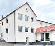
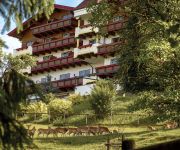
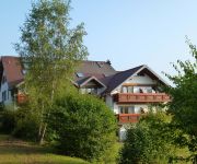
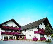
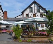
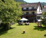
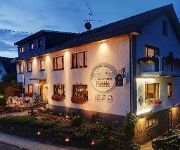
Hotels and Places to Stay
GT3 das sportliche Hotel
Kastenholz
Landhaus Sonnenhof
Ewerts Landhotel
Keuler Landgasthaus
Strohe Gasthaus
Eifelpension Brückenschenke
Zum Sahrtal
Eifelstube
Hochthürmer-Blick Garni
Videos from this area
These are videos related to the place based on their proximity to this place.
Karnevalseröffnung Hönningen 10.11.2012: Tanz der gr. Funken
Karnevalseröffnung Hönningen 2012, Tanz der älteren Funken.
2010_02_05 Hein sein Autopilot
Autopilot, Nachbau von "Die Reise in einem verrückten Flugzeug". Heinz hatte sich für seinen Modellheli einen Autopiloten gewünscht. Die Truppe hatte darum einen Autopiloten der besonderen...
2010-10-03 Eifel Tour C
Dieses ist der 3. Teil unserer Eifel Tour. Das Besondere an diesem Video ist, dass Robert nach hinten filmt und Thomas nach vorne. Beide Szenen sind synchron in einem Video zusammen gefasst....
Eifel Tour am 23.8.2009
Meggy und ich auf einer Motorrad Tour mit Tiger 1050 und Street Triple 675. Ich hatte die Camera an der Tiger am Gepäckträger mit Blick nach hinten montiert, so dass ich während der ganzen...
Oldtimer-Ausfahrt Rund um Bad Münstereifel | Motorräder | Rhein-Eifel.TV
http://www.rhein-eifel.tv/rund-um-bad-muenstereifel.htm - Das seit 2002 ausgetragene Treffen für Motorräder bis Baujahr 1939 hat sich zu einer etablierten Veranstaltung für Fans von historischen...
Linienrausch @ Insul 2013
Mitten in der Eifel, im kleinen beschaulichen Insul, fand wieder einmal der Insul Freeride statt. Vom 31. August bis zum 1. September konnten hier ca 100 Fahrer für ein geringes Startgeld...
Insul Longboard Downhill 2014 (Full HD)
Impressionen von der Deutschen Meisterschaft und Freeride in Insul am 23. + 24. August 2014. Aufgenommen mit einer Sony TD10. Dieses Video existiert auch in einer 3D-Fassung.
[3D] Insul Longboard Downhill 2014 (Full HD yt3d )
3D-Impressionen zur Deutschen Meisterschaft und Freeride im Longboard Downhill in Insul am 23. + 24. August 2014. Aufgenommen mit einer Sony TD10.
Videos provided by Youtube are under the copyright of their owners.
Attractions and noteworthy things
Distances are based on the centre of the city/town and sightseeing location. This list contains brief abstracts about monuments, holiday activities, national parcs, museums, organisations and more from the area as well as interesting facts about the region itself. Where available, you'll find the corresponding homepage. Otherwise the related wikipedia article.
Ahr Hills
The Ahr Hills (German: Ahrgebirge or Ahreifel) are a range of low mountains and hills up to 623 m high and 25 kilometres long in the Eifel region of Germany, which lie roughly southwest of Bonn on the border between the German states of North Rhine-Westphalia and Rhineland-Palatinate. The forested Ahr Hills have numerous tourist destinations and the section of a Roman road with its ancient Eifel Aqueduct.





!['[3D] Insul Longboard Downhill 2014 (Full HD yt3d )' preview picture of video '[3D] Insul Longboard Downhill 2014 (Full HD yt3d )'](https://img.youtube.com/vi/2JLVjIn43U0/mqdefault.jpg)