Safety Score: 3,0 of 5.0 based on data from 9 authorites. Meaning we advice caution when travelling to Germany.
Travel warnings are updated daily. Source: Travel Warning Germany. Last Update: 2024-08-13 08:21:03
Discover Enkenbach
The district Enkenbach of Enkenbach-Alsenborn in Rhineland-Palatinate is a district in Germany about 319 mi south-west of Berlin, the country's capital city.
Looking for a place to stay? we compiled a list of available hotels close to the map centre further down the page.
When in this area, you might want to pay a visit to some of the following locations: Mehlingen, Sembach, Hochspeyer, Fischbach and Neuhemsbach. To further explore this place, just scroll down and browse the available info.
Local weather forecast
Todays Local Weather Conditions & Forecast: -0°C / 32 °F
| Morning Temperature | -2°C / 28 °F |
| Evening Temperature | -0°C / 32 °F |
| Night Temperature | 1°C / 34 °F |
| Chance of rainfall | 0% |
| Air Humidity | 81% |
| Air Pressure | 1009 hPa |
| Wind Speed | Moderate breeze with 12 km/h (7 mph) from East |
| Cloud Conditions | Broken clouds, covering 62% of sky |
| General Conditions | Light snow |
Saturday, 23rd of November 2024
3°C (37 °F)
2°C (36 °F)
Light snow, moderate breeze, overcast clouds.
Sunday, 24th of November 2024
11°C (51 °F)
6°C (42 °F)
Overcast clouds, moderate breeze.
Monday, 25th of November 2024
11°C (52 °F)
8°C (46 °F)
Light rain, moderate breeze, overcast clouds.
Hotels and Places to Stay
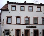
Pfälzer Hof
Kölbl
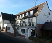
Grinnerhof Landhaus
Mühle am Schlossberg
Barbarossahof
Klostermühle
Klosterhof Landgasthaus - Pension
Videos from this area
These are videos related to the place based on their proximity to this place.
Druckprodukte Werbedrucksachen Vereinsdrucksachen Kleinoffsetdruckerei E. Kutas GmbH Mehlingen
Um die Bedürfnisse unserer Kunden optimal abzudecken, bieten wir die Personalisierung Ihrer Briefe, Anschreiben und Postkarten sowie Adressierungen in unserem Hause an. Kuvertieren und ...
Mehlinger Heide
Mehlinger Heide - Reportage über den Ausflug von Nico Alexander Heinz nach Rheinland-Pfalz in der nähe von Kaiserslautern zum Naturschutzgebiet Mehlinegr Heide. Homepage: ...
Rasentraktor-Rennen Sembach 2014
Großer Preis von Sembach. Rasentraktor-Rennen 2014 vom 18.07.-20.07.2014.
Alsenborn von Oben Erleben Sonnenuntergang
Da mir mal gerade danach war machte ich ein paar tolle aufnahmen.
Rasentraktor-Rennen Sembach 2014
Großer Preis von Sembach. Rasentraktor-Rennen 2014 vom 18.07.-20.07.2014.
Sembach Air Base: Ghosts of the Cold War
Here is a walkthrough of the former flight line of Sembach Air Base, Germany. The flight line was closed in 1995, although the annex area, about a mile from the former flight line, is still...
Bad Dürkheim Wanderung Rußhütte Erlenbach Isenach Quelle Frankenstein
Von der Rußhütte in Frankenstein den Erlenbach entlang zur Wattenheimer Hütte Amtmannsplatz den gelbweissen Pfad zum Ursprung der Isenach. Von der Quelle ins Tal und nach rechts Richtung...
Wanderung durch das Leinbachtal
Wanderung duch das Leinbachtal bei Frankenstein / Pfalz. Ein herrliches langgezogenes Tal mit kleinen Seitentäler die man unbedingt besuchen sollte. An den Hängen findet man viele ...
Videos provided by Youtube are under the copyright of their owners.
Attractions and noteworthy things
Distances are based on the centre of the city/town and sightseeing location. This list contains brief abstracts about monuments, holiday activities, national parcs, museums, organisations and more from the area as well as interesting facts about the region itself. Where available, you'll find the corresponding homepage. Otherwise the related wikipedia article.
Palatinate (region)
The Palatinate, historically also Rhenish Palatinate, is a region in south-western Germany. It occupies more than a quarter of the German federal state (Bundesland) of Rhineland-Palatinate (Rheinland-Pfalz). Historically in union with Bavaria, Palatinate itself covers 5,451.23 km sq in area.
Electoral Palatinate
The County Palatine of the Rhine (German: Pfalzgrafschaft bei Rhein), later the Electoral Palatinate, was a historical territory of the Holy Roman Empire, a palatinate administered by a count palatine. Its rulers served as prince-electors of the Holy Roman Empire from "time immemorial", were noted as such in a papal letter of 1261, and were confirmed as electors by the Golden Bull of 1356.
Fritz-Walter-Stadion
The Fritz-Walter-Stadion is the home to the Bundesliga club 1. FC Kaiserslautern and is located in the city of Kaiserslautern, Rhineland-Palatinate, Germany. It is also one of the stadia used in the 2006 World Cup. It is named after Fritz Walter, who played for the Kaiserslautern club throughout his career and was captain of the Germany national football team that won the 1954 FIFA World Cup in the "Legend of Bern".
Kaiserslautern-Süd
Kaiserslautern-Süd is a Verbandsgemeinde ("collective municipality") in the district of Kaiserslautern, in Rhineland-Palatinate, Germany. It is situated in the Palatinate forest, approx. 10 km south of Kaiserslautern, which is the seat of the municipality, but not part of it. The Verbandsgemeinde Kaiserslautern-Süd consists of the following Ortsgemeinden ("local municipalities"): Krickenbach Linden Queidersbach Schopp Stelzenberg
Kaiserslautern Town Hall
The Town Hall Kaiserslautern(Das Rathaus) was the tallest town hall in Germany at its inauguration in 1968. It has 25 floors above ground, from which the three uppermost are only used as storage or for operational devices. The height of the building, which has four elevators and in which most administrative units of Kaiserslautern are, amounts to 84 metres. On the 21st floor there is a cafe with a good view over the town.
38th Combat Support Wing
The 38th Combat Support Wing (38 CSW) is an inactive wing of the United States Air Force. Its last assignment was with Third Air Force (Air Forces Europe), being inactivated on 1 May 2007 at Ramstein Air Base, Germany. The mission of the 38 CSW was to enhance support to USAFE geographically separated units. The Wing's origins date to 1948 as the 38th Bombardment Wing. It's operational group, the 38th Bombardment Group, was one of the first U.S.
Winnweiler (Verbandsgemeinde)
Winnweiler is a Verbandsgemeinde ("collective municipality") in the Donnersbergkreis, in Rhineland-Palatinate, Germany. The seat of the Verbandsgemeinde is in Winnweiler. The Verbandsgemeinde Winnweiler consists of the following Ortsgemeinden ("local municipalities"): Börrstadt Breunigweiler Falkenstein Gonbach Höringen Imsbach Lohnsfeld Münchweiler an der Alsenz Schweisweiler Sippersfeld Steinbach am Donnersberg Wartenberg-Rohrbach
Hochspeyer (Verbandsgemeinde)
Hochspeyer is a Verbandsgemeinde ("collective municipality") in the district of Kaiserslautern, Rhineland-Palatinate, Germany. The seat of the Verbandsgemeinde is in Hochspeyer. The Verbandsgemeinde Hochspeyer consists of the following Ortsgemeinden ("local municipalities"): Fischbach Frankenstein Hochspeyer
Otterberg (Verbandsgemeinde)
Otterberg is a Verbandsgemeinde in the district of Kaiserslautern, Rhineland-Palatinate, Germany. The seat of the Verbandsgemeinde is in Otterberg. The Verbandsgemeinde Otterberg consists of the following Ortsgemeinden ("local municipalities"): Heiligenmoschel Niederkirchen Otterberg Schallodenbach
Battle of Kaiserslautern
The Battle of Kaiserslautern (28-30 November 1793) was a battle of the War of the First Coalition (part of the French Revolutionary Wars), fought near the German city of Kaiserslautern. It resulted in a victory of the Prussian army under the Duke of Brunswick against the French Army of the Moselle led by Lazare Hoche.
Elmstein Castle
Elmstein Castle is a castle ruin built in the High Middle Ages overlooking Elmstein in the Palatinate Forest in Rhineland-Palatinate, Germany. It was built in the 12th century.
Humberg Tower
The Humberg Tower is an observation tower on the Humberg hill, 425 metres (1,400 feet) high, to the south of the city of Kaiserslautern. The idea of building a tower on the Humberg (already in those days a favourite hill among the citizens of Kaiserslautern, for its view) was taken up in 1896. For this purpose, inhabitants of the city founded the Humberg Association, with the aim of financing the building of an observation tower.
822d Tactical Missile Squadron
The 822d Tactical Missile Squadron is an inactive United States Air Force unit. Its last assignment was with the 38th Tactical Missile Wing, based at Sembach Air Base, West Germany. It was inactivated on 25 September 1966.
823d Tactical Missile Squadron
The 823d Tactical Missile Squadron is an inactive United States Air Force unit. Its last assignment was with the 38th Tactical Missile Wing, based at Sembach Air Base, West Germany. It was inactivated on 25 September 1966.
Franzosenwoog
Franzosenwoog is a lake in Pfälzerwald, Rhineland-Palatinate, Germany. At an elevation of, its surface area is ca. 8900 m².
Kaiserslautern Central Station
Kaiserslautern Central Station (Kaiserslautern Hauptbahnhof) is a through-station in the German city of Kaiserslautern and one of seven stations in the city. It is a stop on the Rhine-Neckar S-Bahn and Deutsche Bahn’s Intercity-Express network and a hub for all the regional trains of the western Palatinate. On 10 June 2007, the Rhealys high-speed rail consortium established a service with a stop in Kaiserslautern, reducing travel time to Paris to two and a half hours.
Sembach Kaserne
Sembach Kaserne (formerly Sembach Air Base) is a United States Army installation in Sembach, Germany, near Kaiserslautern, and is about 19 miles (30 km) east of Ramstein Air Base. Prior to October 2010, it was a United States Air Force installation, and prior to 1995, it was an active military airfield known as Sembach Air Base (former ICAO ETAS).
Speyerbach
The Speyerbach is a left tributary of the Rhine in the Palatinate part of Rhineland-Palatinate. In Speyer, the river split into Gießhübelbach and Woogbach. The Woogbach changes its name to Nonnenbach, then flows into Gießhübelbach shortly before the latter flows into the Rhine.
587th Tactical Missile Group
The 587th Tactical Missile Group is an inactive United States Air Force unit. It was last assigned to the 38th Tactical Missile Wing and stationed at Sembach Air Base, West Germany. It was inactivated on 25 September 1962.
Isenach
TheIsenach is a left tributary of the Rhine in the northeastern Palatine region of Rhineland-Palatinate. It is nearly 36 km long.
Hochspeyerbach
The Hochspeyerbach is a 21 km long river in the Palatinate forest in Rhineland-Palatinate and a left tributary of the Speyerbach.
University of Applied Sciences Kaiserslautern
The University of Applied Sciences Kaiserslautern is a Fachhochschule (University of Applied Sciences) located in Kaiserslautern, Germany. With 5600 students (as of November 2011), it is one of the largest Universities of Applied Sciences in the state of Rhineland-Palatinate. It comprises three campuses in Kaiserslautern, Pirmasens and Zweibrücken.
Eckbach
TheEckbach (locally known as the Eck and in the lower reaches also as Neugraben or Leiniger Graben) is a river in the northeastern Palatinate and the southeastern Rhenish Hesse. It is slightly over 39 km long.
Pfrimm
The Pfrimm is a 42.7 km long, left or western tributary of the Rhine in the Rhineland-Palatinate.
Eisbach (Rhine)
The Eisbach, locally known as die Eis is a 38 km long river and left or western tributary of the Rhine in the northeastern Palatinate and southeastern Rhenish Hesse, in the German state of Rhineland-Palatinate.


