Safety Score: 3,0 of 5.0 based on data from 9 authorites. Meaning we advice caution when travelling to Germany.
Travel warnings are updated daily. Source: Travel Warning Germany. Last Update: 2024-08-13 08:21:03
Delve into Edingen
Edingen in Rhineland-Palatinate is a city located in Germany about 353 mi (or 568 km) south-west of Berlin, the country's capital town.
Current time in Edingen is now 12:11 PM (Monday). The local timezone is named Europe / Berlin with an UTC offset of one hour. We know of 11 airports closer to Edingen, of which 4 are larger airports. The closest airport in Germany is Bitburg Airport in a distance of 10 mi (or 15 km), North. Besides the airports, there are other travel options available (check left side).
There are several Unesco world heritage sites nearby. The closest heritage site in Germany is Roman Monuments, Cathedral of St Peter and Church of Our Lady in Trier in a distance of 8 mi (or 13 km), South-East. In need of a room? We compiled a list of available hotels close to the map centre further down the page.
Since you are here already, you might want to pay a visit to some of the following locations: Ralingen, Menningen, Rosport, Minden and Eisenach. To further explore this place, just scroll down and browse the available info.
Local weather forecast
Todays Local Weather Conditions & Forecast: 14°C / 57 °F
| Morning Temperature | 12°C / 53 °F |
| Evening Temperature | 10°C / 50 °F |
| Night Temperature | 9°C / 48 °F |
| Chance of rainfall | 7% |
| Air Humidity | 72% |
| Air Pressure | 1008 hPa |
| Wind Speed | Fresh Breeze with 16 km/h (10 mph) from North |
| Cloud Conditions | Overcast clouds, covering 99% of sky |
| General Conditions | Moderate rain |
Tuesday, 26th of November 2024
8°C (47 °F)
5°C (40 °F)
Sky is clear, gentle breeze, clear sky.
Wednesday, 27th of November 2024
9°C (48 °F)
5°C (41 °F)
Light rain, fresh breeze, overcast clouds.
Thursday, 28th of November 2024
6°C (43 °F)
3°C (37 °F)
Overcast clouds, gentle breeze.
Hotels and Places to Stay
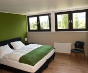
Ralinger Hof Landgasthof
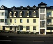
Koch-Schilt
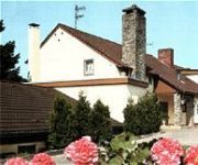
Europa
Videos from this area
These are videos related to the place based on their proximity to this place.
DAS FREEMAN TOR - Trailer
Trailer for Udo "Ufo" Everhardt's Heinz Fiction epic feature film DAS FREEMAN TOR. The no-budget adventures of Dave Freeman took 10 years in the making alone. Prepare to be amazed by multiple...
zunne grote vuurbal , jonguh.MOV
tijdens kamp 2010 in Echternach te luxemburg. Hebben we met de rowans uit geldrop overnacht in een diepe donkere grot(16 personen) de ochtend moest men zelf brood maken (met meel en ...
Teufelsschlucht - Teuflische Acht - Luxemburger Schweiz
Wanderung in der luxemburger Schweiz in der Nähe der Teufelsschucht im Naturpark delux. Hier der ▻ Link auf den Blogbeitrag http://goo.gl/zyqMma.
Irreler Wasserfälle
Kastelse Kayak Klub River: Prüm, Irreler Wasserfälle Water level: 85 cm Website: www.kastelsekayakklub.be Facebook: www.facebook.com/KastelseKayakKlub Youtube: ...
Camping Nimseck Irrel Overzicht
Een deel van de Camping Nimseck een korte overzicht netjes en schoon.
LUXEMBOURG: Echternach town [HD]
Echternach, the oldest town in Luxembourg, was founded in 698 by St Willibrord, a monk of Irish origin. It lies near the border with Germany. The picturesque town, still surrounded by its...
Echternach Marathon 2009
Echternach Marathon (18.10.2009) Start 10:00 (Marathon, 10-Meilen-Lauf und Staffellauf) Echternach (Lux) - Echternacher See (Lux) - Steinheim (Lux) - Echternach (Lux) - Weilerbach (Lux)...
Videos provided by Youtube are under the copyright of their owners.
Attractions and noteworthy things
Distances are based on the centre of the city/town and sightseeing location. This list contains brief abstracts about monuments, holiday activities, national parcs, museums, organisations and more from the area as well as interesting facts about the region itself. Where available, you'll find the corresponding homepage. Otherwise the related wikipedia article.
Rosport
Rosport is a commune and small town in eastern Luxembourg. It is part of the canton of Echternach, which is part of the district of Grevenmacher. As of 2005, the town of Rosport, which lies in the north-east of the commune, has a population of 656. Other towns within the commune include Dickweiler, Girst, Girsterklaus, Hinkel, Osweiler, and Steinheim. Rosport Castle, built in 1892, was the home of the Luxembourg inventor Henri Tudor.
Dickweiler
Dickweiler is a village in the commune of Rosport, in eastern Luxembourg. As of 2001, the village has a population of 107.
Steinheim, Luxembourg
Steinheim is a town in the commune of Rosport, in eastern Luxembourg. As of 2005, the town has a population of 532.
Prüm (river)
The Prüm is a river in Rhineland-Palatinate, Germany, left tributary of the Sauer. Its total length is 95 km, and its basin area is 889 km². The Prüm rises in the Schneifel hills, north of the town of Prüm, close to the border with Belgium. It flows southward through Prüm, Waxweiler, Holsthum, and Irrel. The Prüm discharges to the Sauer in Minden, on the border with Luxembourg, three kilometres east of Echternach. The largest tributary of the Prüm is the Nims.
Nims (river)
The Nims is a river in Rhineland-Palatinate, Germany, left tributary of the Prüm. Its total length is 59 km. The Nims originates in the Eifel hills, east of the town of Prüm. It flows south through Schönecken, Seffern, and through the western quarters of Bitburg. The Nims joins the Prüm in Irrel.
Irrel (Verbandsgemeinde)
Irrel is a Verbandsgemeinde ("collective municipality") in the district Bitburg-Prüm, in Rhineland-Palatinate, Germany. The seat of the Verbandsgemeinde is in Irrel. The Verbandsgemeinde Irrel consists of the following Ortsgemeinden ("local municipalities"):
Tudor Museum
The Tudor Museum, also known as Rosport Castle (French: Château de Rosport), is located in the little town of Rosport in eastern Luxembourg. Built in 1892, it was the home of the Luxembourg inventor Henri Tudor. Since May 2009, the castle has housed the Tudor Museum.


!['LUXEMBOURG: Echternach town [HD]' preview picture of video 'LUXEMBOURG: Echternach town [HD]'](https://img.youtube.com/vi/P7G2g9m6gmM/mqdefault.jpg)
