Safety Score: 3,0 of 5.0 based on data from 9 authorites. Meaning we advice caution when travelling to Germany.
Travel warnings are updated daily. Source: Travel Warning Germany. Last Update: 2024-08-13 08:21:03
Delve into Kobern
The district Kobern of Dieblicherberg in Rhineland-Palatinate is a district located in Germany about 299 mi south-west of Berlin, the country's capital town.
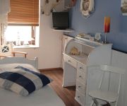
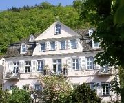
In need of a room? We compiled a list of available hotels close to the map centre further down the page.
Since you are here already, you might want to pay a visit to some of the following locations: Kobern-Gondorf, Dieblich, Wolken, Niederfell and Lehmen. To further explore this place, just scroll down and browse the available info.
Local weather forecast
Todays Local Weather Conditions & Forecast: 17°C / 62 °F
| Morning Temperature | 13°C / 55 °F |
| Evening Temperature | 14°C / 58 °F |
| Night Temperature | 9°C / 49 °F |
| Chance of rainfall | 6% |
| Air Humidity | 56% |
| Air Pressure | 1007 hPa |
| Wind Speed | Moderate breeze with 11 km/h (7 mph) from North-East |
| Cloud Conditions | Overcast clouds, covering 97% of sky |
| General Conditions | Moderate rain |
Tuesday, 26th of November 2024
10°C (50 °F)
6°C (43 °F)
Light rain, gentle breeze, scattered clouds.
Wednesday, 27th of November 2024
9°C (48 °F)
6°C (43 °F)
Moderate rain, moderate breeze, overcast clouds.
Thursday, 28th of November 2024
7°C (45 °F)
4°C (39 °F)
Sky is clear, moderate breeze, clear sky.
Hotels and Places to Stay
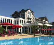
Hähn Moselhotel
Parkhotel Krähennest Moselstern Hotel
Hotel Simonis
Romantisches Hotel zur Post
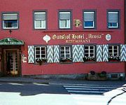
Gutshof Arosa
Lellmann
Traube
Hotel-Weinhaus Heinrich Haupt
Mosel-Pension Gästehaus Christiane
Bengel´s
Videos from this area
These are videos related to the place based on their proximity to this place.
Moselsteig - Niederburg bei Kobern-Gondorf
Blick von der Niederburg auf das Moseltal und das unterhalb der Burg liegende Kobern-Gondorf. Aufgenommen anlässlich einer Wanderung auf dem Moselsteig. April 2014. Hier der Link auf den ...
Trial DM 2010 in Dreckenach
Lauf zur Deutschen Trial Meisterschaft 2010 in Dreckenach bei Kobern Gondorf.
Trial DM 2006 in Dreckenach
Lauf zur Deutschen Trial Meisterschaft 2006 in Dreckenach bei Kobern Gondorf.
Timelapse Himmel am Sonntagnachmittag 2014-10-12
Zeitraffer vom Himmel in Kobern-Gondorf am Sonntagnachmittag.
Schloss Liebieg - Art & Event Locations
Herzlich Willkommen im Schloss Liebieg Schloss Liebieg auf Facebook: http://www.facebook.com/schlossliebieg Art & Event auf Facebook und im Netz: http://www.facebook.com/ArtEventLocations...
Johann Maas Land- und Motoergeräte
Seit 1933 ist der Familienbetrieb in Wolken bei Koblenz ansässig. Gab es bis vor Jahren nur die reine Landtechnik, so sind heute die Sparten Kommunaltechnik und Motorgerätetechnik bei uns...
Videos provided by Youtube are under the copyright of their owners.
Attractions and noteworthy things
Distances are based on the centre of the city/town and sightseeing location. This list contains brief abstracts about monuments, holiday activities, national parcs, museums, organisations and more from the area as well as interesting facts about the region itself. Where available, you'll find the corresponding homepage. Otherwise the related wikipedia article.
Mayen-Koblenz
Mayen-Koblenz is a district (Kreis) in the north of Rhineland-Palatinate, Germany. Neighboring districts are (from north clockwise) Ahrweiler, Neuwied, Westerwaldkreis, district-free Koblenz, Rhein-Lahn, Rhein-Hunsrück, Cochem-Zell, and Vulkaneifel.
Rhin-et-Moselle
Rhin-et-Moselle is the name of a département of the First French Empire in present Germany. It is named after the rivers Rhine and Moselle. It was formed in 1798, when the left bank of the Rhine was annexed by France. Until the French occupation, its territory was divided between the Archbishopric of Cologne, the Archbishopric of Trier, and the Electorate of the Palatinate. Its territory is part of the present German states of Rhineland-Palatinate and North Rhine-Westphalia.
Goloring
The Goloring is an ancient earthworks monument located near Koblenz, Germany. It was created in the Bronze Age era, which dates back to the Urnfield culture. During this time a widespread solar cult is believed to have existed in Central Europe. The Goloring consists of a circular ditch of 175 metres in diameter with an outside embankment extending to 190 metres. Technically this makes the structure a henge monument, although the use of the term henge outside of Britain is sometimes disputed.
Bundesautobahn 61
Bundesautobahn 61 is an autobahn in Germany that connects the border to the Netherlands near Venlo in the northwest to the interchange with A 6 near Hockenheim. In 1965, this required a redesign of the Hockenheimring. The autobahn runs parallel to the A 3 on the opposite side of the Rhine.
Wied (river)
The Wied is a river in Rhineland-Palatinate, Germany, right tributary of the Rhine. It is 102 km long. It flows generally south-west, through the Westerwald hills. Its source is near Dreifelden. It flows through Altenkirchen, Neustadt (Wied) and Waldbreitbach, and ends in the Rhine in Neuwied.
Niederlahnstein
Niederlahnstein is a part of the city of Lahnstein in Rhineland-Palatinate in Germany.
Maifeld
Maifeld is a Verbandsgemeinde ("collective municipality") in the district Mayen-Koblenz, in Rhineland-Palatinate, Germany. It is situated south-east of Mayen, and west of Koblenz. The seat of the municipality is in Polch. The Verbandsgemeinde Maifeld consists of the following Ortsgemeinden ("local municipalities"):
Untermosel
Untermosel is a Verbandsgemeinde ("collective municipality") in the district Mayen-Koblenz, in Rhineland-Palatinate, Germany. It is situated along the lower course of the Mosel, south-west of Koblenz. The seat of the municipality is in Kobern-Gondorf. The Verbandsgemeinde Untermosel consists of the following Ortsgemeinden ("local municipalities"): Alken Brodenbach Burgen Dieblich Hatzenport Kobern-Gondorf Lehmen Löf Macken Niederfell Nörtershausen Oberfell Winningen
Bischofstein Castle (Germany)
Bischofstein Castle is a castle on the Moselle in Germany. The castle sits between Moselkern and Hatzenport and across from the borough of Burgen. It was a stronghold belonging to the Archbishops of Treves. A characteristic attribute of the castle are its tall cylindrical donjon tower girt round with a white plaster streak about halfway up and the ruined chapel adjoining it. The castle was built in 1270, destroyed in 1689 and rebuilt again in 1930.
Stadion Oberwerth
Stadion Oberwerth is a multi-use stadium in Koblenz, Germany. It is currently mostly used for football matches and is the home stadium of TuS Koblenz, who got relegated to the 3rd German division after the 2009/10 season. The stadium has a total capacity of 15,000 people including 4000 seats.
Caesar's Rhine bridges
Caesar's Bridge across the Rhine, the first two bridges to cross the Rhine River, were built by Julius Caesar and his legionaries during the Gallic War in 55 BC and 53 BC, respectively. Strategically successful, they are also considered masterpieces of military engineering.
Fernmeldeturm Koblenz
Fernmeldeturm Koblenz is a free standing telecommunications tower on the mountain Kühkopf near Koblenz, Germany. It was built between 1972 and 1976. The Fernmeldeturm Kühkopf is 255 m (837 ft) high and not accessible to visitors.
West Rhine Railway
|} The West Rhine railway is a famously picturesque, double-track electrified railway line running for 185 km from Cologne via Bonn, Koblenz, and Bingen to Mainz. It is situated close to the western (left) bank of the river Rhine and mostly aligned to allow 160 km/h operation between Cologne and Koblenz and between Bingen and Mainz. Line speed between Koblenz and Bingen is restricted by the meandering nature of the Rhine.
Koblenz Central Station
Koblenz Central Station (Koblenz Hauptbahnhof) is a railway station for the city of Koblenz in the German state of Rhineland-Palatinate. It is the focal point of rail transport in the Rhine-Moselle-Lahn area. It is a through station in southern Koblenz built below Fort Großfürst Konstantin and opened in 1902 in the Neustadt (new city), which was built after the demolition of the city walls in 1890.
Weißenthurm (Verbandsgemeinde)
Weißenthurm is a Verbandsgemeinde ("collective municipality") in the district Mayen-Koblenz, in Rhineland-Palatinate, Germany. The seat of the municipality is in Weißenthurm. The Verbandsgemeinde Weißenthurm consists of the following Ortsgemeinden ("local municipalities"): Bassenheim Kaltenengers Kettig Mülheim-Kärlich Sankt Sebastian Urmitz
German Federal Archives
The German Federal Archives or Bundesarchiv (BArch) are the National Archives of Germany. They were established at the current location in Koblenz in 1952. They are subordinated to the State Minister of Culture (as of 2011, Bernd Neumann), and before 1998, to the Federal Ministry of the Interior. The institution's 2009 budget amounted to 54.6 million Euro. On December 6, 2008 the Archives donated 100,000 photos to the public, by making them accessible via Wikimedia Commons.
Moselle Viaduct
The Moselle Viaduct carries the Bundesautobahn 61 over a meander of the river Moselle, connecting the Hunsrück and Eifel mountain ranges. It was built between 1969 and 1972 between the German villages Winningen and Dieblich, about 10 kilometres southwest of Koblenz, where the river Moselle flows into the river Rhine. Moselle Viaduct is also the name of the 1974 bridge where Bundesautobahn 1 between Wittlich and Trier crosses the river Moselle near Schweich.
Stolzenfels Castle
Stolzenfels Castle is a castle near Koblenz on the Rhine, Germany.
German Army Command
Army Command in Falckenstein Barracks in Koblenz is one of the two leadership pillars of the German Army, together with the German Army Office. Since 1994, Army Command, as the supreme command authority, has directed the majority of military units within the Army. However, army troops on operations abroad are commanded by the Bundeswehr Operations Command of the Bundeswehr based at Potsdam. Currently Army Command has about 83,500 soldiers in its subordinate organisations.
Neuwied station
Neuwied station is, along with Engers station, a hub of public transport in the town of Neuwied in the German state of Rhineland-Palatinate and it is located in its west. The station is located on the East Rhine Railway and is the starting point of the Neuwied–Koblenz railway. In the station forecourt there is a bus station. The station is classified by Deutsche Bahn as a category 4 station.
Neuwied–Koblenz railway
|} The Koblenz–Neuwied railway is a two-track, electrified main line railway in the German state of Rhineland-Palatinate. It connects the Neuwied station on the Right (east) Rhine line to the major railway junction at Koblenz Hauptbahnhof (central station) and to the Left (west) Rhine and Moselle lines.
Koblenz Stadtmitte station
Koblenz Stadmitte station (German: Haltepunkt Koblenz Stadtmitte, freely translated as "Koblenz City Centre station") was opened on 14 April 2011 on the West Rhine Railway in central Koblenz in the German state of Rhineland Palatinate. The main purpose of this station is to improve public transport access to central Koblenz because it is more convenient than Koblenz Hauptbahnhof (main station).
Andernach station
Andernach station is the transportation hub of the city of Andernach in the German state of Rhineland-Palatinate. It is a middle-sized stations with thousands of passengers each day. It is currently classified by Deutsche Bahn as a category 4 station. After completion of the renovation, it will be classified as a category 3 station. It has four passenger paltforms (tracks 1, 2, 3 and 24), three with a length of more than 280 m, and sidings and freight tracks.
III Corps (Bundeswehr)
III Corps was a corps of the German Army (Bundeswehr Heer) active from 1957 to 1994. The preparation of the staff of the corps took place from 16 March 1957 at Gneisenau-Kaserne, Koblenz; the corps was officially formed on 6 April 1957. Initially, the 2nd Panzergrenadier Division and 5th Panzer Division moved in 1957 from the II Corps to III Corps. The corps was integrated into defence planning from mid-1957, as part of NATO's Central Army Group, commanded by the commander of the U.S.
Koblenz-Winningen Airport
Koblenz-Winningen Airport is a regional airport in Germany. It supports general aviation with no commercial airline service scheduled.


