Safety Score: 3,0 of 5.0 based on data from 9 authorites. Meaning we advice caution when travelling to Germany.
Travel warnings are updated daily. Source: Travel Warning Germany. Last Update: 2024-08-13 08:21:03
Discover Roxheim
The district Roxheim of Bobenheim-Roxheim in Rhineland-Palatinate is a district in Germany about 299 mi south-west of Berlin, the country's capital city.
Looking for a place to stay? we compiled a list of available hotels close to the map centre further down the page.
When in this area, you might want to pay a visit to some of the following locations: Kleinniedesheim, Frankenthal, Beindersheim, Grossniedesheim and Worms. To further explore this place, just scroll down and browse the available info.
Local weather forecast
Todays Local Weather Conditions & Forecast: 10°C / 50 °F
| Morning Temperature | 7°C / 44 °F |
| Evening Temperature | 11°C / 52 °F |
| Night Temperature | 11°C / 52 °F |
| Chance of rainfall | 0% |
| Air Humidity | 75% |
| Air Pressure | 1020 hPa |
| Wind Speed | Moderate breeze with 11 km/h (7 mph) from North-East |
| Cloud Conditions | Overcast clouds, covering 94% of sky |
| General Conditions | Light rain |
Thursday, 28th of November 2024
9°C (48 °F)
5°C (40 °F)
Light rain, gentle breeze, broken clouds.
Friday, 29th of November 2024
7°C (45 °F)
4°C (39 °F)
Broken clouds, light breeze.
Saturday, 30th of November 2024
6°C (44 °F)
3°C (37 °F)
Sky is clear, light breeze, clear sky.
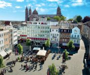
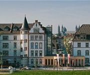
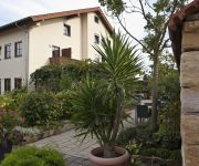
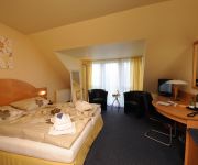
Hotels and Places to Stay
Central
Domhotel
Victors Residenz
Parkhotel Prinz Carl
Sandwiese Winzerhotel
Am Schlosspark
Asgard
Filling Weinstube
Central
Altes Ruderhaus
Videos from this area
These are videos related to the place based on their proximity to this place.
Wolfsrudel im Tiergarten Worms wird durch Hund provoziert
http://wolves.evolutionpart.de Ein Rudel Wölfe wird im Tiergarten Worms durch den Hund eines Besuchers provoziert. Trotzdem bleiben die Wölfe cool - da sie sich wohl nicht wirklich bedroht...
Streichelzoo und Tiere füttern im Tiergarten Worms 2013-Okt
Im begehbaren Streichelzoo und im Nachbargehege kann man Tieren begegnen und sie füttern. Tiere sind meistens Ziegen.
1969 Worms, Heidelberg, Freiburg, West Germany
August 1-3, 1969 - after leaving DDR drove to Frankfurt, crossed Rhine, to Mainz. Then to Worms, Heidelberg, and finally Freiburg im Breisgau.. Also film of William Noack Jr. and Lynn Shepherd...
Schulfest 27.06.2012 Bobenheim-Roxheim Realschule Plus
Schulfest 27.06.2012 Bobenheim-Roxheim Realschule Plus.
Vogelpark Bobenheim-Roxheim
Ein Besuch im Vogelpark Bobenheim-Roxheim am 24.10.2012. Bobenheim-Roxheim liegt in der Vorderpfalz zwischen den Städten Frankenthal und Worms. Im Park werden zahlreiche Vogelarten, ...
Tagesfeuerwerk zum Gondefest Bobenheim Roxheim
Ein Tagesfeuerwerk ist in Deutschland ja eher was seltenes. Daher ist es ganz interessant sowas mal zu sehen. Geschossen durch die Fa. Hübner.
Lokomotion 189 912 und Express Rail 189 845 mit dem Ekol-Zug bei Bobenheim-Roxheim
Lokomotion 189 912 und Express Rail 189 845 mit dem Ekol-Zug bei Bobenheim-Roxheim.
Grabowsky - 'ne Frau die mich liebt
Grabowsky Hoffest "50 Jahre Getränkevertrieb Wolf" Bobenheim-Roxheim 13.04.2013.
Videos provided by Youtube are under the copyright of their owners.
Attractions and noteworthy things
Distances are based on the centre of the city/town and sightseeing location. This list contains brief abstracts about monuments, holiday activities, national parcs, museums, organisations and more from the area as well as interesting facts about the region itself. Where available, you'll find the corresponding homepage. Otherwise the related wikipedia article.
Neckar
The Neckar is a 367 km long river in Germany, mainly flowing through the southwestern state of Baden-Württemberg, with a short section through Hesse. The Neckar is a major right tributary of the River Rhine.
BASF
BASF SE is the largest chemical company in the world and is headquartered in Ludwigshafen, Germany. BASF originally stood for Badische Anilin- und Soda-Fabrik. Today, the four letters are a registered trademark and the company is listed on the Frankfurt Stock Exchange, London Stock Exchange, and Zurich Stock Exchange. The company delisted its ADR from the New York Stock Exchange in September 2007.
Hemshof
Hemshof is one of the oldest city districts of Ludwigshafen Am Rhein, Germany. It is located above the "Nord" district. The first settlement in Hemshof is believed to have been built by the Celts in 516, not as a city but as a small farm. In the 19th century the Hemshof became an important living district for the workers in the BASF. \t\t \t\t\tLudwigshafen Stadthaus Nord. jpg \t\t\t Stadthaus Nord \t\t\t \t\t \t\t \t\t\tApostelkirche Ludwigshafen Rhein.
Oppau explosion
The Oppau explosion occurred on September 21, 1921 when a tower silo storing 4,500 tonnes of a mixture of ammonium sulfate and ammonium nitrate fertilizer exploded at a BASF plant in Oppau, now part of Ludwigshafen, Germany, killing 500–600 people and injuring about 2,000 more.
Worms Cathedral
Cathedral of St Peter is a church in Worms, southern Germany. It was the seat of the Catholic Prince-Bishopric of Worms until its extinction in 1800. It is a basilica with four round towers, two large domes, and a choir at each end. The interior is built in red sandstone. Only the ground plan and the lower part of the western towers belong to the original building consecrated in 1110.
Bürstadt
Bürstadt is a town in the Bergstraße district in southern Hesse, Germany, 7 km east of Worms, and 17 km north of Mannheim. In 1981, the town hosted the 21st Hessentag state festival.
Coleman Army Airfield
Coleman Barracks/Coleman Army Airfield is a United States Army military installation located in the Sandhofen district of Mannheim, Germany. It is assigned to U.S. Army, Europe and administered by the U.S. Army Installation Management Command-Europe (IMCOM-E). Coleman Barracks should not be confused with the former "Coleman Kaserne", located in Gelnhausen.
Sandhofen
Sandhofen is a northern district of Mannheim, Germany. The US Army is present in Sandhofen with Coleman Airfield and Coleman Barracks. The US Army's only military prison in Europe is located on that base. All US Army helicopter maintenance for Europe and the Middle East is performed at Coleman.
Ruchheim
Ruchheim is the far western suburb of Ludwigshafen am Rhein located in the Rhineland-Palatinate state of Germany. In the past Ruchheim was typically a small farming town, now however due to housing estates its population has burgeoned to approximately 6,000 inhabitants. Ruchheim's existence can be traced back to 800 AD when it is mentioned in the Lorsch Codex. \t\t \t\t\tLudwigshafen-Ruchheim Rathaus. jpg \t\t\t former townhall \t\t\t \t\t \t\t \t\t\tLudwigshafen-Ruchheim Paul-Muench-Brunnen.
Theodor Heuss Bridge (Frankenthal)
The Theodor-Heuss-Rhine River Bridge (Theodor-Heuss-Rheinbrücke) also known as the Autobahnbrücke Frankenthal is a bridge that spans the Rhine River along Autobahn 6 and connects the regions of Rhineland-Palatinate with Baden-Wuerttemberg. The four-lane bridge crosses the upper Rhine north of the cities of Ludwigshafen and Mannheim in an east-west direction on the motorway connecting Saarbrücken, Kaiserslautern, Mannheim, and Viernheim.
Heßheim (Verbandsgemeinde)
Heßheim is a Verbandsgemeinde ("collective municipality") in the district Rhein-Pfalz-Kreis, in Rhineland-Palatinate, Germany. The seat of the Verbandsgemeinde is in Heßheim. The Verbandsgemeinde Heßheim consists of the following Ortsgemeinden ("local municipalities"): seat of the Verbandsgemeinde
Maxdorf (Verbandsgemeinde)
Maxdorf is a Verbandsgemeinde ("collective municipality") in the district Rhein-Pfalz-Kreis, in Rhineland-Palatinate, Germany. The seat of the Verbandsgemeinde is in Maxdorf. The Verbandsgemeinde Maxdorf consists of the following Ortsgemeinden ("local municipalities"): seat of the Verbandsgemeinde
Yavuz Sultan Selim Mosque
The Yavuz-Sultan-Selim mosque is a religious building in Mannheim, Germany, named for Selim I. It is the biggest mosque in Germany, and attracts up to 3,000 Muslims every weekend. Since the mosque was opened in 1995, Muslim shops and youth centers have become a magnet for the Muslim community.
Worms Synagogue
The Worms Synagogue, also known as Rashi Shul, is an 11th century synagogue located in Worms, Germany.
Jewish Cemetery, Worms
The Jewish Cemetery in Worms or Heiliger Sand, in Worms, Germany, is usually called the oldest surviving Jewish cemetery in Europe, although the Jewish burials in the Jewish sections of the Roman catacombs predate it by a millennium. The Jewish community of Worms was established by the early eleventh century, and the oldest tombstone still legible dates from 1058/59. The cemetery was closed in 1911, when a new cemetery was inaugurated. Some family burials continued until the late 1930s.
Wormatia-Stadion
EWR-Arena (called Wormatia-Stadion until 2011) is a multi-use stadium in Worms, Germany. It is currently used mostly for football matches and is the home of Wormatia Worms. The stadium has a capacity of 5,724 people. It opened in 1927 and was renovated in 2008 when Wormatia Worms were promoted into Regionalliga Süd.
Biblis Airfield
Biblis Airfield is an abandoned World War II military airfield located in Germany, approximately 5 miles northeast of Worms (Rheinland-Pfalz); approximately 300 miles southwest of Berlin. Biblis was built by the United States Army Air Forces at the site of a Wehrmacht Army Barracks (Biblis Kaserne). It was also the first USAAF airfield to be built in support of Seventh Army operations east of the Rhine River after two divisions crossed the river near Worms on 26 March 1945.
Stadion am Alsenweg
Stadion am Alsenweg is a multi-use stadium in Mannheim, Germany . It was initially used as the stadium of SV Waldhof Mannheim matches. It was replaced by Carl-Benz-Stadion in 1994. The capacity of the stadium is 15,200. In 1996 it was renamed as Seppl-Herberger-Stadion.
United States Army Corrections Facility-Europe
United States Army Corrections Facility – Europe (USACF-E) is the only Department of Defense, Level 1 corrections facility in the European theater and is currently located on Coleman Barracks in Mannheim, Baden-Württemberg, Germany. USACF-E reports directly to the United States Army Corrections Command in Alexandria, Virginia.
Worms Central Station
Worms Central Station (Worms Hauptbahnhof) is, along with Worms Brücke station and Worms Pfeddersheim station, one of three operational passenger stations in the Rhenish Hesse city of Worms, Germany. The station with is its pedestrian underpass is also an essential link between the eastern and the western parts of central Worms. Every day it is used by about 15,000 people.
Ludwigshafen Central Station
Ludwigshafen Central Station (Ludwigshafen Hauptbahnhof) is a combination of a wedge shaped station and a two-level interchange station in Ludwigshafen am Rhein in the German state of Rhineland-Palatinate. The station is at the junction on the lines from Mainz and Neustadt an der Weinstrasse to Mannheim. It is classified by Deutsche Bahn as a category 2 station. The Ludwigshafen station was built in 1847 as a terminal station in the centre of modern Ludwigshafen.
Wine Museum, Ehnen
The Wine Museum (Musée du Vin), located in Ehnen on the Luxembourg side of the Moselle, illustrates the art of wine-making with exhibits of traditional vintner's tools and bottling equipment together with old documents and photographs. Opened by the State in 1978, it occupies the home of a former vintner with wine-making antiques and furnishings.
University of Applied Sciences Worms
The University of Applied Sciences Worms is a public university located in Worms, Germany. It was founded in 1978. The University of Applied Sciences Worms comprises faculties of business, tourism/transportation, and informatics. A common feature of all degree programs is a practical approach to the respective subjects, a relatively short average duration of study, and the international orientation.
Frankenthal Central Station
Frankenthal Central Station (Frankenthal Hauptbahnhof) is the central station for the city of Frankenthal in the German state of Rhineland-Palatinate and is located on the Mainz–Ludwigshafen railway. It is classified by Deutsche Bahn as a category 4 station. Besides Frankenthal Hauptbahnhof the only other station in Frankenthal is Flomersheim. Another station is planned as Frankenthal Süd.
Friedrich-Engelhorn-Hochhaus
The Friedrich-Engelhorn-Hochhaus is a 28-storey, 101.63 m skyscraper in Ludwigshafen am Rhein, Germany. When completed in 1957 as the headquarters for the BASF Corporation, it was the tallest building in Germany.


