Safety Score: 3,0 of 5.0 based on data from 9 authorites. Meaning we advice caution when travelling to Germany.
Travel warnings are updated daily. Source: Travel Warning Germany. Last Update: 2024-08-13 08:21:03
Discover Rinkerode
Rinkerode in Regierungsbezirk Münster (North Rhine-Westphalia) is a town in Germany about 247 mi (or 397 km) west of Berlin, the country's capital city.
Current time in Rinkerode is now 01:35 PM (Thursday). The local timezone is named Europe / Berlin with an UTC offset of one hour. We know of 11 airports near Rinkerode, of which 5 are larger airports. The closest airport in Germany is Münster Osnabrück Airport in a distance of 20 mi (or 32 km), North. Besides the airports, there are other travel options available (check left side).
There are several Unesco world heritage sites nearby. The closest heritage site in Germany is Zollverein Coal Mine Industrial Complex in Essen in a distance of 37 mi (or 59 km), South-West. We discovered 1 points of interest in the vicinity of this place. Looking for a place to stay? we compiled a list of available hotels close to the map centre further down the page.
When in this area, you might want to pay a visit to some of the following locations: Ascheberg, Muenster, Everswinkel, Nordkirchen and Senden. To further explore this place, just scroll down and browse the available info.
Local weather forecast
Todays Local Weather Conditions & Forecast: 3°C / 37 °F
| Morning Temperature | 1°C / 34 °F |
| Evening Temperature | -0°C / 32 °F |
| Night Temperature | -1°C / 30 °F |
| Chance of rainfall | 0% |
| Air Humidity | 70% |
| Air Pressure | 999 hPa |
| Wind Speed | Moderate breeze with 11 km/h (7 mph) from North-East |
| Cloud Conditions | Scattered clouds, covering 42% of sky |
| General Conditions | Rain and snow |
Friday, 22nd of November 2024
2°C (36 °F)
1°C (34 °F)
Broken clouds, fresh breeze.
Saturday, 23rd of November 2024
4°C (39 °F)
5°C (41 °F)
Overcast clouds, fresh breeze.
Sunday, 24th of November 2024
12°C (53 °F)
13°C (55 °F)
Light rain, fresh breeze, overcast clouds.
Hotels and Places to Stay
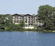
Best Western Premier Seehotel Krautkrämer
Land-gut-Hotel Lohmann
Vierjahreszeiten Landhaus
Zur Prinzenbrücke
Ambiente
Goldener Stern Flair Hotel
Münnich
Jagdschlößchen Ascheberg
Zur Davert
Zur Dicken Eiche
Videos from this area
These are videos related to the place based on their proximity to this place.
Mein Antrag :-)
Also....mir ist durch die NSA belastendes Videomaterial zugespielt worden, Mein Heiratsantrag ist tatsächlich gefilmt worden, Ich möchte mich schon mal für d...
Boss Hoss V8 Probefahrt
Westfalen Boss Hoss Tag der offenen Tür 2012-07-21 Er hats schwer, er musste fahren, aber was ein Sound... Der Chef hat ihn gezwungen, hehe...
Westfalen Boss Hoss V8 Tag der offenen Tür und Probefahrt
Westfalen Boss Hoss Tag der offenen Tür 2012-07-21 bei MK Bike Systems in Albersloh Blick auf den Platz und die Moppeds...
Absturz auf dem Hudson (LEGO)
Das ist ein Film bei den mir GFilms http://www.youtube.com/user/thegfilms1 half und http://www.youtube.com/user/exosphere3d/ mir Audio Aufnahmen gab. Es handelt sich um die Notwasserung auf...
Deutschland - Drensteinfurt
Südlich von Münster und westlich von Ahlen liegt diese Stadt, deren niederdeutscher Name Stewwert ist. Gut 15.000 Menschen leben hier. Schon 851 wurde die kleine Stadt erstmals erwähnt....
Renntag in Drensteinfurt 2008
Einmal im Jahr lockt das Erlfeld in Drensteinfurt die Trabrennszene an. 2008 waren nicht Pferde am Start, sondern auch Windhunde liefen um den Sportplatz in ...
Videos provided by Youtube are under the copyright of their owners.
Attractions and noteworthy things
Distances are based on the centre of the city/town and sightseeing location. This list contains brief abstracts about monuments, holiday activities, national parcs, museums, organisations and more from the area as well as interesting facts about the region itself. Where available, you'll find the corresponding homepage. Otherwise the related wikipedia article.
Hiltruper See
Hiltruper See is a lake in Münsterland, North Rhine-Westphalia, Germany. At an elevation of 58 m, its surface area is 15.8 ha.


