Safety Score: 3,0 of 5.0 based on data from 9 authorites. Meaning we advice caution when travelling to Germany.
Travel warnings are updated daily. Source: Travel Warning Germany. Last Update: 2024-08-13 08:21:03
Touring Dwarsefeld
Dwarsefeld in Regierungsbezirk Münster (North Rhine-Westphalia) is a town located in Germany about 300 mi (or 483 km) west of Berlin, the country's capital place.
Time in Dwarsefeld is now 06:36 AM (Tuesday). The local timezone is named Europe / Berlin with an UTC offset of one hour. We know of 12 airports nearby Dwarsefeld, of which 5 are larger airports. The closest airport in Germany is Niederrhein Airport in a distance of 21 mi (or 34 km), South-West. Besides the airports, there are other travel options available (check left side).
There are several Unesco world heritage sites nearby. The closest heritage site in Germany is Zollverein Coal Mine Industrial Complex in Essen in a distance of 37 mi (or 60 km), South-East. We collected 1 points of interest near this location. Need some hints on where to stay? We compiled a list of available hotels close to the map centre further down the page.
Being here already, you might want to pay a visit to some of the following locations: Uedem, Sonsbeck, Kleve, Wesel and Alpen. To further explore this place, just scroll down and browse the available info.
Local weather forecast
Todays Local Weather Conditions & Forecast: 12°C / 53 °F
| Morning Temperature | 6°C / 43 °F |
| Evening Temperature | 8°C / 46 °F |
| Night Temperature | 7°C / 44 °F |
| Chance of rainfall | 0% |
| Air Humidity | 60% |
| Air Pressure | 1024 hPa |
| Wind Speed | Light breeze with 5 km/h (3 mph) from North-West |
| Cloud Conditions | Broken clouds, covering 57% of sky |
| General Conditions | Broken clouds |
Wednesday, 6th of November 2024
12°C (53 °F)
7°C (45 °F)
Sky is clear, light breeze, clear sky.
Thursday, 7th of November 2024
12°C (53 °F)
6°C (43 °F)
Sky is clear, gentle breeze, clear sky.
Friday, 8th of November 2024
13°C (55 °F)
8°C (47 °F)
Sky is clear, gentle breeze, few clouds.
Hotels and Places to Stay
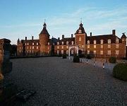
Romantik Parkhotel Wasserburg Anholt
Landhaus zur Issel
Lindenhof
Videos from this area
These are videos related to the place based on their proximity to this place.
19.09.2010 - Ludieke Brandweer Wedstrijden 2010 - Gendringen
Ludieke Brandweer Wedstrijden 2010 in Gendringen. Feuerwehr Spiel ohne Grenzen 2010 in Gendringen. Der Löschzug Anholt der Freiwilligen Feuerwehr Isselburg belegte mit 65 Punkten den ersten ...
27.09.2010 - Dienstabend Atemschutzübung in Gendringen
Die Löschzüge Anholt, Isselburg und Werth waren zu Gast bei der Brandweer in Gendringen. In einem Haus das für den Wettstreit in Gendringen aufgebaut wurde übten die Löschzüge den Einsatz...
15.05.2010 - Olympia's Ronde - Anholt Gendringen - Radrennen
15.05.2010 - Olympia's Ronde / Olympia's Tour - Anholt Gendringen - Radrennen in Anholt. Etwa 220 freiwillige Helfer, Polizeibeamte und Feuerwehrleute waren an diesem Tag im Einsatz, um die...
De Regenboog - IJzeren uitkijktoren in het natuurgebied bij Engbergen
Officiële opening 12 maart 2015. Uitkijktoren in natuurgebied Engbergen, geplaatst aan de Oude IJssel tussen Ulft en Gendringen. 500 Meter verderop noordelijke richting is de samenvoeging...
S.T. Nelles - Pien in de kop - guerrilla première tour - De Huppelklumpkes
Bekijk ook de originele videoclip op YouTube en website. . Watch the original videoclip: S.T. Nelles - 'Pien in de kop (die stille stormen)' on YouTube and on www.stnelles.nl . This...
Frühlingserwachen Schützenverein Anholt - KØRMIT Live
KØRMIT beim Frühlingserwachen des Bürger-Schützenverein Anholt e.V. - Museumsscheune Daniels.
Mein Isselburg - St. Martinszug am 13.11.2013 in Isselburg - Anholt
St. Martinszug am 13.11.2013 in Isselburg - Anholt http://www.fb.com/meinisselburg Videoproduktion - "mein Isselburg" - das Portal für deine Stadt!
10.11.2010 - Sankt Martin in Isselburg - Anholt
Sankt Martin in Isselburg Anholt am 10.11.2010 - Freiwillige Feuerwehr Isselburg Löschzug Anholt.
27.11.2010 - Jahresabschlussübung des Löschzug Anholt
Freiwillige Feuerwehr Isselburg - Löschzug Anholt. Jahresabschlussübung mit dem DRK Ortsverein Isselburg.
Videos provided by Youtube are under the copyright of their owners.
Attractions and noteworthy things
Distances are based on the centre of the city/town and sightseeing location. This list contains brief abstracts about monuments, holiday activities, national parcs, museums, organisations and more from the area as well as interesting facts about the region itself. Where available, you'll find the corresponding homepage. Otherwise the related wikipedia article.
Gendringen
Gendringen is a village in the Dutch province of Gelderland. It is located in the municipality of Oude IJsselstreek, about 12 km southeast of Doetinchem and 20 km northwest of the German city Bocholt. It has approximately 4500 inhabitants. In the Middle Ages, Gendringen was a fortress. Being property of the archbishop of Köln (Cologne), Gendringen was loaned to the lords living in the castle of 's-Heerenberg. In 1830, downtown Gendringen burned down for the most part.
Voorst, Oude IJsselstreek
Voorst is a village in the Dutch province of Gelderland. It is located in the municipality of Oude IJsselstreek, about 3 km east of the town of Gendringen.
Ulft
Ulft is a town in Oude IJsselstreek in the Achterhoek area in the province of Gelderland, Netherlands. The town has over 10.700 inhabitants and is the biggest town in the municipality Oude IJsselstreek. Until 1 January 2005, Ulft was part of the municipality Gendringen. At the municipal re-ordering in the Achterhoek, the municipalities Gendringen and Wisch joined together to form the Oude IJsselstreek. Ulft consists out of three hamlets: Ulft, Oer and De Pol.
Silvolde
Silvolde is a village in the Achterhoek and is part of the municipality Oude IJsselstreek.
Megchelen
Megchelen is a village in the Dutch province of Gelderland. It is a tiny hook of land surrounded on three sides by the German border in the municipality of Oude IJsselstreek, about 7 km southeast of the town of Ulft on the Zwanenburgseweg.


