Safety Score: 3,0 of 5.0 based on data from 9 authorites. Meaning we advice caution when travelling to Germany.
Travel warnings are updated daily. Source: Travel Warning Germany. Last Update: 2024-08-13 08:21:03
Explore Neukirchen
The district Neukirchen of Neukircherfeld in Regierungsbezirk Düsseldorf (North Rhine-Westphalia) is located in Germany about 300 mi west of Berlin, the country's capital.
If you need a place to sleep, we compiled a list of available hotels close to the map centre further down the page.
Depending on your travel schedule, you might want to pay a visit to some of the following locations: Rheurdt, Krefeld, Alpen, Issum and Duisburg. To further explore this place, just scroll down and browse the available info.
Local weather forecast
Todays Local Weather Conditions & Forecast: 14°C / 57 °F
| Morning Temperature | 15°C / 58 °F |
| Evening Temperature | 11°C / 52 °F |
| Night Temperature | 10°C / 50 °F |
| Chance of rainfall | 4% |
| Air Humidity | 71% |
| Air Pressure | 1003 hPa |
| Wind Speed | Fresh Breeze with 16 km/h (10 mph) from North |
| Cloud Conditions | Overcast clouds, covering 94% of sky |
| General Conditions | Moderate rain |
Tuesday, 26th of November 2024
10°C (50 °F)
6°C (42 °F)
Light rain, moderate breeze, scattered clouds.
Wednesday, 27th of November 2024
9°C (49 °F)
7°C (45 °F)
Moderate rain, fresh breeze, overcast clouds.
Thursday, 28th of November 2024
8°C (46 °F)
5°C (40 °F)
Few clouds, moderate breeze.
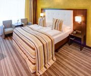
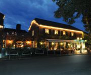
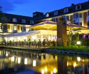
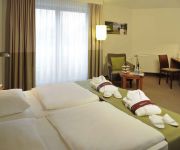
Hotels and Places to Stay
Moers van der Valk
Wellings Romantik Hotel zur Linde
Schloss Leyenburg Hotel & SPA
Wellings Parkhotel
Mercure Tagungs & Landhotel Krefeld
Seerose
Vluyner Stuben Landhaus
Hotel Dormir
Am Prinzenplatz Zur Post - Superior
Hotel Omega
Videos from this area
These are videos related to the place based on their proximity to this place.
HARDERS FASHION-OUTLET Neukirchen-Vluyn | Herrenmoden + Damenmoden an Niederrhein & Ruhrgebiet
HARDERS FASHION-OUTLET - Herrenmoden + Damenmoden an Niederrhein & Ruhrgebiet | http://www.harders-outlet.de Wir sind seit fast 40 Jahren DER inhabergeführte Herrenmoden-Spezialist in ...
Hotel Dampfmühle Neukirchen-Vluyn bei Moers
Unweit des pulsierenden Ruhrgebiets und des anziehenden Großraums Düsseldorf ist das niederrheinische Hotel**** Dampfmühle ideal gelegen für Ihre Anlässe. Mit optimalen ...
TacNet Mitschnitt CO / Mission 2014-06-07 - Hunting Jackal
Mitschnitt der Arma 2 ACE-Mission "Operation Hunting Jackal" - durchgeführt von Tactical-Network, dem Fallschirm-Jägerbataillon 323 & Gruppe Lightning. Missionsinfo: Sangin - 20. August...
Bienenzuchtverein Neukirchen-Vluyn
Bericht vom WDR Duisburg (Lokalzeit) über den Bienenzuchtverein Neukirchen-Vluyn.
Pappe of Destiny - Aftershow Dong Open Air 2014
www.pod-show.de Als erste Playback Show Band in Deutschland, kommt Pappe of Destiny mit einer einstündigen Show zum 14. Dong Open Air Metal Festival 2014, um dort die Aftershow auszurichten ...
Neukirchen-Vluyn - Schloss Bloemersheim
Das Video zeigt Impressionen aus der Umgebung von Schloss Bloemersheim in Neukirchen-Vluyn Im Bundesland Nordrhein-Westfalen! www.rheinruhronline.de.
Stammlager Auschwitz: Videoraum zum Leben der Juden
Im Stammlager Auschwitz, Oswiecim (Polen), ein Todesort für viele tausende Juden während der Zeit des Nationalsozialismus, befindet sich heute eine Ausstellung über das Leben im Konzentrationsla ...
Videos provided by Youtube are under the copyright of their owners.
Attractions and noteworthy things
Distances are based on the centre of the city/town and sightseeing location. This list contains brief abstracts about monuments, holiday activities, national parcs, museums, organisations and more from the area as well as interesting facts about the region itself. Where available, you'll find the corresponding homepage. Otherwise the related wikipedia article.
Düsseldorf (region)
Düsseldorf is one of the five Regierungsbezirke of North Rhine-Westphalia, Germany, located in the north-west of the country. It covers the western part of the Ruhr Area, as well as the Niederrheinische Tiefebene, the lower Rhine area. It is the most populated of all German administrative areas of the kind. It's the only area in Germany where the traditional dialects are Low Franconian, rather than Low German or High German.
Underberg
Underberg is a digestif bitter produced in Germany by Underberg AG, made of aromatic herbs from 43 countries. The exact number and identity of the herbs remain a well-guarded secret.
Oppum
Oppum is a district of Krefeld, a city in North Rhine-Westphalia, Germany. Oppum probably developed as a Frankish farmer settlement. Its existence was first documented in the year 1072.
Grotenburg-Stadion
The Grotenburg-Stadion is a multi-use stadium in Krefeld, Germany. It is used mostly for football matches and hosts the home matches of KFC Uerdingen 05. The stadium has a capacity of 34,500 and was built in 1927.
Beeckerwerth
Beeckerwerth is a part of the German city of Duisburg and located right of the Rhine. It has a population of 3.807 and an area of 7,62 km².
DÜWAG
The DUEWAG AG was one of Germany's major manufacturers for rail vehicles. The business was sold in 1999 to Siemens transportation.
König Palast
König Palast is an arena in Krefeld, Germany. It is primarily used for ice hockey, and is the home to the Krefeld Pinguine of the DEL. König Palast opened in 2004 and holds 9,000 people.
Kamp Abbey
Kamp Abbey (Kloster Kamp), also known as Altenkamp Abbey or Alt(en)feld Abbey (and in English formerly Camp Abbey) was the first Cistercian monastery founded in German territory, in the present town of Kamp-Lintfort in North Rhine-Westphalia.
Roman Catholic Diocese of Aachen
The Diocese of Aachen is one of 22 dioceses in Germany. It is also one of 7 dioceses that has a population that is in majority Catholic, in this case 57.6%. The weekly attendance rate at mass in the Diocese of Aachen is 11.5% of the Catholics in the diocese.
Lower Rhine region
The Lower Rhine region or Niederrhein is a region around the Lower Rhine section of the river Rhine in North-Rhine Westphalia, Germany between approximately Oberhausen and Krefeld in the East and the Dutch border around Kleve in the West.
Uerdingen
Uerdingen is a district of the city of Krefeld, Germany, with a population of 18,507, though Uerdingen received its charter as a city as early as 1255, well before Krefeld. Uerdingen was merged with Krefeld in 1929, after which the term “Krefeld-Uerdingen” was used, until, eventually, the use of the term “Uerdingen” fell away altogether.
Krefeld-Linn
Linn has been a part of the City of Krefeld, Germany, since its incorporation into that city in 1901. Linn lies with its historic city center within the lower Rhenish lowlands about 5 km east of the Krefeld city center. The place known as Linn was first mentioned in an Imperial document composed between 1090 and 1120. By the beginning of the fourteenth century, Linn must have been raised to the status of a city, as in another document in 1314, city jurors were named.
PCC-Stadion
The PCC-Stadion is a football stadium in Duisburg-Homberg. It is the home ground of the women's Bundesliga side FCR 2001 Duisburg and men's fourth division side VfB Homberg. The stadium has a capacity of 3,000. The main stand has 800 covered seats.
Haus Lange and Haus Esters
Haus Lange and Haus Esters are residential houses designed by Ludwig Mies van der Rohe in Krefeld, Germany. They were built between 1928 and 1930 in the Bauhaus style. The houses have now been converted into museums for Contemporary art.
Elfrather See
Elfrather See is a lake in North Rhine-Westphalia, Germany. At an elevation of 30 m, its surface area is 0.5 square kilometres . The Elfrather lake, popularly known as E for short-sea, is located in the north east of the city of Krefeld on the border of the Elfrath district. The lake was created from a disused gravel pit, which has been filled with groundwater. The degradation was made in the Lower Rhine because of the low water level with typical wetness reduction construction of a dredger.
Krefeld Central Station
Krefeld Central Station (Krefeld Hauptbahnhof) is the largest station of the city of Krefeld in the German state of North Rhine-Westphalia. The double-track and electrified Duisburg-Ruhrort–Mönchengladbach railway (KBS 425) and the Lower Left Rhine Railway (KBS 495) cross at the station. A line to Rheydt formerly began at the station, but this now only extends as far as the Krefeld steelworks as a siding.
Ruhrort–Homberg train ferry
The Ruhrort–Homberg train ferry was a German train ferry on the Rhine between Ruhrort and Homberg, now districts of Duisburg.
Halde Rheinpreußen
The Halde Rheinpreußen is a spoil tip in the German city Moers which lies 70 metres above its ambit. It is part of the category Panoramas of the Ruhr Industrial Heritage Trail. In 1963, the spoil tip was heaped up with materials of the pit 5/9, i.e. the mine Zeche Rheinpreußen. In autumn 1999, the artist Otto Piene, co-founder of the ZERO group, presented his idea of a mining lamp memorial called Geleucht for the first time.
Rheinhausen station
Rheinhausen station is located in the Duisburg suburb of Rheinhausen in the Lower Rhine region of the German state of North Rhine-Westphalia. It lies on the Duisburg-Ruhrort–Mönchengladbach railway and is the starting point of the Lower Rhine Railway towards Xanten.
Fabrik Heeder
Fabrik Heeder is a theatre in North Rhine-Westphalia, Germany.
Krieewelsche pappköpp
Krieewelsche pappköpp is a theatre in North Rhine-Westphalia, Germany.
Schlosstheater Moers
Schlosstheater Moers is a theatre in North Rhine-Westphalia, Germany.
TAM (Theater)
TAM (Theater) is a theatre in North Rhine-Westphalia, Germany.
Rheinlandhalle
Rheinlandhalle, is an arena in Krefeld, Germany. It is primarily used for ice hockey, and was the home to the Krefeld Pinguine of the Deutsche Eishockey Liga until the König Palast opened in 2004. It opened in 1955 and holds 6,714 spectators.
Krefeld Airfield
Krefeld Airfield is a former military airfield, located 4.2 km northeast of Krefeld in North Rhine-Westphalia, Germany.


