Safety Score: 3,0 of 5.0 based on data from 9 authorites. Meaning we advice caution when travelling to Germany.
Travel warnings are updated daily. Source: Travel Warning Germany. Last Update: 2024-08-13 08:21:03
Delve into Sankt Anton-Amern
The district Sankt Anton-Amern of Geneschen Eins in Regierungsbezirk Düsseldorf (North Rhine-Westphalia) is a subburb in Germany about 318 mi west of Berlin, the country's capital town.
If you need a hotel, we compiled a list of available hotels close to the map centre further down the page.
While being here, you might want to pay a visit to some of the following locations: Schwalmtal, Niederkruchten, Bruggen, Nettetal and Grefrath. To further explore this place, just scroll down and browse the available info.
Local weather forecast
Todays Local Weather Conditions & Forecast: 2°C / 36 °F
| Morning Temperature | 1°C / 34 °F |
| Evening Temperature | 1°C / 34 °F |
| Night Temperature | -0°C / 31 °F |
| Chance of rainfall | 0% |
| Air Humidity | 77% |
| Air Pressure | 998 hPa |
| Wind Speed | Moderate breeze with 10 km/h (6 mph) from North-East |
| Cloud Conditions | Overcast clouds, covering 98% of sky |
| General Conditions | Snow |
Friday, 22nd of November 2024
4°C (39 °F)
2°C (36 °F)
Rain and snow, fresh breeze, broken clouds.
Saturday, 23rd of November 2024
5°C (41 °F)
7°C (44 °F)
Light rain, moderate breeze, overcast clouds.
Sunday, 24th of November 2024
13°C (55 °F)
13°C (56 °F)
Light rain, fresh breeze, overcast clouds.
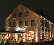
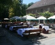
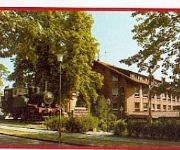
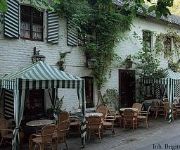
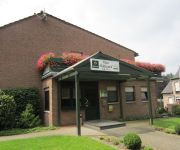
Hotels and Places to Stay
Lüthemühle
Lüttelforster Mühle
Akzent Hotel Brüggener Klimp
Zum Schänzchen
Molzmühle
Haus Hildegard Garni
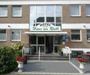
Haus am Rieth
Haus Berger
Hotel Lenhsen
Stadt Lobberich
Videos from this area
These are videos related to the place based on their proximity to this place.
NUR HOLZ Holzbau, Holzhausbau, Massivholzhaus / Vollholzhaus Holzhaus Montage Niederkrüchten
NUR HOLZ Holzhaus Bau - Massivholzhaus / Vollholzhaus Holzhaus Montage Niederkrüchten.
Kartbahn Kuka Kart 18.09.2012 Niederkrüchten
Kartbahn Kuka Kart 18.09.2012 Niederkrüchten mit 11 PS 270 ccm.
After-Zoch-Party 2012 Pfarrheim Niederkrüchten
Stimmung im Pfarrheim nach dem Tulpensonntagszug - Kamera: Bernd Nienhaus.
Kartbahn Niederkrüchten 02.07.2012 Lauf 1 Suzuki DRZ
Meine erste Fahrt auf der Kartbahn in Niederkrüchten. Zudem das erste mal auf Slicks. Suzuki DRZ 400 SM.
DrumCover - Bat Country - A7X
DrumCover from Avenged Sevenfold´s "Bat Counry". Enjoy it and have fun :-)
Geschäftiges Treiben im Wespennest
Wespennest in einem Erdloch. Die Wespen sind eifrig dabei, etwas aus dem Nest heraus zu tragen. Niederkrüchten/Oberkrüchten.
Videos provided by Youtube are under the copyright of their owners.
Attractions and noteworthy things
Distances are based on the centre of the city/town and sightseeing location. This list contains brief abstracts about monuments, holiday activities, national parcs, museums, organisations and more from the area as well as interesting facts about the region itself. Where available, you'll find the corresponding homepage. Otherwise the related wikipedia article.
Headquarters Allied Rapid Reaction Corps
The Headquarters Allied Rapid Reaction Corps, (HQ ARRC or ARRC) is a North Atlantic Treaty Organisation High Readiness Force (Land) Headquarters ready for deployment worldwide within five to thirty days.
RAF Bruggen
The former Royal Air Force Station Brüggen, more commonly known as RAF Brüggen, in Germany was a major station of the Royal Air Force until 15 June 2001. It was situated next to the village of Elmpt, approximately 43 kilometres west of Düsseldorf near the German-Netherlands border. The base was named after the village of Brüggen, the nearest rail depot. Construction began in mid-1952, which involved the clearing of dense forest and draining of marshland.
Tegelen
Tegelen is a village in the province of Limburg in the Netherlands. It was an independent municipality until 2001, when it was merged into the municipality of Venlo.
Forstwald
Forstwald is a region of Krefeld located to the west of the main city center. It is marked by its forest landscape and more up-scale housing than other regions of Krefeld.
RAF Rheindahlen
The former Royal Air Force Station Rheindahlen, more commonly known as RAF Rheindahlen, was a non-flying Royal Air Force military base, part of the Rheindahlen Military Complex in North Rhine-Westphalia, Germany - part of British Forces Germany (BFG). Established after World War II it served mainly as the administrative support centre for the 2nd Tactical Air Force (2TAF). It was disbanded in 1993 and amalgamated with the other military support units at Rheindahlen.
JHQ Rheindahlen
JHQ Rheindahlen, latterly also called the Rheindahlen Military Complex, is a British forces base in Mönchengladbach, North Rhine-Westphalia, Germany. JHQ stands for Joint Headquarters and the base has functioned as the main headquarters for British forces in Germany since being built in the 1950s. Its German address is Mönchengladbach-JHQ with a post code of 41179.
RAF Wildenrath
The former Royal Air Force Station Wildenrath, commonly known as RAF Wildenrath, was a Royal Air Force military airbase which opened on 15 January 1952. Wildenrath was the first of four 'Clutch' stations built for the RAF in Germany during the early 1950s. The other stations were at RAF Geilenkirchen, opened on 24 May 1953, RAF Brüggen, formed in 1 May 1953 and completed in July of that year, and RAF Laarbruch, opened on 15 October 1954.
RAF Hospital Wegberg
The former Royal Air Force Hospital Wegberg, commonly abbreviated to RAF(H) Wegberg, was a Royal Air Force military hospital located in Wegberg, near the city of Mönchengladbach, in Germany.
Lobberich
Lobberich is a village in North Rhine-Westphalia, Germany, situated close to the Dutch border at Venlo. It has a population of around 14,000 inhabitants. Since 1970 the town belongs to the city of Nettetal.
Dülken
Dülken is a town located in the North Rhine-Westphalia state of Germany. It has a population of about 20,000. It is part of the municipality of Viersen. It received its town charter in 1364 thus being the oldest part of the municipality of Viersen. It lies in the administrative region of Düsseldorf. The river Nette having its source underground in the middle of the town rises near the town. The town motto is, "Gloria tibi Duelken", or "Glory to you, Duelken".
De Koel
De Koel, also known as Seacon Stadion – De Koel after the main sponsor, is a multi-purpose stadium in Venlo, Netherlands. It is currently mostly used for football matches and is the home stadium of VVV-Venlo. The stadium is able to hold 8,000 people and was built in 1972.
Grenzlandring
The Grenzlandring (German for "border-region ring"), sometimes Grenzland-Ring written, is a former high-speed race track oval in the Lower Rhine area of Germany, around the town of Wegberg, located close to Mönchengladbach and the Dutch town of Roermond. The Grenzlandring, to many foreigners also known as Wegbergring or Wegberg Ring, is told to be "discovered" nearly undamaged after World War II when during one dark 1947 night, Dr.
Leuth (Germany)
Leuth is a village in North Rhine-Westphalia on the Dutch border in the district of Viersen. It is the smallest part of the municipality of Nettetal and has approximately 2000 inhabitants. Its historical origin lies in the early Middle Ages (before the year 1000).
Kaldenkirchen station
Kaldenkirchen is the railway station on the Viersen–Venlo railway in the municipality of Kaldenkirchen, itself a town part of Nettetal in the Viersen district in western Germany. Between 1867 and 1999 it was also on the now closed Kempen–Venlo railway It is situated at the far western end of the Viersen to Venlo line, about three kilometers away from the Dutch border.
Vlodrop-station
Vlodrop-station is a hamlet in the Dutch province of Limburg. It is located on the German border, about 5 km east of the village Vlodrop. The hamlet is named after the railway station of Vlodrop, which was located on the Iron Rhine connection between Antwerp and Germany. The large distance to the village meant that the station had little importance for passenger traffic.
Hariksee
Hariksee is a lake in Niederrhein, North Rhine-Westphalia, Germany. At an elevation of, its surface area is 0.2 km².
Sequoiafarm Kaldenkirchen
The Sequoiafarm Kaldenkirchen is a German arboretum that has been used as a biological institute for many years. Part of the protected area in the city of Nettetal, it is situated in the "Kaldenkirchen Grenzwald" (forest bordering Germany and the Netherlands). Nettetal lies in the Lower Rhine region of Germany.
Test and validation centre, Wegberg-Wildenrath
The Test and validation centre, Wegberg-Wildenrath is a railway test centre owned by Siemens Mobility near Wildenrath in North Rhine-Westphalia, Germany. |} |}
Bismarck Tower (Viersen)
The Bismarck Tower located in Viersen was erected in honour of the chancellor Otto von Bismarck and has since become an icon of the city of Viersen.
Ithaka Science Center
Ithaka Science Center is a hands-on science education center for the Limburg Province of the Netherlands and other visitors from the rest of the Netherlands and nearby Germany and Belgium. Founded by Vaggelis E. Fragiadakis and Margriet van Tulder, Ithaka is a non-profit organization funded as a public-private partnership, providing interactive exhibits, programs, public lectures and other events for schools and the general public.
Dülkener Schöppenmarkt
The Dülkener Schöppenmarkt (i. e. „Shovel Fair“) in Dülken is one of the largest and oldest country-fairs or Krammärkte in Western Germany.
Tegelen railway station
Tegelen is a railway station in Tegelen, Netherlands. The station was opened on 21 November 1865 and was closed twice during World War II. The station is located on the Maastricht–Venlo railway, which is also known as the Staatslijn E. The train services are operated by Veolia.
Meinweg National Park
Meinweg National Park (Nationaal Park De Meinweg) is a national park in Limburg, Netherlands. It is about 1800 hectares in size and was established in 1995. In 2002 it became part of the Maas-Swalm-Nette park, a transboundary protected area on the German/Dutch border, covering 10,000 hectares.
Multinational Division Central
The Multinational Division Central MND (C), was a multi-national division in NATO for Central Europe and had its headquarters at the British base in JHQ Rheindahlen near Mönchengladbach. The concept for this first genuine multi-national division in NATO with its four participating nations - Belgium, Germany, the United Kingdom and the Netherlands originated during the Cold War. The airmobile MND (C) was to support Northern Army Group Central Europe (NORTHAG) as a reserve formation.
Werner-Jaeger-Halle
Werner-Jaeger-Halle is a theatre in North Rhine-Westphalia, Germany.


