Safety Score: 3,0 of 5.0 based on data from 9 authorites. Meaning we advice caution when travelling to Germany.
Travel warnings are updated daily. Source: Travel Warning Germany. Last Update: 2024-08-13 08:21:03
Explore Horst
The district Horst of Vlotho in Regierungsbezirk Detmold (North Rhine-Westphalia) is located in Germany about 194 mi west of Berlin, the country's capital.
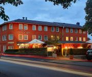
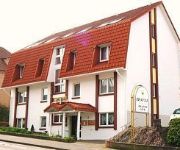
If you need a place to sleep, we compiled a list of available hotels close to the map centre further down the page.
Depending on your travel schedule, you might want to pay a visit to some of the following locations: Minden, Herford, Dorentrup, Leopoldshohe and Hille. To further explore this place, just scroll down and browse the available info.
Local weather forecast
Todays Local Weather Conditions & Forecast: 2°C / 36 °F
| Morning Temperature | -1°C / 30 °F |
| Evening Temperature | 2°C / 35 °F |
| Night Temperature | 0°C / 32 °F |
| Chance of rainfall | 0% |
| Air Humidity | 87% |
| Air Pressure | 999 hPa |
| Wind Speed | Fresh Breeze with 15 km/h (9 mph) from North-East |
| Cloud Conditions | Overcast clouds, covering 87% of sky |
| General Conditions | Rain and snow |
Saturday, 23rd of November 2024
3°C (38 °F)
4°C (39 °F)
Moderate rain, fresh breeze, overcast clouds.
Sunday, 24th of November 2024
12°C (53 °F)
11°C (53 °F)
Moderate rain, fresh breeze, overcast clouds.
Monday, 25th of November 2024
13°C (55 °F)
9°C (48 °F)
Light rain, fresh breeze, overcast clouds.
Hotels and Places to Stay
Boardinghouse by M & K
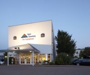
Best Western Bonneberg
Vienna House Easy Bad Oeynhausen
Waldhotel
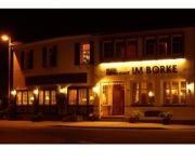
Im Borke
An der Ilse
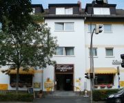
Hotel Westfälischer Hof
Stickdorn
Arador-City
Bosse Cityhotel
Videos from this area
These are videos related to the place based on their proximity to this place.
Hammerfest Hier bei uns, Wilde Zeit....
Hammefest Hier bei uns Wilde Zeit Irgendwann sowieso Helden Für kein Geld der Welt Nächster Hammerfest-Auftritt bitte vormerken: Vlothos Kultband spielt am 1. August beim »Umsonst und Draußen.
WMF 2011 / Crimson Tree - Eyes Of Medusa
WESER MOSHFEST 2011 (03.09.2011) Crimson Tree - Eyes Of Medusa Metal E.V. - Bad Oeynhausen.
Hammerfest: Bubulubi, Hände hoch und Jeder gegen Jeden -Freibadfete Vlotho 2014-
Hammerfest Bubilubi Hände hoch Jeder gegen Jeden Arbeitslos von Hammerfest Nächster Hammerfest-Auftritt bitte vormerken: Vlothos Kultband spielt am 1. August beim »Umsonst und Draußen«...
Bachspaziergang von Vlotho-Hollwiesen nach Vlotho-Wehrendorf
Vlotho kommt von dem Wort Flote-Owe bzw. "Fluss-Aue". Mit dem Fluss ist aber nicht die Weser gemeint, sondern die Beke, die durch Vlotho fließt. Wir folgen der Beke in Vlotho zwischen Hollwiesen...
Bonstapel - Teil 1
Der Bonstapel-Rundweg bei Steinbründorf. Erster Teil (weil ich das Format von 4:3 auf 16:9 gewechselt hatte, teile ich auch den Film)
Videos provided by Youtube are under the copyright of their owners.
Attractions and noteworthy things
Distances are based on the centre of the city/town and sightseeing location. This list contains brief abstracts about monuments, holiday activities, national parcs, museums, organisations and more from the area as well as interesting facts about the region itself. Where available, you'll find the corresponding homepage. Otherwise the related wikipedia article.
Zollern
Zollern, from 1218 Hohenzollern, was a county of the Holy Roman Empire. Its ruling dynasty was the House of Hohenzollern, a Swabian noble family first mentioned in 1061. They named their estates after Hohenzollern Castle at the Swabian Alb; its capital was Hechingen. Its coat of arms was that of the ruling house. According to the medieval chronicler Berthold of Reichenau, the nobleman Burkhard I, Count of Zollern (de Zolorin) was born before 1025 and died in 1061.
1st Armoured Division (United Kingdom)
The 1st Armoured Division is an armoured division of the British Army, currently the only British division to be stationed in Germany. Originally formed in November 1937 as the Mobile Division, it saw extensive service during the Second World War, was disbanded afterward, was reconstituted in 1976, and remains in service today. It should not be confused with 1st Infantry Division which saw service in the Second World War as a separate formation.
Bundesautobahn 2
Bundesautobahn 2 is an autobahn in Germany that connects the Ruhr area in the west to Berlin in the east. The A 2 starts at the western city of Oberhausen, passes through the north of the Ruhr valley, through the Münsterland and into Ostwestfalen, crossing the former inner German border and continuing through the Magdeburger Börde to merge into the Berliner Ring shortly before reaching Berlin.
Porta Westfalica (gorge)
The Porta Westfalica is a gorge and water gap, where the Weser river runs through the passage between the mountain chains of the Wiehengebirge in the west and the Wesergebirge (part of the Weserbergland) in the east. It is located in the district of Minden-Lübbecke in North Rhine-Westphalia, Germany. Since 1973 Porta Westfalica is also the name of a town, which was established by merging fifteen villages surrounding the gorge. Since 2006 it is a National Geotope.
Lipperlandhalle
Lipperlandhalle is an indoor sporting arena located in Lemgo, Germany. The capacity of the arena is 5,000 people. It hosted some matches at the 2007 World Men's Handball Championship.
Jakobsberg Telecommunication Tower
Jakobsberg Telecommunication Tower is a 142 metre tall TV tower built of reinforced concrete on the 238 metre high elevated Jakobsberg near Porta Westfalica. Jakobsberg Telecommunication Tower was built May 1st, 1974 and September 28th, 1978 as replacement for a small telecommunication tower also equipped with an observation deck, which was built in 1952 on the site of the former Bismarck column, erected in 1902.
Battle of Vlotho
The Battle of Vlotho was fought on 17 October 1638, it was a victory for the Imperial Army under the command of Field Marshal Melchior von Hatzfeldt, and ended the attempt by Charles I Louis, Elector Palatine, to recapture the Palatinate. {{#invoke:Footnotes|sfn}} Charles Louis' defeat marked the last time either Palatine or English forces played a significant role in the Thirty Years' War.
Wittekindsberg
The Wittekindsberg is a hill, 281.48 m above sea level, which forms the easternmost peak of the Wiehen Hills and is also the western guardian of the Weser gorge, the Porta Westfalica, in North Rhine-Westphalia. The hill is well-known, especially as the site of the Emperor William Monument (Kaiser Wilhelm Denkmal), but also for the Moltke Tower and Wittekind Castle.
Ostwestfalen-Lippe University of Applied Sciences
The Ostwestfalen-Lippe University of Applied Sciences is a state institution in Germany, which carries out research and higher education at four locations. OWL University enrolled approximately 6.500 students in 9 faculties, which offers Bachelor and Master study programmes. Ph.D. -Studies are carried out in cooperation with different partner universities (e.g.). The headquarter is located in Lemgo, between Hannover and Bielefeld, in the north-east of the state North Rhine-Westphalia.
List of rivers in Ostwestfalen-Lippe
This list of rivers and streams in Ostwestfalen-Lippe contains a selection of the rivers, streams and lakes which lie wholly or partly in Ostwestfalen-Lippe (OWL). The rivers are organised based on the Weser, Lippe and Ems river systems. In addition they are sometimes further divided into sub-regions. The list does not contain all named rivers in OWL, but at least all those with a total catchment area of 10 square kilometres.
Minden station
Minden (Westfalen) station (officially Minden Bf) is a railway station in Minden. The station is located on the Hanover–Minden railway to Hanover, the Hamm–Minden railway to Hamm and the Weser–Aller railway to Rotenburg an der Wümme. The train services are operated by Deutsche Bahn.
Löhne station
Löhne is a railway station located in Löhne, Germany. The station is located on the Löhne–Rheine, Hamm–Minden and Elze–Löhne lines. The train services are operated by Deutsche Bahn, Eurobahn and Westfalenbahn.
Porta Westfalica railway station
Porta Westfalicais a railway station located in Porta Westfalica, Germany. The station was opened in 1916 and is located on the Hamm–Minden railway. The train services are operated by Deutsche Bahn.
Minden Cathedral
Minden Cathedral, dedicated to Saints Gorgonius and Peter, is a Roman Catholic church in the city of Minden, North Rhine-Westphalia, Germany. From the year 803 AD, when the area was conquered by Charlemagne, it was the center of a diocese and subsequently became the center of a small sovereign state, a prince-bishopric of Minden, until the time of the Peace of Westphalia (1648), when Minden was secularized as the Principality of Minden (which lasted until 1806).
Minden Land
Minden Land is a cultural landscape in East Westphalia, the northeastern part of North Rhine-Westphalia in Germany. It covers the four-fifths of the district of Minden-Lübbecke that lie on the North German Plain and is clearly bounded to the south by the Weser Hills and Wiehen Hills, where it adjoins the Ravensberg Land and the Upper Weser Valley. Its other boundaries are delineated by those of the district.
Minden Coalfield
The Minden Coalfield is located in the norther Wiehen foothills near the German town of Minden. Here, seams of Wealden Coal (Wealdenkohle) reach the surface of the earth in the Schaumburg Basin (Schaumburger Mulde). During the Thirty Years' War Swedish soldiers first discovered this black coal near Minden whilst preparing fieldworks on the Bölhorst. By 1663 it was forbidden to dig privately for coal and severe penalties were imposed for doing so.
Passade (river)
Passade is a river of North Rhine-Westphalia, Germany.
Bega (Werre)
Bega (Werre) is a river of North Rhine-Westphalia, Germany.
Bentgraben
Bentgraben is a river of North Rhine-Westphalia, Germany.
Bexter
Bexter is a river of North Rhine-Westphalia, Germany.
Haferbach
Haferbach is a river of North Rhine-Westphalia, Germany.
Ilse (Bega)
Ilse (Bega) is a river of North Rhine-Westphalia, Germany.
Salze (Bega)
Salze (Bega) is a river of North Rhine-Westphalia, Germany.
Siekbach (Werre)
Siekbach (Werre) is a river of North Rhine-Westphalia, Germany.
Stadttheater Minden
Stadttheater Minden is a theatre in North Rhine-Westphalia, Germany.


