Safety Score: 3,0 of 5.0 based on data from 9 authorites. Meaning we advice caution when travelling to Germany.
Travel warnings are updated daily. Source: Travel Warning Germany. Last Update: 2024-08-13 08:21:03
Explore Krollage
Krollage in Regierungsbezirk Detmold (North Rhine-Westphalia) is located in Germany about 207 mi (or 332 km) west of Berlin, the country's capital.
Local time in Krollage is now 12:04 AM (Friday). The local timezone is named Europe / Berlin with an UTC offset of one hour. We know of 10 airports in the wider vicinity of Krollage, of which 4 are larger airports. The closest airport in Germany is Bielefeld Airport in a distance of 22 mi (or 35 km), South. Besides the airports, there are other travel options available (check left side).
There are several Unesco world heritage sites nearby. The closest heritage site in Germany is Carolingian Westwork and Civitas Corvey in a distance of 51 mi (or 82 km), South-East. We found 2 points of interest in the vicinity of this place. If you need a place to sleep, we compiled a list of available hotels close to the map centre further down the page.
Depending on your travel schedule, you might want to pay a visit to some of the following locations: Rodinghausen, Kirchlengern, Huellhorst, Hiddenhausen and Bad Essen. To further explore this place, just scroll down and browse the available info.
Local weather forecast
Todays Local Weather Conditions & Forecast: 3°C / 37 °F
| Morning Temperature | 2°C / 35 °F |
| Evening Temperature | 1°C / 34 °F |
| Night Temperature | 1°C / 34 °F |
| Chance of rainfall | 0% |
| Air Humidity | 76% |
| Air Pressure | 995 hPa |
| Wind Speed | Fresh Breeze with 13 km/h (8 mph) from North-East |
| Cloud Conditions | Broken clouds, covering 58% of sky |
| General Conditions | Light snow |
Friday, 22nd of November 2024
2°C (36 °F)
1°C (34 °F)
Rain and snow, fresh breeze, broken clouds.
Saturday, 23rd of November 2024
3°C (37 °F)
4°C (40 °F)
Moderate rain, fresh breeze, overcast clouds.
Sunday, 24th of November 2024
11°C (51 °F)
11°C (51 °F)
Moderate rain, fresh breeze, overcast clouds.
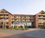
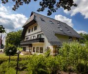
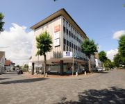
Hotels and Places to Stay
Annelie Landhotel
Landhaus Blankenstein
Gasthof zum Nonnenstein
Quellenhof
Handelshof
Forsthaus Limberg
Videos from this area
These are videos related to the place based on their proximity to this place.
Dashcam LS430W Cabrio test
Test der DOD LS430W bei Nacht im offenem Cabrio wegen Fahrtwind Geräusche.
DER NIKOLAUS WAR DA !!
Luke Leon war sooo lieb, da kam natürlich der Nikolaus ! Weihnachten 2011 kann dann nun auch kommen.....
Licht und Ton Verleih Rödinghausen
Diese Licht- und Tonanlage gibt es zum günstigen Verleih in Rödinghausen und Umgebung! Ich habe diese Anlage in "Brunos Bahnhof" in Bieren gefilmt, die dort zur Präsentation aufgebaut wurde.
Riesenrad fahrt Blasheimer Markt Sep. 2014
Eine fahrt mit dem Riesenrad, nicht jeder hat das auf dem Blasheimer Markt gemacht. Wir haben es für Euch gefilmt, aufgenommen am Sonntag 07.09.2014 kurz vorm Sonnenuntergang. Ihr habt auch...
Schloß Benkhausen
Rundgang auf Schloß Benkhausen Ostern 2015 - Erzeugt mit AquaSoft DiaShow für YouTube: http://www.aquasoft.de.
Paintball in Preussisch Oldendorf - Battle #2 - 13.01.2013 UNCUT
13.01.2013 in Preussisch Oldendorf bei http://www.paintless.de/ kleineres Gefecht bei Halle 2 zwischen dem Bunker im Wald und dem Campinganhänger, welches wir leider verloren haben.
Paintball in Preussisch Oldendorf - Battle #5 - 13.01.2013 UNCUT
13.01.2013 in Preussisch Oldendorf bei http://www.paintless.de/
Bahnhofsfest mit MAK Stangenlok treffen in Preußisch Oldendorf auf der Wittlager Kreisbahn
Am 25.05 und 26.05.2013 fand in Preußisch Oldendorf an der Wittlager Kreisbahn ein Bahnhofsfest statt. Es stand unter dem Motto „MAK Stangenloks". Bei dem Bahnhofsfest waren unter anderem...
Videos provided by Youtube are under the copyright of their owners.
Attractions and noteworthy things
Distances are based on the centre of the city/town and sightseeing location. This list contains brief abstracts about monuments, holiday activities, national parcs, museums, organisations and more from the area as well as interesting facts about the region itself. Where available, you'll find the corresponding homepage. Otherwise the related wikipedia article.
Wiehen Hills
The Wiehen Hills (German: Wiehengebirge, also locally, just Wiehen) are a low mountain range in North Rhine-Westphalia and Lower Saxony in Germany. The hills run from west to east like a long finger away from the main upland area of the Lower Saxon Hills, beginning at the Weser River near Minden and terminating in the vicinity of Osnabrück. It is the northern apophysis of the German low mountain ranges in the northern lowlands.
Lübbecke Loessland
The Lübbecke Loessland is a natural region that is mainly situated in northeastern North Rhine-Westphalia but with a small area also lying in the western part of Lower Saxony in Germany. It is a belt of land, covered by loess, about 2 to 5 km wide and around 35 km long, that lies just north of the eastern part of the Wiehen Hills. The total area of the region is about 100 km². The Lübbecke Loessland is a transitional region between the North German Plain and the Central Uplands.
Egge (Wiehen Hills)
The Egge, also called the Preußisch Oldendorfer Berg is a roughly seven kilometre long secondary ridge of the Wiehen Hills and gives its name to the Eggetal valley in the districts of Osnabrück and Minden-Lübbecke in North Germany.


