Safety Score: 3,0 of 5.0 based on data from 9 authorites. Meaning we advice caution when travelling to Germany.
Travel warnings are updated daily. Source: Travel Warning Germany. Last Update: 2024-08-13 08:21:03
Discover Horn
The district Horn of Horn-Bad Meinberg in Regierungsbezirk Detmold (North Rhine-Westphalia) with it's 7,018 citizens Horn is a subburb in Germany about 194 mi west of Berlin, the country's capital city.
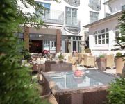
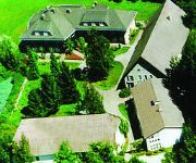
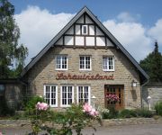
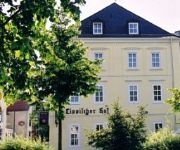
If you need a hotel, we compiled a list of available hotels close to the map centre further down the page.
While being here, you might want to pay a visit to some of the following locations: Detmold, Altenbeken, Schlangen, Dorentrup and Augustdorf. To further explore this place, just scroll down and browse the available info.
Local weather forecast
Todays Local Weather Conditions & Forecast: 13°C / 55 °F
| Morning Temperature | 10°C / 49 °F |
| Evening Temperature | 13°C / 55 °F |
| Night Temperature | 11°C / 52 °F |
| Chance of rainfall | 4% |
| Air Humidity | 70% |
| Air Pressure | 1011 hPa |
| Wind Speed | Fresh Breeze with 16 km/h (10 mph) from North-East |
| Cloud Conditions | Overcast clouds, covering 100% of sky |
| General Conditions | Moderate rain |
Monday, 25th of November 2024
13°C (55 °F)
9°C (47 °F)
Light rain, fresh breeze, overcast clouds.
Tuesday, 26th of November 2024
8°C (47 °F)
8°C (47 °F)
Light rain, moderate breeze, broken clouds.
Wednesday, 27th of November 2024
9°C (49 °F)
10°C (50 °F)
Light rain, fresh breeze, overcast clouds.
Hotels and Places to Stay
H&S Residenz Hotel Detmold
Gut Rothensiek
Detmolder Hof
Ringhotel Waldhotel Bärenstein
Quality Hotel Vital zum Stern
Elisabeth garni
Schauinsland
Lippischer Hof
Altstadt Hotel
Hirschsprung Landhaus
Videos from this area
These are videos related to the place based on their proximity to this place.
Externsteine im Schnee - DJI Phantom 2 H3 - 3D GoPro Hero 3 + Black Edition, Flug, Luftaufnahmen
Die Externsteine im Winter mit reichlich Schnee. Aufgenommen mit meinem DJI Phantom 2 H3 - 3D und der GoPro Hero 3 + Black Edition. GoPro Hero 3 + Black Edition, DJI Phantom 2 mit Gimbal...
Mediclin Rose Klinik 2015 in Horn-Bad Meinberg
MEDICLIN Rose Klinik -Aufenthalt vom 11.03. bis 01.04.2015 -Bericht auf http://duesseldorf4you.blogspot.de Ich bin nicht spezialisiert auf professionelle Berichterstattung, Foto- und Videoaufnahm...
Externsteine Horn-Bad Meinberg - www.lipperland.de
Rundweg um die sagenumwobenen Externsteine in Horn-Bad Meinberg. Mehr Informationen: ...
Videos provided by Youtube are under the copyright of their owners.
Attractions and noteworthy things
Distances are based on the centre of the city/town and sightseeing location. This list contains brief abstracts about monuments, holiday activities, national parcs, museums, organisations and more from the area as well as interesting facts about the region itself. Where available, you'll find the corresponding homepage. Otherwise the related wikipedia article.
Teutoburg Forest
The Teutoburg Forest is a range of low, forested mountains in the German states of Lower Saxony and North Rhine-Westphalia which is believed to be the scene of a decisive battle in AD 9. Until the 19th century the official name of the mountain ridge was Osning.
Lippe
Lippe is a Kreis in the east of North Rhine-Westphalia, Germany. Neighboring districts are Herford, Minden-Lübbecke, Höxter, Paderborn, Gütersloh, and district-free Bielefeld, which forms the region Ostwestfalen-Lippe. The district of Lippe is named after the Lords of Lippe and their Principality of Lippe. It was a state within the Holy Roman Empire and retained statehood until 1947, when it became a district of North Rhine-Westphalia.
Externsteine
The Externsteine are a distinctive rock formation located in Ostwestfalen-Lippe of northwestern Germany, not far from the city of Detmold at Horn-Bad Meinberg. The formation is a tor consisting of several tall, narrow columns of rock which rise abruptly from the surrounding wooded hills. The name probably means "stones of the Egge", Egge meaning ridge.
Hermannsdenkmal
The Hermannsdenkmal (German for Hermann monument) is a monument located in Ostwestfalen-Lippe in Germany in the Southern part of the Teutoburg Forest, which is southwest of Detmold in the district of Lippe. It stands on the densely forested and 386 m tall Teutberg in the ring fortification located there, which is called Grotenburg.
Sender Bielstein
The Sender Bielstein (Transmitter Bielstein) is an FM- and TV-broadcasting facility on the 393 metre high Bielstein mountain in the Forest of Teutoburg, North Rhine-Westphalia, Germany. Bielstein transmitter, which is property of WDR and used for transmitting its programmes was established in 1951. It used until 1954 a 60 metre tall mast. This mast was replaced in 1954 by a 102 metre tall antenna tower.
Ostwestfalen-Lippe
Ostwestfalen-Lippe, abbreviation OWL, is a region in the German state of North Rhine-Westphalia, with a 2,000-year-old history and culture. Ostwestfalen-Lippe is the eastern part of the region of Westphalia, joined with the Lippe region. A literal translation of the region's name would be East(ern) Westphalia-Lippe. The region is congruent with the area of the administrative region Detmold.
Werre
The Werre is a river in the Detmold region (Regierungsbezirk) of North Rhine-Westphalia, Germany, left tributary of the Weser. Its source is near Horn-Bad Meinberg. The Werre flows generally north through the towns Detmold, Lage, Bad Salzuflen, Herford and Löhne. It flows into the Weser close to Bad Oeynhausen. The total length of the Werre is 71.9 km. It crosses the districts of Lippe, Herford and Minden-Lübbecke.
Free State of Lippe
The Free State of Lippe was a German state formed after the Principality of Lippe was abolished following the German Revolution of 1918. After the end of World War II, Lippe was restored from Nazi rule. This autonomy ended in January 1947, when the Control Commission for Germany - British Element (CCG/BE) incorporated Lippe into the new German state of North Rhine-Westphalia created three months earlier.
Norderteich
Norderteich is a lake in North Rhine-Westphalia, Germany. At an elevation of 153 m, its surface area is 12.5 ha.
Detmold Open-air Museum
The Detmold Open-air Museum, or Westphalian Open Air Museum, is open seasonally, between April 1 and October 31. The museum is at Detmold, North Rhine-Westphalia, Germany. Over 100 historic, rural buildings were transported and reconstructed from across the state, including schools, farmhouses, thatched cottages, and windmills. Over 200 acres of bucolic fields and ponds are available for horse-drawn carriage rides, walking tours, and picnicking.
Altenbeken station
Altenbeken station is in the municipality of Altenbeken in the Paderborn district of the German state of North Rhine-Westphalia. The station has a great importance as a hub for local and long-distance transport due to its location on the line from the Ruhr area to Warburg and Kassel, as well as to Holzminden–Kreiensen, Hanover and Herford. Its importance has increased recently because of the lack of Intercity-Express/Intercity services on the so-called Mid-Germany Railway.
Altenbeken Viaduct
The Altenbeken Viaduct (German: Altenbekener Viadukt, also known as Bekeviadukt or Großer Viadukt Altenbeken) is a 482 metres long and up to 35 metres high double track limestone railway viaduct. It spans the Beke valley, west of the town of Altenbeken, in the Land of North Rhine-Westphalia, Germany. The viaduct is Europe's longest limestone bridge, and its construction was one of the earliest significant events in the history of rail transport in Germany.
Lippe State Library at Detmold
Lippe State Library (Lippische Landesbibliothek Detmold) is the universal and regional library for Ostwestfalen-Lippe in Germany. It is based at Detmold.
Princess Pauline Foundation
The Princess Pauline Foundation (Fürstin-Pauline-Stiftung) is an independent Lutheran foundation in Detmold, wholly devoted to charitable purposes and to childcare, youth work and care of the elderly. Previously known as the Paulinenanstalt, it is named after its founder Princess Pauline of Anhalt-Bernburg.
Durbeke
Durbeke is a river of North Rhine-Westphalia, Germany.
Heidenbach
Heidenbach is a river of North Rhine-Westphalia, Germany.
Silberbach (Heubach)
Silberbach (Heubach) is a river of North Rhine-Westphalia, Germany.
Strangbach
Strangbach is a river of North Rhine-Westphalia, Germany.
Wiembecke
Wiembecke is a river of North Rhine-Westphalia, Germany.
Wörbke
Wörbke is a river of North Rhine-Westphalia, Germany. The Wörbke is approximately 4 km long, a right tributary of the Werre in the Lippe district in Ostwestfalen-Lippe. The source of the river has an elevation of 260 metres and the mouth an elevation of 148 metres.
Detmolder Sommertheater
Detmolder Sommertheater is a theatre in North Rhine-Westphalia, Germany.
Landestheater Detmold
Landestheater Detmold is a theatre in North Rhine-Westphalia, Germany.
Hobart Barracks
Hobart Barracks is a former military airfield, located 1.6 km east-northeast of Detmold in North Rhine-Westphalia, Germany.
Teutoburg Forest / Egge Hills Nature Park
The Teutoburg Forest / Egge Hills Nature Park (German: Naturpark Teutoburger Wald / Eggegebirge) is a nature park founded in 1965 in the northeast of the German state of North Rhine-Westphalia. After being expanded in 2008, the nature park in the southern Teutoburg Forest and Egge Hills has an area of 2,711 km², making it the largest in the state and the sixth largest in Germany. The Teutoburg Forest / Egge Hills Nature Park won the state competition for nature parks, "Naturpark.2009.
Hohenloh
Hohenloh is a suburb in the city of Detmold, North Rhine-Westphalia, Germany, 1.6 km east-northeast of the centre of Detmold. It is located on the site of Hobart Barracks, a former military airfield, used before the war by the Luftwaffe and later by Allied Forces.


