Safety Score: 3,0 of 5.0 based on data from 9 authorites. Meaning we advice caution when travelling to Germany.
Travel warnings are updated daily. Source: Travel Warning Germany. Last Update: 2024-08-13 08:21:03
Delve into Auf der Lieth
Auf der Lieth in Regierungsbezirk Detmold (North Rhine-Westphalia) is a town located in Germany about 202 mi (or 325 km) west of Berlin, the country's capital town.
Time in Auf der Lieth is now 08:29 PM (Friday). The local timezone is named Europe / Berlin with an UTC offset of one hour. We know of 8 airports closer to Auf der Lieth, of which 3 are larger airports. The closest airport in Germany is Paderborn Lippstadt Airport in a distance of 12 mi (or 19 km), South-West. Besides the airports, there are other travel options available (check left side).
There are several Unesco world heritage sites nearby. The closest heritage site in Germany is Carolingian Westwork and Civitas Corvey in a distance of 25 mi (or 40 km), East. We saw 1 points of interest near this location. In need of a room? We compiled a list of available hotels close to the map centre further down the page.
Since you are here already, you might want to pay a visit to some of the following locations: Paderborn, Schlangen, Altenbeken, Hovelhof and Horn-Bad Meinberg. To further explore this place, just scroll down and browse the available info.
Local weather forecast
Todays Local Weather Conditions & Forecast: 3°C / 37 °F
| Morning Temperature | -0°C / 31 °F |
| Evening Temperature | 2°C / 36 °F |
| Night Temperature | 1°C / 34 °F |
| Chance of rainfall | 3% |
| Air Humidity | 82% |
| Air Pressure | 1001 hPa |
| Wind Speed | Fresh Breeze with 17 km/h (11 mph) from East |
| Cloud Conditions | Overcast clouds, covering 96% of sky |
| General Conditions | Snow |
Saturday, 23rd of November 2024
4°C (39 °F)
5°C (41 °F)
Light rain, moderate breeze, overcast clouds.
Sunday, 24th of November 2024
13°C (56 °F)
13°C (55 °F)
Moderate rain, fresh breeze, overcast clouds.
Monday, 25th of November 2024
14°C (57 °F)
9°C (49 °F)
Moderate rain, fresh breeze, overcast clouds.
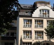
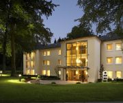
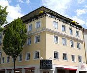
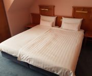
Hotels and Places to Stay
Best Western Plus Arosa
Scherf Die Residenz
Vital Hotel Das Thermenhotel
Best Western Premier Park Hotel & Spa
Dominik Motel
Aspethera
Zur Mühle
Stadthaus
IN VIA
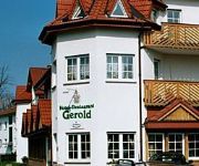
Gerold
Videos from this area
These are videos related to the place based on their proximity to this place.
Car-Freitag der Paderszene in Paderborn
Autos wohin das Auge reicht: Mehre tausend Tuningfreunde trafen sich am Karfreitag, den 3. April 2015, am Uni-Parkplatz in Paderborn.
Saisonstart Paderborn 2k15
Am 03. April war es wieder so weit. In Paderborn fand der Saisonstart der Tuningszene statt. Wir waren mit dabei. www.facebook.com/S.View2014.
Zusammenfassung des Spiels UFC Paderborn gegen VT Rinteln
Futsal Westfalenliga 2014/15 - Staffel Ost Die Partie zwischen Tabellenführer UFC Paderborn und dem zehnten VT Rinteln.
Stirling Motor Animation Universität Paderborn
https://www.facebook.com/pages/MindArts-Medienproduktion/162950433726318 -Aufbau -Regenerator - 4 Zustandsänderungen - pV - Diagramm.
Landeanflug auf Paderborn Lippstadt Airport / Flughafen | Zeitraffer
Landeanflug auf den Flughafen Paderborn, gefilmt mit einem iPhone 5s aus einer Boeing 737 der Fluggeselschaft SunExpress. Musik: YouTube.
LED Rutschen in der Westfalen Therme in Bad Lippspringe
LED Rutschen in der Westfalentherme in Bad Lippspringe. 123 Meter und 73 Meter.
Videos provided by Youtube are under the copyright of their owners.
Attractions and noteworthy things
Distances are based on the centre of the city/town and sightseeing location. This list contains brief abstracts about monuments, holiday activities, national parcs, museums, organisations and more from the area as well as interesting facts about the region itself. Where available, you'll find the corresponding homepage. Otherwise the related wikipedia article.
Paderborn Plateau
The Paderborn Plateau in central Germany is, geologically speaking, the southeastern element of the Westphalian Bight and, at the same time, the largest limestone and karst landscape in Westphalia. In the west the Alme valley forms the boundary with the Hellweg region including the Haarstrang and Hellweg Börde; to the north the plateau is bordered by the Lippe depression, the Senne and the Teutoburg Forest. Its eastern limit is the Eggegebirge.


