Safety Score: 3,0 of 5.0 based on data from 9 authorites. Meaning we advice caution when travelling to Germany.
Travel warnings are updated daily. Source: Travel Warning Germany. Last Update: 2024-08-13 08:21:03
Explore Sankt Wilhelmshütte
Sankt Wilhelmshütte in Regierungsbezirk Arnsberg (North Rhine-Westphalia) is located in Germany about 227 mi (or 365 km) west of Berlin, the country's capital.
Local time in Sankt Wilhelmshütte is now 06:28 AM (Friday). The local timezone is named Europe / Berlin with an UTC offset of one hour. We know of 9 airports in the wider vicinity of Sankt Wilhelmshütte, of which 3 are larger airports. The closest airport in Germany is Paderborn Lippstadt Airport in a distance of 16 mi (or 25 km), North-East. Besides the airports, there are other travel options available (check left side).
There are several Unesco world heritage sites nearby. The closest heritage site in Germany is Bergpark Wilhelmshöhe in a distance of 45 mi (or 73 km), East. We found 1 points of interest in the vicinity of this place. If you need a place to sleep, we compiled a list of available hotels close to the map centre further down the page.
Depending on your travel schedule, you might want to pay a visit to some of the following locations: Bestwig, Anroechte, Meschede, Mohnesee and Bad Sassendorf. To further explore this place, just scroll down and browse the available info.
Local weather forecast
Todays Local Weather Conditions & Forecast: -1°C / 31 °F
| Morning Temperature | -3°C / 27 °F |
| Evening Temperature | -0°C / 31 °F |
| Night Temperature | -0°C / 31 °F |
| Chance of rainfall | 4% |
| Air Humidity | 93% |
| Air Pressure | 1003 hPa |
| Wind Speed | Moderate breeze with 13 km/h (8 mph) from East |
| Cloud Conditions | Broken clouds, covering 76% of sky |
| General Conditions | Snow |
Saturday, 23rd of November 2024
0°C (33 °F)
2°C (36 °F)
Snow, fresh breeze, overcast clouds.
Sunday, 24th of November 2024
7°C (45 °F)
8°C (46 °F)
Light rain, fresh breeze, overcast clouds.
Monday, 25th of November 2024
9°C (49 °F)
6°C (42 °F)
Light rain, moderate breeze, overcast clouds.
Hotels and Places to Stay
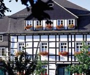
Knippschild Romantik Hotel
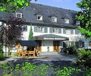
Im Waldpark Gästehaus
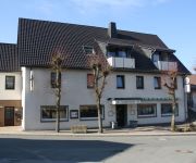
Grofe Gasthof
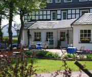
Hotel Waldhaus Föckinghausen
Hotel Spitze Warte
Videos from this area
These are videos related to the place based on their proximity to this place.
Hubschrauber Luftaufnahmen in Warstein
Hubschrauber Luftaufnahmen mit einer Bell 206 Longranger über Warstein im Sauerland während der 24. Warsteiner internationalen Montgolfiade. Produktion: Daniel Evers © 2014 WupperVideo...
Warsteiner Rosenmontagszug 2015
Der Warsteiner Rosenmontagszug hatte wieder eine gute Wegstrecke hinter sich gebracht. Die Jecken gingen wieder in Suttrop los, um dann durch die Warsteiner Mitte zum Ziel zu gelangen.
An- u. Ausläuten Glocken Pfarrkirche St. Pankratius Warstein
Glocke I (St. Petrus, Bürgerglocke): Durchmesser: 1,95 m - Gewicht: 4.100 kg - Schlagton: gis° Inschrift: „Ich ward getauft auf den Namen Petrus zu Ehren des hohen Patrons der Stadt Warstein....
Fotofilm Glocke 1 Pfarrkirche Warstein
Glocke I (St. Petrus, Bürgerglocke): Durchmesser: 1,95 m - Gewicht: 4.100 kg - Schlagton: gis° Inschrift: „Ich ward getauft auf den Namen Petrus zu Ehren des hohen Patrons der Stadt Warstein....
Kommt her ihr Cherubinen - St. Pankratius Warstein
Kommt her, ihr Cherubinen, kommt her, ihr Seraphinen, kommt, Engel ohne Zahl, in unser Erdental; stimmt ein in unsre Lieder, kniet hier im Staube nieder, und ehrt den höchsten Gott in der...
Te Deum (Großer Gott, wir loben Dich) GL 257 - St. Pankratius Warstein
Teil 1 Schlusssegen in der Pfarrkirche St. Pankratius Warstein im Anschluss an eine Prozession mit "Te Deum". Die Prozession fand aufgrund schlechter Witterung innerhalb der Pfarrkirche statt....
An- und Ausläuten Glocke 4 Pfarrkiche Warstein
Glocke IV (St. Agatha): Durchmesser: 1,33 m - Gewicht: 1.070 kg - Schlagton: e' Inschrift: „St. Agatha, an Ehren reich, uns'rer Stadt Dich hilfreich zeig. Halt ab die gift'gen Flammen...
Bikepark Warstein Freeride 17.08.2013
Fahrer:Nils Kamera:Rolleil Bullet 4s Aufgenommen am 17.08.2013.
An- u. Ausläuten Glocke 1 (Bürgerglocke) Pfarrkirche Warstein (Kurzläuten)
Glocke I (St. Petrus, Bürgerglocke): Durchmesser: 1,95 m - Gewicht: 4.100 kg - Schlagton: gis° Inschrift: „Ich ward getauft auf den Namen Petrus zu Ehren des hohen Patrons der Stadt Warstein....
An-/Ausläuten Glocke 1 Pfarrkirche Warstein
Glocke I (St. Petrus, Bürgerglocke): Durchmesser: 1,95 m - Gewicht: 4.100 kg - Schlagton: gis° Inschrift: „Ich ward getauft auf den Namen Petrus zu Ehren des hohen Patrons der Stadt Warstein....
Videos provided by Youtube are under the copyright of their owners.
Attractions and noteworthy things
Distances are based on the centre of the city/town and sightseeing location. This list contains brief abstracts about monuments, holiday activities, national parcs, museums, organisations and more from the area as well as interesting facts about the region itself. Where available, you'll find the corresponding homepage. Otherwise the related wikipedia article.
Warsteiner
Warsteiner beer is brewed in the Arnsberg Forest Nature Park outside of Warstein, North-Rhine Westphalia, Germany. Warsteiner has been a product of the Cramer family since 1753. Warsteiner is Germany's largest privately owned brewery; its most popular beer is 'Warsteiner Premium Verum'. Catharina Cramer (* 1978) is the owner of Warsteiner. Warsteiner ranks number 4 among Germany's best selling breweries. It is sponsoring competitive hot air ballooning in Germany.
Langer Bach
Langer Bach is a river of North Rhine-Westphalia, Germany.
Lörmecke
Lörmecke is a river of North Rhine-Westphalia, Germany.
Treise
Treise is a river of North Rhine-Westphalia, Germany.


