Safety Score: 3,0 of 5.0 based on data from 9 authorites. Meaning we advice caution when travelling to Germany.
Travel warnings are updated daily. Source: Travel Warning Germany. Last Update: 2024-08-13 08:21:03
Touring Rösenbeck
Rösenbeck in Regierungsbezirk Arnsberg (North Rhine-Westphalia) is a town located in Germany about 215 mi (or 347 km) west of Berlin, the country's capital place.
Time in Rösenbeck is now 10:03 PM (Tuesday). The local timezone is named Europe / Berlin with an UTC offset of one hour. We know of 9 airports nearby Rösenbeck, of which 3 are larger airports. The closest airport in Germany is Paderborn Lippstadt Airport in a distance of 15 mi (or 23 km), North. Besides the airports, there are other travel options available (check left side).
There are several Unesco world heritage sites nearby. The closest heritage site in Germany is Bergpark Wilhelmshöhe in a distance of 31 mi (or 50 km), East. Need some hints on where to stay? We compiled a list of available hotels close to the map centre further down the page.
Being here already, you might want to pay a visit to some of the following locations: Korbach, Bestwig, Bromskirchen, Paderborn and Vohl. To further explore this place, just scroll down and browse the available info.
Local weather forecast
Todays Local Weather Conditions & Forecast: 10°C / 50 °F
| Morning Temperature | 5°C / 40 °F |
| Evening Temperature | 7°C / 44 °F |
| Night Temperature | 5°C / 40 °F |
| Chance of rainfall | 0% |
| Air Humidity | 59% |
| Air Pressure | 1024 hPa |
| Wind Speed | Light breeze with 4 km/h (3 mph) from North |
| Cloud Conditions | Overcast clouds, covering 94% of sky |
| General Conditions | Overcast clouds |
Wednesday, 6th of November 2024
12°C (53 °F)
5°C (41 °F)
Few clouds, calm.
Thursday, 7th of November 2024
11°C (52 °F)
4°C (40 °F)
Sky is clear, light breeze, clear sky.
Friday, 8th of November 2024
11°C (52 °F)
5°C (41 °F)
Few clouds, light breeze.
Hotels and Places to Stay
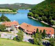
Göbel´s Seehotel Diemelsee
Videos from this area
These are videos related to the place based on their proximity to this place.
TrailGround in Brilon Panorama-Trail
Das Video entstand vor dem letzten Sturm! Der TrailGround ist jetzt erst mal bis zur Eröffnung am 18.04.15 NICHT befahrbar da erst mal wieder alle Bäume von den Strecke müssen. :) Ihr seht...
Die Elektro-Gurke - ungeschnitten - Tim Weißbach Modellflugzeuge
Hier ist der zweite Flug der serienreifen Elektro-Gurke zu sehen. Eine ganze Akkuladung, ungeschnitten. So macht rumgurken Spaß.. www.tims-modellflugzeuge.de Lieferbar ab Anfang Juli 2013!...
Hubschrauber- Rundflug über Hoppecke - Diemelsee - Messinghausen
Hubschrauber-Rundflug mit Heli NRW beim Flugplatzfest Thülen Pfingsten 2012 über Hoppecke, Messinghausen, Diemelsee,...
Rundflug über dem Sauerland
Flugplatzfest Thülen, Pfingsten 2012, Hubschrauber-Rundflug mit Heli NRW.
Viertel Meile - Flugplatz Brilon - September 2014
1/4 Meile Dragrace am Flugplatz Brilon September 2014.
BMW E39 M5 1/4 Meile EFR Germany Brilon 2013 Trunk Cam Rollei Bullet 5s
Reaktion: 0,45s / 60ft: 2,25s / 1/8meile: 8,93 (131 km/h) / 1/4meile: 13,65 (172 km/h)
Frontal gegen Lkw: Eine Stunde eingeklemmt.mpg
Diemelsee. Ein Kurierfahrer ist am Dienstagmittag (24.05.2011) in Nordhessen mit einem Silozug zusammengestoßen. Der 33 Jahre alte Mann aus Kassel erlitt schwerste Verletzungen und wurde im...
Videos provided by Youtube are under the copyright of their owners.
Attractions and noteworthy things
Distances are based on the centre of the city/town and sightseeing location. This list contains brief abstracts about monuments, holiday activities, national parcs, museums, organisations and more from the area as well as interesting facts about the region itself. Where available, you'll find the corresponding homepage. Otherwise the related wikipedia article.
Itter (Diemel)
Itter (Diemel) is a river of Hesse, Germany.


