Safety Score: 3,0 of 5.0 based on data from 9 authorites. Meaning we advice caution when travelling to Germany.
Travel warnings are updated daily. Source: Travel Warning Germany. Last Update: 2024-08-13 08:21:03
Explore Züllighoven
Züllighoven in Cologne District (North Rhine-Westphalia) is a city in Germany about 299 mi (or 481 km) south-west of Berlin, the country's capital.
Local time in Züllighoven is now 07:25 AM (Friday). The local timezone is named Europe / Berlin with an UTC offset of one hour. We know of 10 airports in the vicinity of Züllighoven, of which 4 are larger airports. The closest airport in Germany is Cologne Bonn Airport in a distance of 17 mi (or 28 km), North. Besides the airports, there are other travel options available (check left side).
There are several Unesco world heritage sites nearby. The closest heritage site in Germany is Castles of Augustusburg and Falkenlust at Brühl in a distance of 18 mi (or 29 km), North-West. We found 3 points of interest in the vicinity of this place. If you need a place to sleep, we compiled a list of available hotels close to the map centre further down the page.
Depending on your travel schedule, you might want to pay a visit to some of the following locations: Wachtberg, Rheinbreitbach, Erpel, Bad Neuenahr-Ahrweiler and Bruchhausen. To further explore this place, just scroll down and browse the available info.
Local weather forecast
Todays Local Weather Conditions & Forecast: 10°C / 49 °F
| Morning Temperature | 8°C / 46 °F |
| Evening Temperature | 6°C / 43 °F |
| Night Temperature | 4°C / 40 °F |
| Chance of rainfall | 0% |
| Air Humidity | 64% |
| Air Pressure | 1028 hPa |
| Wind Speed | Calm with 3 km/h (2 mph) from North |
| Cloud Conditions | Few clouds, covering 13% of sky |
| General Conditions | Few clouds |
Saturday, 16th of November 2024
9°C (48 °F)
4°C (39 °F)
Few clouds, light breeze.
Sunday, 17th of November 2024
6°C (43 °F)
5°C (41 °F)
Moderate rain, gentle breeze, overcast clouds.
Monday, 18th of November 2024
6°C (43 °F)
4°C (40 °F)
Light rain, gentle breeze, few clouds.
Hotels and Places to Stay
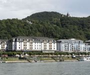
Maritim
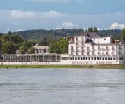
Rheinhotel Dreesen Ringhotel
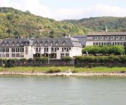
Rheinhotel Schulz
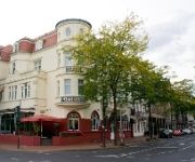
Best Western Kaiserhof
Dahl
Rheinhotel Loreley
Altes Brauhaus Orangerie
Görres
Burgblick
Baynunah Hotel Drachenfels
Videos from this area
These are videos related to the place based on their proximity to this place.
Nationalpark Eifel (Honda Transalp)
Kleine Abend Tour am 04.09.2013 Start: Zuelpich Checkpoint: Blankenheim Ziel: Bonn Total: ~ 200km Motorrad: 1994 Honda Transalp PD06 XL 600V Ne kleine Tour ueber die heimischen Straesschen ...
Servietten falten: Der Schmetterling - frühlingshafte Tischdeko selber machen - Video-Faltanleitung
Hier erfahrt ihr alles über Servietten und Tischdeko. Mit Videos und Bastel-Anleitungen zu allen Modellen. Servietten falten leicht gemacht: http://www.chefkoch.de/magazin/artikel/1485,0/Chefkoch/...
Sylvester am Rodderberg / Bonn
Filming Sylvester 2013 on the Rodderberg near Bonn in Germany It was a very stormy cold night..sorry for shaking.. have fun :-)
das zweite mal Unwetter in Unkelbach
am 20.06.2013 ist es erneut passiert. Durch große mengen Regenwasser wurden Dreck und Schmutz wieder durch Unkelbach getragen.
Elektromotor Torqeedo vom Hochwasserboot Abnehmen
Für kurze Einsätze auf Binnenseen der Elektromotor Torqeedo 1000 Watt ∙ er ist so schnell wie der Benzinmotor ∙ superleicht ( inkl. Akku 13,4 kg) ∙ sehr schnell am Boot anzubringen...
Weihnachtsfahrt Gemarkenhof Remagen
Anmeldung erfoderlich! Tel.: 02642 21960 oder per E-Mail: info@straussenfarm-gemarkenhof.de Fahrten in der festlich geschmückten Bimmelbahn Begeben Sie sich mit uns auf eine kleine Suchfahrt...
Fähre von Remagen Rolandseck nach Bad Honnef am 14.07.2013.
Die Fähre ist von Remagen-Rolandseck nach Bad Honnef unterwegs.
MS Moby Dick am 14.07.2013 vor Rolandseck.
MS Moby Dick fährt rheinaufwärts zum Anleger Remagen-Rolandseck. Das Schiff befindet sich auf der Linienfahrt von Bonn nach Linz. Im Hintergrund die Fähre von Remagen-Rolandseck nach Bad ...
Hochwasser Rheinbreitbach am 9.1.2011
Das ist das Hochwasser vom 9.1.2011aus Rheinbreitbach am Rhein.
Wachtberg Air view - teaser (Vorschau)
Erste probeflüge für mein vorhaben die schönsten ecken wachtbergs zusammenzustellen. http://de.wikipedia.org/wiki/Wachtberg.
Videos provided by Youtube are under the copyright of their owners.
Attractions and noteworthy things
Distances are based on the centre of the city/town and sightseeing location. This list contains brief abstracts about monuments, holiday activities, national parcs, museums, organisations and more from the area as well as interesting facts about the region itself. Where available, you'll find the corresponding homepage. Otherwise the related wikipedia article.
Rodderberg
The Rodderberg is an extinct volcano in the east of the municipality of Wachtberg near Bonn, Germany. The last eruption was 250,000 years ago. It is situated just above the Rhine-valley. Together with the Drachenfels directly opposite, the Rodderberg narrows the Rhine-valley. This gorge portion is the southern limit of the lowland-bay of Cologne. The Rodderberg offers views to the Siebengebirge, the Rhine-valley and up to the Cologne Cathedral, about 50 km away.
TIRA (System)
The Tracking & Imaging Radar (TIRA) system serves as the central experimental facility for the development and investigation of radar techniques for the detection and reconnaissance of objects in space, and to a certain degree also of air targets. The TIRA system gains radar data at 22.5 cm and 1.8 cm wavelengths. It is located at the FGAN-FHR site, in Wachtberg near Bonn, Germany .
Arzdorfer Bach
Arzdorfer Bach is a river of North Rhine-Westphalia, Germany.
Noßbach
Noßbach is a river of North Rhine-Westphalia, Germany.


