Safety Score: 3,0 of 5.0 based on data from 9 authorites. Meaning we advice caution when travelling to Germany.
Travel warnings are updated daily. Source: Travel Warning Germany. Last Update: 2024-08-13 08:21:03
Discover Simonskall
Simonskall in Cologne District (North Rhine-Westphalia) is a city in Germany about 329 mi (or 529 km) south-west of Berlin, the country's capital city.
Local time in Simonskall is now 11:02 AM (Friday). The local timezone is named Europe / Berlin with an UTC offset of one hour. We know of 10 airports in the vicinity of Simonskall, of which 5 are larger airports. The closest airport in Germany is Aachen-Merzbrück Airport in a distance of 13 mi (or 21 km), North-West. Besides the airports, there are other travel options available (check left side).
There are several Unesco world heritage sites nearby. The closest heritage site in Germany is Aachen Cathedral in a distance of 14 mi (or 22 km), North-West. Also, if you like golfing, there are a few options in driving distance. We discovered 1 points of interest in the vicinity of this place. Looking for a place to stay? we compiled a list of available hotels close to the map centre further down the page.
When in this area, you might want to pay a visit to some of the following locations: Hurtgenwald, Simmerath, Langerwehe, Roetgen and Kreuzau. To further explore this place, just scroll down and browse the available info.
Local weather forecast
Todays Local Weather Conditions & Forecast: 8°C / 46 °F
| Morning Temperature | 6°C / 42 °F |
| Evening Temperature | 3°C / 38 °F |
| Night Temperature | 2°C / 36 °F |
| Chance of rainfall | 0% |
| Air Humidity | 70% |
| Air Pressure | 1028 hPa |
| Wind Speed | Light breeze with 3 km/h (2 mph) from North |
| Cloud Conditions | Few clouds, covering 13% of sky |
| General Conditions | Few clouds |
Saturday, 16th of November 2024
7°C (44 °F)
4°C (39 °F)
Scattered clouds, gentle breeze.
Sunday, 17th of November 2024
4°C (40 °F)
2°C (36 °F)
Rain and snow, moderate breeze, overcast clouds.
Monday, 18th of November 2024
3°C (37 °F)
3°C (38 °F)
Rain and snow, moderate breeze, broken clouds.
Hotels and Places to Stay
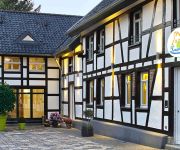
Kallbach Landhotel
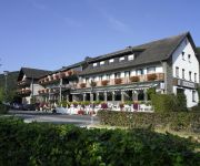
Land-gut-Hotel Zum Alten Forsthaus
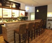
Kragemann Hotel und Vinothek
Im Waldhotel Wiesengrund
Roeb
Café Henn
Paulushof
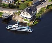
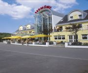
Seemöwe
Vichter Landhaus
Videos from this area
These are videos related to the place based on their proximity to this place.
Feuerwerk - Rursee in Flammen - 26.07.2014 - Woffelsbach
Alljährlich ... Für alle, die es nicht gesehen haben :( Feuerwerk von "Rursee in Flammen" 2014 - gefilmt vom "Fuße" des Drachenfels - Diesmal mit meiner neuen EOS 100D + EFS 18-55 gefilmt....
Drachenbootrennen Rursee 2012, die flotten Weißen
Das Team "Die flotten Weißen" nahm am 28.07.2012 am Drachenbootrennen auf dem Rursee teil. Für einen ersten Versuch nicht schlecht, aber es gibt noch reichlich Raum für Verbesserungen. 2013...
16.06.2012 Eventlauf Rollesbroich
Vilvo filmt - http://www.vilvo.de : Eventlauf Rollesbroich http://www.roland-rollesbroich.de.
D1 KallTrail
Dieses Dokument ist Teil des Projekts Multimedia-Historyguide der Konejung Stiftung: Kultur. Auf sechs Themenschleifen des „Historisch-literarischen Wanderweges ® Hürtgenwald 1938 -1947"...
D13 KallTrail Part 1
Dieses Dokument ist Teil des Projekts Multimedia-Historyguide der Konejung Stiftung: Kultur. Auf sechs Themenschleifen des „Historisch-literarischen Wanderweges ® Hürtgenwald 1938 -...
D3 KallTrail
Dieses Dokument ist Teil des Projekts Multimedia-Historyguide der Konejung Stiftung: Kultur. Auf sechs Themenschleifen des „Historisch-literarischen Wanderweges ® Hürtgenwald 1938 -...
D5 KallTrail
Dieses Dokument ist Teil des Projekts Multimedia-Historyguide der Konejung Stiftung: Kultur. Auf sechs Themenschleifen des „Historisch-literarischen Wanderweges ® Hürtgenwald 1938 -...
D2 KallTrail
Dieses Dokument ist Teil des Projekts Multimedia-Historyguide der Konejung Stiftung: Kultur. Auf sechs Themenschleifen des „Historisch-literarischen Wanderweges ® Hürtgenwald 1938 -1947"...
D14 KallTrail
Dieses Dokument ist Teil des Projekts Multimedia-Historyguide der Konejung Stiftung: Kultur. Auf sechs Themenschleifen des „Historisch-literarischen Wanderweges ® Hürtgenwald 1938 -...
Videos provided by Youtube are under the copyright of their owners.
Attractions and noteworthy things
Distances are based on the centre of the city/town and sightseeing location. This list contains brief abstracts about monuments, holiday activities, national parcs, museums, organisations and more from the area as well as interesting facts about the region itself. Where available, you'll find the corresponding homepage. Otherwise the related wikipedia article.
Battle of Hürtgen Forest
The Battle of Hürtgen Forest is the name given to the series of fierce battles fought between U.S. and German forces during World War II in the Hürtgen Forest, which became the longest battle on German ground during World War II, and the longest single battle the U.S. Army has ever fought. The battles took place from 19 September 1944 to 10 February 1945, over barely 50 sq mi, east of the Belgian–German border. The U.S.


