Safety Score: 3,0 of 5.0 based on data from 9 authorites. Meaning we advice caution when travelling to Germany.
Travel warnings are updated daily. Source: Travel Warning Germany. Last Update: 2024-08-13 08:21:03
Delve into Scherpenseel
Scherpenseel in Cologne District (North Rhine-Westphalia) is located in Germany about 333 mi (or 536 km) west of Berlin, the country's capital town.
Current time in Scherpenseel is now 07:20 AM (Sunday). The local timezone is named Europe / Berlin with an UTC offset of one hour. We know of 11 airports close to Scherpenseel, of which 5 are larger airports. The closest airport in Germany is Geilenkirchen Airport in a distance of 3 mi (or 4 km), North-West. Besides the airports, there are other travel options available (check left side).
There are several Unesco world heritage sites nearby. The closest heritage site in Germany is Aachen Cathedral in a distance of 11 mi (or 17 km), South. Also, if you like playing golf, there are some options within driving distance. We encountered 2 points of interest near this location. If you need a hotel, we compiled a list of available hotels close to the map centre further down the page.
While being here, you might want to pay a visit to some of the following locations: UEbach-Palenberg, Gangelt, Heinsberg, Aachen and Waldfeucht. To further explore this place, just scroll down and browse the available info.
Local weather forecast
Todays Local Weather Conditions & Forecast: 14°C / 57 °F
| Morning Temperature | 11°C / 52 °F |
| Evening Temperature | 14°C / 58 °F |
| Night Temperature | 13°C / 56 °F |
| Chance of rainfall | 0% |
| Air Humidity | 64% |
| Air Pressure | 1010 hPa |
| Wind Speed | Strong breeze with 19 km/h (12 mph) from North |
| Cloud Conditions | Overcast clouds, covering 100% of sky |
| General Conditions | Light rain |
Monday, 25th of November 2024
15°C (59 °F)
9°C (47 °F)
Moderate rain, strong breeze, overcast clouds.
Tuesday, 26th of November 2024
9°C (49 °F)
8°C (47 °F)
Light rain, fresh breeze, few clouds.
Wednesday, 27th of November 2024
10°C (50 °F)
5°C (41 °F)
Light rain, strong breeze, overcast clouds.
Hotels and Places to Stay
Brunssummerheide
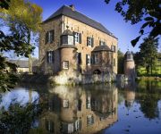
Fletcher Kasteelhotel Erenstein
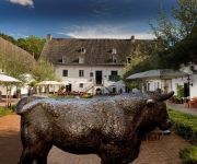
WinselerHof
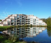
Hotel SnowWorld & Conference
Golden Tulip Parkstad Zuid Limburg
Mercator-Hotel
Abdij Rolduc
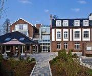
Overste Hof Hotel & Restaurant
City
Tulip Inn Heerlen City Centre
Videos from this area
These are videos related to the place based on their proximity to this place.
Geilenkirchen Air Base 15-06-2012 (Arrivals 30 years anniversary NATO base) Part 3/4
Geilenkirchen Air Base 15-06-2012 (Arrivals 30 years anniversary NATO base) Part 3/4 0:00 Arrival Hellenic Air Force F-16D 149 1:48 Arrival NATO E-3A AWACS LX-N90456 5:31 Departing TNT ...
Geilenkirchen Air Base 15-06-2012 (Arrivals 30 years anniversary NATO base) Part 1/4
Geilenkirchen Air Base 15-06-2012 (Arrivals 30 years anniversary NATO base) Part 1/4 0:00 Arrival Czech Air Force Casa C-295M 0454 3:22 Arrival Royal Netherlands Air Force Allouette 3 A-292...
Geilenkirchen Air Base 15-06-2012 (Arrivals 30 years anniversary NATO base) Part 2/4
Geilenkirchen Air Base 15-06-2012 (Arrivals 30 years anniversary NATO base) Part 2/4 0:00 Arrival German Air Force F-4F Phantom 38+24 5:15 Arrival German Air Force Tornado IDS 45+85 10:29...
Antonov An-225 - Approaching ETNG - GEILENKIRCHEN - Part 1
Antonov 225 approaching and landing at Geilenkirchen Air Base. AWACS home base - Germany. The worlds biggest aircraft ever built.
Sat 1 Automagazin www.Rahmen-Automobile.de Eu Neuwagen Geilenkirchen
Schnäppchen beim Neuwagenkauf. Das Sat1 Automagazin besucht Rahmen Automobile. www.rahmen-automobile.de.
Ilyushin Il-76 Take off at Geilenkirchen
Ilyushin Il-76 take off at Geilenkirchen Air Base at 20-08-2008.
Antonov An-124 landing in Geilenkirchen (GKE)
Antonov An-124-100 Ruslan, Volga-Dnepr Airlines (HeavyLift - Volga-Dnepr)landing on the NATO Air Base Geilenkirchen/Germany (GKE / ETNG).
Ilyushin Il-76MD landing in Geilenkirchen
Ilyushin Il-76MD landing on the NATO Air Base Geilenkirchen/Germany (GKE / ETNG).
Videos provided by Youtube are under the copyright of their owners.
Attractions and noteworthy things
Distances are based on the centre of the city/town and sightseeing location. This list contains brief abstracts about monuments, holiday activities, national parcs, museums, organisations and more from the area as well as interesting facts about the region itself. Where available, you'll find the corresponding homepage. Otherwise the related wikipedia article.
Eygelshoven
Eygelshoven is a small village near the town of Kerkrade in the southeast of the Netherlands, close to the German and Belgian borders. It has two former coal mines, Laura and Julia, which were named after the wives of the two owners. Both pits closed in 1974. Local soccer clubs are also named after the former coal mines. Eygelshoven has a small former church from the sixteenth century, which stands on top of a hill. In 1922, another church was built.
Ubach over Worms
Ubach over Worms is a former municipality located in the southeast of the Netherlands, in the province of Limburg. In 1982 it was incorporated into the new municipality of Landgraaf along with Schaesberg and Nieuwenhagen. The German name for this part of Landgraaf is "Waubach". It is believed that the latter name derives from Waldbach, which is German for "woodland creek", referring to the local Worm stream. This name is said to have later corrupted into Waubach.
NATO Air Base Geilenkirchen
NATO Air Base Geilenkirchen (E-3A Component) is located near Geilenkirchen, Germany. It is the Main Operating Base of the NATO E-3A Component, one of two operational elements of the NATO Airborne Early Warning & Control Force.
RAF Geilenkirchen
The former Royal Air Force Station Geilenkirchen, more commonly known as RAF Geilenkirchen, was a Royal Air Force military air field in the North Rhine-Westphalia region of Germany, built by the British who used the facility mainly as an airfield for RAF fighter squadrons from May 1953 until 21 January 1968.
Nieuwenhagen
Nieuwenhagen is a former village in the Dutch province of Limburg. It is now a part of the municipality of Landgraaf. Nieuwenhagen was a separate municipality until 1982, when it became a part of Landgraaf.
Rimburg
Rimburg is a village in the Dutch province of Limburg. It is located in the municipality of Landgraaf, on the German border. Rimburg was a separate municipality until 1887, when it was merged with Ubach over Worms.


