Safety Score: 3,0 of 5.0 based on data from 9 authorites. Meaning we advice caution when travelling to Germany.
Travel warnings are updated daily. Source: Travel Warning Germany. Last Update: 2024-08-13 08:21:03
Touring Mulartshütte
Mulartshütte in Cologne District (North Rhine-Westphalia) is a town located in Germany about 333 mi (or 536 km) south-west of Berlin, the country's capital place.
Time in Mulartshütte is now 08:38 AM (Friday). The local timezone is named Europe / Berlin with an UTC offset of one hour. We know of 10 airports nearby Mulartshütte, of which 5 are larger airports. The closest airport in Germany is Aachen-Merzbrück Airport in a distance of 9 mi (or 14 km), North. Besides the airports, there are other travel options available (check left side).
There are several Unesco world heritage sites nearby. The closest heritage site in Germany is Aachen Cathedral in a distance of 8 mi (or 13 km), North-West. Also, if you like the game of golf, there are several options within driving distance. We collected 1 points of interest near this location. Need some hints on where to stay? We compiled a list of available hotels close to the map centre further down the page.
Being here already, you might want to pay a visit to some of the following locations: Roetgen, Simmerath, Hurtgenwald, Aachen and Langerwehe. To further explore this place, just scroll down and browse the available info.
Local weather forecast
Todays Local Weather Conditions & Forecast: 8°C / 46 °F
| Morning Temperature | 6°C / 43 °F |
| Evening Temperature | 4°C / 39 °F |
| Night Temperature | 3°C / 37 °F |
| Chance of rainfall | 0% |
| Air Humidity | 70% |
| Air Pressure | 1028 hPa |
| Wind Speed | Light breeze with 3 km/h (2 mph) from North |
| Cloud Conditions | Few clouds, covering 12% of sky |
| General Conditions | Few clouds |
Saturday, 16th of November 2024
7°C (45 °F)
5°C (40 °F)
Scattered clouds, gentle breeze.
Sunday, 17th of November 2024
5°C (41 °F)
3°C (38 °F)
Moderate rain, moderate breeze, overcast clouds.
Monday, 18th of November 2024
3°C (38 °F)
4°C (39 °F)
Moderate rain, moderate breeze, broken clouds.
Hotels and Places to Stay
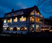
Zum Walde Appartementanlage
Zum Walde
Romantik Parkhotel Am Hammerberg
Zur Abtei
Vichter Landhaus
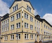
City-Hotel Stolberg
Burghof Hotel-Restaurant
TSH/FSHT Offizierswohnheim / Feldwebelwohnheim
Videos from this area
These are videos related to the place based on their proximity to this place.
Westwall
Zapora przeciwczołgowa na wale zachodnim ciągnąca się kilometrami wzdłuż Linii Zygfryda, zwana przez amerykanów "Smocze Zęby" oraz tama "Dreilägerbachtalsperre", zbudowana w roku ...
K.V. De Vennkatze im Rosenmontagzug 2013 in Stolberg - Breinig
K.V. De Vennkatze aus Stolberg / Venwegen im Rosenmontagzug in Stolberg - Breinig am 11.02.2013.
Bahnübergang Breinig
Manuelle Zugsicherung am Bahnhof Stolberg-Breinig Zur Sekunde 50 wird abgesperrt.
My Raven Rumburak and Ben are the best Friends!
Ben our Dog and Rumburak liked long hiking Trip,and they are the best Friends! Ben unser Hund und Rumburak unser Rabe lieben lange Spaziergänge!
Weiden zwischen Breinig und Vennwegen
Ein Rundblick über die freie Fläche zwischen Vennwegen und Breinig.
Videos provided by Youtube are under the copyright of their owners.
Attractions and noteworthy things
Distances are based on the centre of the city/town and sightseeing location. This list contains brief abstracts about monuments, holiday activities, national parcs, museums, organisations and more from the area as well as interesting facts about the region itself. Where available, you'll find the corresponding homepage. Otherwise the related wikipedia article.
Kornelimünster Abbey
Kornelimünster Abbey is a Benedictine monastery in Kornelimünster, since 1972 a part of Aachen (as Stadtbezirk Kornelimünster/Walheim), in North Rhine-Westphalia in Germany.
Natural Reserve Schlangenberg
The natural reserve Schlangenberg which means snake-mountain is located in the west of Germany close to the Dutch and Belgian border. The reserve is near the village Breinigerberg, 15 kilometres from Aachen or 7 kilometres distant from the city of Stolberg (Rhineland). Schlangenberg itself is a small hill peaking 276 m above sea level. The 108 hectares large area is famous for its calamine flora.
St. Anthony-Chapel
The St. Anthony-Chapel is located in Kornelimünster, a district of the German city of Aachen. The chapel was built in 1718 but destroyed by an earthquake before consecration. Charles Ludwig von Sickingen-Ebernburg, the abbot of the abbey at Kornelimünster later ordered to rebuild the damaged unfinished building. The work was completed in 1781 and the chapel consecrated in the same year to Anthony of Padua by the administrator of the abbey Charles Caspar von der Horst. The St.


