Safety Score: 3,0 of 5.0 based on data from 9 authorites. Meaning we advice caution when travelling to Germany.
Travel warnings are updated daily. Source: Travel Warning Germany. Last Update: 2024-08-13 08:21:03
Delve into Höhenhaus
The district Höhenhaus of Leverkusen in Cologne District (North Rhine-Westphalia) is a subburb in Germany about 292 mi west of Berlin, the country's capital town.
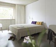
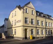
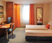
If you need a hotel, we compiled a list of available hotels close to the map centre further down the page.
While being here, you might want to pay a visit to some of the following locations: Odenthal, Bergisch Gladbach, Cologne, Solingen and Kurten. To further explore this place, just scroll down and browse the available info.
Local weather forecast
Todays Local Weather Conditions & Forecast: 9°C / 48 °F
| Morning Temperature | 8°C / 47 °F |
| Evening Temperature | 7°C / 44 °F |
| Night Temperature | 5°C / 41 °F |
| Chance of rainfall | 4% |
| Air Humidity | 75% |
| Air Pressure | 1013 hPa |
| Wind Speed | Moderate breeze with 9 km/h (6 mph) from East |
| Cloud Conditions | Overcast clouds, covering 100% of sky |
| General Conditions | Moderate rain |
Monday, 18th of November 2024
5°C (41 °F)
5°C (42 °F)
Moderate rain, moderate breeze, overcast clouds.
Tuesday, 19th of November 2024
10°C (50 °F)
5°C (41 °F)
Light rain, fresh breeze, overcast clouds.
Wednesday, 20th of November 2024
5°C (41 °F)
2°C (36 °F)
Rain and snow, moderate breeze, overcast clouds.
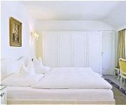
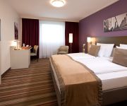
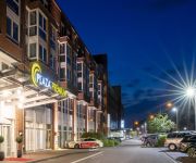
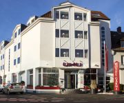
Hotels and Places to Stay
Kaiser
Leonardo
Hotel Park Consul
Uhu Garni
ipartment Concrete
Kasino
PhiLeRo Hotel Köln
Holiday Inn Express COLOGNE - MUELHEIM
UHU Gästehaus
Servatius
Videos from this area
These are videos related to the place based on their proximity to this place.
3. Köln-Dünnwald 2012 -- Der Karnevalszug durch Dünnwald | IG-Hornpott
Unsere Homepage: http://www.ig-hornpott.de Der Hornpott ist eine ca. 150-köpfige Gemeinde im Grenzgebiet zwischen Dünnwald und Lev.-Schlebusch, mit Zugehörigkeit zu Köln-Dünnwald. Wir,...
Stunksitzung 2013 - Ozan Akhan & Köbes Underground - Falsches Deo
Ozan Akhan als transpirierender Tänzer - Ausschnitt aus der WDR-Fernsehaufzeichnung.
Köln - Mülheim Fronleichnam 7.Juni 2012
Köln-Mülheimer Gottestracht 2012 Eine der Höhepunkte im Jahr des Mülheimer Kulturlebens ist zweifellos die Gottestracht, die Fronleichnams-Schiffsprozession auf dem Rhein. Mit der Gottestracht...
Wing Tzun Kampfkunstschule Dellbrück Strassenfest Holweide 2014 Bühne Teil 2/5 Lat Sao Kinder
Wir bedanken uns mit diesem Video bei den Schülern, Angehörigen, Freunden der Kampfkunstschule Dellbrück, Claudia Schirmer ( Fanartikel-Köln ), Thorsten Becker, Axel und allen anderen ...
Video Domino's Neueroeffnung Koeln Holweide
Neueröffnung einer Domino's Pizza-Filiale in Köln-Holweide.
Wing Tzun Kampfkunstschule Dellbrück Straßenfest Holweide 2014 Teil 3/5 Lat Sao
Wir bedanken uns mit diesem Video bei den Schülern, Angehörigen, Freunden der Kampfkunstschule Dellbrück, Claudia Schirmer ( Fanartikel-Köln ), Thorsten Becker, Axel und allen anderen ...
Immobilien Köln - 3 Zimmer Eigentumswohnung mit Garage in Köln-Holweide.
http://www.arch-ing-immobilien.de Immobilien Köln - Sehr schöne gepflegte 3 Zimmerwohnung (Eigentumswohnung) mit Balkon und Garage in Köln-Holweide. +++VERKAUFT+++ Immobilienfilm von ...
Wing Tzun Kampfkunstschule Dellbrück Strassenfest Holweide 2014 Bühne Teil 1/5 Kindertraining
Wir bedanken uns mit diesem Video bei den Schülern, Angehörigen, Freunden der Kampfkunstschule Dellbrück, Claudia Schirmer ( Fanartikel-Köln ), Thorsten Becker, Axel und allen anderen ...
Videos provided by Youtube are under the copyright of their owners.
Attractions and noteworthy things
Distances are based on the centre of the city/town and sightseeing location. This list contains brief abstracts about monuments, holiday activities, national parcs, museums, organisations and more from the area as well as interesting facts about the region itself. Where available, you'll find the corresponding homepage. Otherwise the related wikipedia article.
Bayer Cross Leverkusen
The Bayer Cross in the German city of Leverkusen is the largest illuminated advertisement in the world. The advertisement is for Bayer, the multinational pharmaceutical company based in Leverkusen. The advertisement, installed in 1958, shows the emblem of the company Bayer. It hangs on two 118-metre steel towers and possesses a diameter of 51 metres and a weight of 300 tons. It takes 1,712 40-Watt bulbs to light the display. In 2003, the Bayer cross was overhauled completely.
Mülheim, Cologne
Mülheim is a city district of Cologne in Germany and a formerly independent town (Mülheim am Rhein). Mülheim is located on the right bank of the Rhine opposite the old town of Cologne. The district borders Leverkusen to the north, Bergisch Gladbach to the east, the Cologne districts of Kalk and Innenstadt to the south. The river Rhine lies west of Mülheim, on the other riverbank lies the Cologne borough of Nippes.
Mülheim Bridge, Cologne
The Mülheim Bridge (Mülheimer Brücke) in Cologne is a suspension bridge on the river Rhine in Western Germany. It has a main span of 315 metres. The bridge was originally completed in 1929 and rebuilt between 1949 and 1951, having been destroyed in 1944. It connects the city district Riehl on the west side of the river with Mülheim on the east side, after which the bridge is named.
Zollkriminalamt
The German Customs Investigation Bureau in Cologne (Zollkriminalamt, ZKA) and its investigation offices are federal agencies that fall under the German Finance Ministry. The ZKA coordinates customs investigations nationwide in particular monitoring foreign trade, uncovering violations of EU market regulations, illegal technology exports, subsidy fraud in the agricultural sector, drug trafficking and money laundering.
Köln-Stammheim station
Köln-Stammheim is a railway station situated at Stammheim, Cologne in western Germany. It is served by the S6 line of the Rhine-Ruhr S-Bahn.
Köln-Holweide station
Köln-Holweide is a passenger railway station situated between the Holweide and Höhenhaus boroughs of Cologne, Germany. It is situated on the line from Köln-Mülheim to Bergisch Gladbach and served by the S11 line of the Rhine-Ruhr S-Bahn.
Köln-Mülheim station
Köln-Mülheim is a railway station situated at Mülheim, Cologne in western Germany. It is served by several regional trains, the S6 and S11 lines of the Rhine-Ruhr S-Bahn and the 13 and 18 lines of Cologne Stadtbahn.
Köln-Buchforst station
Köln-Buchforst is a railway station situated at Buchforst, Cologne in western Germany. It is served by the S6 and S11 lines of the Rhine-Ruhr S-Bahn.
Köln-Dellbrück station
Köln-Dellbrück is a railway station on the line from Köln-Mülheim to Bergisch Gladbach situated at Dellbrück, Cologne in western Germany. It is served by the S11 line of the Rhine-Ruhr S-Bahn.
Stammheim, Cologne
Stammheim is a municipal part of Cologne, Germany and part of the district of Mülheim. Stammheim lies on the right bank of the river Rhine, between Mülheim (proper) and Flittard. The city part has 7.473 inhabitants (as of 31 December 2008) and covers an area of 3,75 km².
Morsbroich Museum
The Morsbroich Museum (German: Museum Morsbroich or Morsbroich Castle Municipal Museum, is a German museum of modern art situated in Leverkusen, 20 km north of Cologne. Formerly a Baroque castle, it is now a municipal museum for the exhibition of current art. It also provides the setting for theatrical productions and other cultural events under the title "Morsbroich Summer". In 1948 the castle was leased to the city of Leverkusen. Since 1951 it is used as an exhibition space.
Thielenbruch (KVB)
Thielenbruch station is a terminal and former depot of Cologne Stadtbahn located in the quarter of Dellbrück in Cologne. It is the northern terminus of Stadtbahn lines 3 and 18.
Bayerwerk station
Bayerwerk is a railway station on the Cologne–Duisburg railway, situated in Leverkusen in western Germany. It is served by the S6 line of the Cologne S-Bahn. It is named after the nearby Bayer chemical production plants.
Zentrale Unterstützungsgruppe Zoll
Zuz redirects here, Zuz could also refer to Zuz Hebrew coin. Zentrale Unterstützungsgruppe Zoll 170px Active 1997 – Present Country 22x20px Germany Branch German Customs Service Type Special response unit Role Law Enforcement Size 36 officers Garrison/HQ Cologne, Germany The Zentrale Unterstützungsgruppe Zoll (Central Customs Support Group, ZUZ) is the SWAT unit of the German Customs Service (Bundeszollverwaltung) and subordinate to the German Customs Investigation Bureau.
Slabystraße (KVB)
Slabystraße is an interchange station on the Cologne Stadtbahn lines 13 and 18, located in the Cologne district of Nippes. The station lies within the western feeder to the Cologne Mülheim Bridge. The station was opened in 1974 and consists of four side platforms with four rail tracks.
Wiener Platz (KVB)
Wiener Platz is an interchange station and hub on the Cologne Stadtbahn lines 4, 13 and 18 in the Cologne district of Mülheim. The station is located at Wiener Platz, the center of Mülheim. The station consists of an at-grade station for line 4 and an underground station for line 13 and 18. The underground station was opened in 1997.
Cologne Mülheim Protestant Cemetery
The Protestant cemetery (German: Evangelischer Friedhof Köln-Mülheim) Bergisch Gladbach road (Highway 506) in Mülheim district of Cologne existed since the beginning of the 17th century and is one of the oldest preserved cemeteries in Cologne, Germany. The cemetery is still in operation and used for burials.
Leverkusen-Schlebusch station
Leverkusen-Schlebusch station is a through station in the district of Schlebusch of the city of Leverkusen in the German state of North Rhine-Westphalia. It was opened on 25 August 1867 on the Gruiten–Köln-Deutz railway, which was completed between the former Bergisch-Märkische Railway Company (BME) station in Mülheim and Opladen by the BME on 1 May 1868. It has three platform tracks and it is classified by Deutsche Bahn as a category 5 station.
2004 Cologne bombing
On 9 June 2004, a pipe bomb detonated in Cologne, Germany, in a business area popular with immigrants from Turkey. 22 people were wounded, four sustained serious injuries. A barber's shop was completely destroyed, many shops and numerous parked cars were seriously damaged by the explosion and the nails added to the bomb for extra damage.
RTHC Bayer Leverkusen
Ruder Tennis Hockey Club Bayer Leverkusen (RTHC Bayer Leverkusen e.V. ) is a German rowing, field hockey and tennis club, one of the projects supported by Bayer 04 Leverkusen and Bayer AG and with 2500 members is one of the largest sports clubs in Leverkusen. To take care of the number of athletes are 18 full-time employees and 20 coaches and trainers. The sports facilities of RTHC Bayer Leverkusen are at three locations.
Jüdischer Friedhof Köln-Mülheim
Jüdischer Friedhof Köln-Mülheim is a Jewish cemetery in the former city of Mülheim am Rhein, which since 1914 has been incorporated into the district of Cologne, Germany. The cemetery was built in 1774.
Kalker Friedhof
Kalker Friedhof is a cemetery in Cologne, Germany. The cemetery was established in 1904.
Katholischer Friedhof Köln-Mülheim
Katholischer Friedhof Köln-Mülheim is a cemetery in Cologne, Germany. The oldest gravestone dates to 1841.
Mülheimer Friedhof
Mülheimer Friedhof is a cemetery in Cologne, Germany. It was established on 30 September 1904.
Ostfriedhof (Cologne)
Ostfriedhof is a cemetery in Cologne, Germany. It was established in 1946.


