Safety Score: 3,0 of 5.0 based on data from 9 authorites. Meaning we advice caution when travelling to Germany.
Travel warnings are updated daily. Source: Travel Warning Germany. Last Update: 2024-08-13 08:21:03
Explore Fühlingen
The district Fühlingen of Leverkusen in Cologne District (North Rhine-Westphalia) is located in Germany about 296 mi west of Berlin, the country's capital.
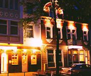
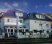
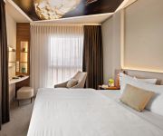
If you need a place to sleep, we compiled a list of available hotels close to the map centre further down the page.
Depending on your travel schedule, you might want to pay a visit to some of the following locations: Cologne, Odenthal, Rommerskirchen, Duesseldorf and Mettmann. To further explore this place, just scroll down and browse the available info.
Local weather forecast
Todays Local Weather Conditions & Forecast: 9°C / 49 °F
| Morning Temperature | 8°C / 46 °F |
| Evening Temperature | 7°C / 44 °F |
| Night Temperature | 5°C / 41 °F |
| Chance of rainfall | 3% |
| Air Humidity | 70% |
| Air Pressure | 1013 hPa |
| Wind Speed | Moderate breeze with 10 km/h (6 mph) from East |
| Cloud Conditions | Overcast clouds, covering 90% of sky |
| General Conditions | Light rain |
Monday, 18th of November 2024
6°C (42 °F)
5°C (41 °F)
Moderate rain, moderate breeze, overcast clouds.
Tuesday, 19th of November 2024
11°C (52 °F)
3°C (38 °F)
Moderate rain, fresh breeze, overcast clouds.
Wednesday, 20th of November 2024
3°C (38 °F)
2°C (35 °F)
Rain and snow, moderate breeze, overcast clouds.
Hotels and Places to Stay
Hotel Capima
B&B am See Privatzimmer
Kristal
Merkenich Garni
Arkade
Hotel 1000
Comfort Hotel Monheim
Zum Vater Rhein Hotel & Restaurant
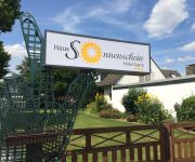
Sonnenschein Haus Garni
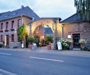
Pohlhof Landhaus
Videos from this area
These are videos related to the place based on their proximity to this place.
Köln Chorweiler, Tinplate Eisenbahn USA, Lionel, Märklin
Auch in diesem Jahr gab es im Bürgerzentrum Chorweiler vom Tinplatefreundeskreis Niederrhein eine Ausstellung von Blecheisenbahnen in Spur 0 und Spur 1, und ich muss sagen, die Aussteller...
Der Rhein bei Dormagen/Leverkusen
Der Rhein zwischen Dormagen und Leverkusen mit DJI Phantom Vision 2 plus.
FPV-Raptor Erstflug
Bin den Raptor so mit Orginal-Bestückung geflogen. Der Regler und der Motor sehen recht einfach aus. Aber das Teil hat genug Kraft um den Segler in der Luft ...
Alweg Test Track (1952)
The original Alweg Monorail test track in Fuhlingen, Germany, as reported by the Dutch press. The first version of Alweg was designed to be a intercity high speed rail system. The sub-scale...
The kajak class day 1
Vic in the kajak class In preparation for my next big trip I had to first complete this kajak class. Put your swimming gear on we will be in the water the whole day :)
R&S Mobile GmbH & Co. KG - Filiale Köln
Dies ist die Geschichte eines Autohauses, das 1982 direkt neben den Kölner Ford Werken ins Rampenlicht trat. Der erfolgreiche Durchbruch kam schon bald nach dem Debüt. R&S wurde zum größten.
Mittelalterlich Phantasie Spectaculum Köln - faun
Sören und René waren in Köln beim Konzert von Faun.
Chorweiler 1975 - Bauphase um die Osloer Str. (Restaurant El Toro)
Original Super 8 Aufnahme ohne Ton (digitalisiert und mit Musik hinterlegt)
Mittelalterlich Phantasie Spectaculum Köln - Im Lager
Sören und René konnten es sich nicht nehmen lassen am 3. August 2008 auf dem Mittelalterlich Phantasie Spectaculum zu Strich zu sein.
Videos provided by Youtube are under the copyright of their owners.
Attractions and noteworthy things
Distances are based on the centre of the city/town and sightseeing location. This list contains brief abstracts about monuments, holiday activities, national parcs, museums, organisations and more from the area as well as interesting facts about the region itself. Where available, you'll find the corresponding homepage. Otherwise the related wikipedia article.
Battle of Worringen
The Battle of Worringen was fought on June 5, 1288, near the town of Worringen (also spelled Woeringen), which is now the northernmost borough of Cologne. The battle was fought for the possession of the Duchy of Limburg, and was one of the largest battles in Europe in the Middle Ages.
Federal Office for the Protection of the Constitution
The Federal Office for the Protection of the Constitution – German: Bundesamt für Verfassungsschutz (BfV) – is the Federal Republic of Germany's domestic intelligence agency.
Wupper
The Wupper is a right tributary of the River Rhine in the state of North Rhine-Westphalia, Germany. Rising near Marienheide in western Sauerland it runs through the mountainous region of the Bergisches Land in Berg County and enters the Rhine at Leverkusen, south of Düsseldorf. Its upper course is called the Wipper. On its course of about 113 km, the Wupper passes through the city of Wuppertal where the suspension railway runs for 10 kilometres above the river.
RAF Butzweilerhof
The former Royal Air Force Station Butzweilerhof, commonly known as RAF Butzweilerhof was a Royal Air Force station/airfield airbase in Germany situated in the northern suburbs of Cologne. The station’s motto was Per Vires Pax, and the station crest depicts the Cologne cathedral rising above the waters.
Summerjam
For the annual American hip hop concert, see Summer Jam. Summerjam FestivalLocation(s) Fühlingen, Cologne, GermanyYears active 1985 - presentDate(s) 3 days (first weekend in July)Genre Reggae, dancehallWebsite www. summerjam. de The Summerjam is Europe's biggest reggae festival. It takes places annually in July at the Fühlinger See, a lake in Cologne, Germany. It is visited by 25.000 to 30.000 people. Two stages and two tents are located on an island, the camping area surrounds the lake.
Dreikönigsgymnasium
The Dreikönigsgymnasium ("Tricoronatum")(meaning "Three Kings School") is a regular public Gymnasium located in Cologne, Germany. Founded in 1450 it is the oldest school in Cologne and one of the oldest in Germany.
Worringer Bruch
The Worringer Bruch is a section of 164 hectares swampy lowlands in the far north of Cologne, Germany. It is approximately 8,000 years old, and is now almost a completely dried up meander part of the Rhine. It was named after an adjacent district of Cologne, Worringen, which once was an independent city, which has a thousand years of history (first mentioned in 922).
Chorweiler
Chorweiler is the Sixth city district of Cologne, Germany. Large portion of the district of Chorweiler were incorporated into the city of Cologne in 1922, the quarter of Chorweiler was created in the 1970s. The district has the lowest population density in Cologne and many areas are very rural. The District of Chorweiler borders with the Cologne boroughs of Nippes and Ehrenfeld to the South, Rhein-Erft-Kreis to the West, Rhein-Kreis Neuss to the North, and the Rhine to the East.
Cologne-Weidenpesch Racecourse
The Cologne-Weidenpesch Racecourse (Galopprennbahn Köln-Weidenpesch) is a horse racing track at Weidenpescher Park in Nippes, Cologne. As the only race course in Germany, hosting more than one European pattern Group 1 race, Weidenpesch is one of the most prominent tracks in the country. Cologne-Weidenpesch is also one of Germany's oldest horse-racing tracks, having been established as a race course in 1897.
Köln-Longerich station
Köln-Longerich is a railway station situated at Longerich, Cologne in western Germany. It is served by the S11 line of the Rhine-Ruhr S-Bahn.
Köln-Volkhovener Weg station
Köln-Volkhovener Weg is a railway station situated at Chorweiler, Cologne in western Germany. It is served by the S11 line of the Rhine-Ruhr S-Bahn.
Köln-Chorweiler station
Köln-Chorweiler is a combined subway and railway station situated at Chorweiler, Cologne in western Germany. It is served by the S11 line of the Rhine-Ruhr S-Bahn and line 15 of Cologne Stadtbahn.
Köln-Chorweiler Nord station
Köln-Chorweiler Nord is a railway station situated at Chorweiler, Cologne in western Germany. It is served by the S11 line of the Rhine-Ruhr S-Bahn.
Akazienweg (KVB)
Akazienweg is an underground station on the Cologne Stadtbahn lines 3 and 4 in Cologne. The station lies on the intersection of Venloer Straße and Akazienweg streets in the district of Ehrenfeld. The station was opened in 1992 and consists of a mezzanine and one island platform with two rail tracks.
Köln-Worringen station
Köln-Worringen is a railway station on the Lower Left Rhine Railway, situated in Cologne in western Germany. It is served by the S11 line of the Cologne S-Bahn.
Köln-Blumenberg station
Köln-Blumenberg is a railway station on the Lower Left Rhine Railway, situated in Cologne in western Germany. It is served by the S11 line of the Cologne S-Bahn.
Cologne Butzweilerhof Airport
The Butzweilerhof is the former civil airport of Cologne. It was established as a training airfield in 1912 and saw airline service from 1922 until the 1950s. It was replaced by the Cologne Bonn Airport. The airport buildings from 1935-36 are listed monuments and a rare example of airport architecture from the Interwar Period.
Am Butzweilerhof (KVB)
Am Butzweilerhof is a terminus station on the Cologne Stadtbahn line 5, located in the Cologne district of Ossendorf. The station lies on Von-Hünefeld-Straße, the center of a large media and business park of Coloneum, RTL Television and NetCologne. Station and the entire neighborhood is named after the former Cologne Butzweilerhof Airport. It was opened on 12. December 2010 and consists of one island platform with two rail tracks.
Langenfeld (Rheinland) station
Langenfeld (Rheinland) station is located in the city of Langenfeld in the German state of North Rhine-Westphalia. It is on the Cologne–Duisburg line and is classified by Deutsche Bahn as a category 5 station. It is served by Rhine-Ruhr S-Bahn lines S 6 every 20 minutes and by a few services of S 68 (which start or finish in Langenfeld) in the peak hour.
Leverkusen-Rheindorf station
Leverkusen-Rheindorf station is located in the district of Rheindorf in the city of Leverkusen in the German state of North Rhine-Westphalia. It is on the Cologne–Duisburg line and is classified by Deutsche Bahn as a category 5 station. It is served by Rhine-Ruhr S-Bahn line S 6 every 20 minutes.
Dormagen Bayerwerk station
Dormagen Bayerwerk station is a station in the Bayer works in the town of Dormagen in the German state of North Rhine-Westphalia. It is on the Lower Left Rhine Railway and it is classified by Deutsche Bahn as a category 6 station. The station was opened briefly during World War I as Hackenbroich. It was reopened in 1948 and was renamed Dormagen Bayerwerk between 1954 and 1957.
Dhünn (Wupper)
Dhünn (Wupper) is a river of North Rhine-Westphalia, Germany.
Jüdischer Friedhof Köln-Bocklemünd
Jüdischer Friedhof Köln-Bocklemünd is a cemetery in Cologne, Germany. A Jewish burial site since 1918, many of its tombstones are noted for their extravagant artistic designs.
Nordfriedhof (Cologne)
Nordfriedhof is a cemetery in Cologne, Germany. Opened on 18 May 1896, after the Second World War the cemetery was significantly expanded.
Westfriedhof (Cologne)
Westfriedhof is a cemetery in Cologne, Germany. WIth an area of 52 hectares, it is amongst the largest of the cemeteries in the city.


