Safety Score: 3,0 of 5.0 based on data from 9 authorites. Meaning we advice caution when travelling to Germany.
Travel warnings are updated daily. Source: Travel Warning Germany. Last Update: 2024-08-13 08:21:03
Delve into Kronenburg
Kronenburg in Cologne District (North Rhine-Westphalia) is located in Germany about 334 mi (or 537 km) south-west of Berlin, the country's capital town.
Current time in Kronenburg is now 09:48 PM (Thursday). The local timezone is named Europe / Berlin with an UTC offset of one hour. We know of 11 airports close to Kronenburg, of which 5 are larger airports. The closest airport in Germany is Bitburg Airport in a distance of 29 mi (or 47 km), South. Besides the airports, there are other travel options available (check left side).
There are several Unesco world heritage sites nearby. The closest heritage site in Germany is Aachen Cathedral in a distance of 33 mi (or 53 km), North-West. Also, if you like playing golf, there is an option about 16 mi (or 26 km). away. If you need a hotel, we compiled a list of available hotels close to the map centre further down the page.
While being here, you might want to pay a visit to some of the following locations: Kerschenbach, Hallschlag, Ormont, Scheid and Stadtkyll. To further explore this place, just scroll down and browse the available info.
Local weather forecast
Todays Local Weather Conditions & Forecast: -1°C / 30 °F
| Morning Temperature | -2°C / 29 °F |
| Evening Temperature | -2°C / 28 °F |
| Night Temperature | -3°C / 27 °F |
| Chance of rainfall | 0% |
| Air Humidity | 66% |
| Air Pressure | 999 hPa |
| Wind Speed | Moderate breeze with 11 km/h (7 mph) from South-East |
| Cloud Conditions | Overcast clouds, covering 100% of sky |
| General Conditions | Light snow |
Friday, 22nd of November 2024
0°C (32 °F)
-1°C (30 °F)
Snow, fresh breeze, overcast clouds.
Saturday, 23rd of November 2024
0°C (32 °F)
2°C (35 °F)
Light snow, fresh breeze, overcast clouds.
Sunday, 24th of November 2024
7°C (45 °F)
7°C (45 °F)
Overcast clouds, fresh breeze.
Hotels and Places to Stay
Villa Kronenburg
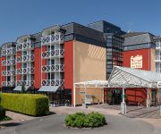
Hotel am Park
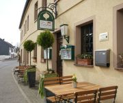
Em Lade Landgasthof
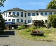
Erlebnishotel Ponyhof
Videos from this area
These are videos related to the place based on their proximity to this place.
B51: AS Prüm - Stadtkyll-Süd (2.5x)
Droga Krajowa B51: Prüm - Stadtkyll-Süd. Kierunek Blankenheim. Bundesstrasse B51: Prüm - Stadtkyll-Süd towards Blankenheim.
Radian Pro Hangflug in der Eifel
Ein Hangflug mit ein paar Freunden in der Eifel ,nähe Stadtkyll....Die Windgeschwindigkeit betrug ungefähr 14-20 km/h und es war eines meiner ersten Hangflüge überhaupt. Der Hang an sich...
Vakantie in de Eifel
februari 2013 vakantie in Landal Wirfttal in Stadtkyll, Duitsland. Toch nog kunnen skiën. Video is mainly shot with the Lumix LX7 and the last a few last scenes with a Kodak Playsport.
CarCam: Fahren in Rheinland-Pfalz
Ein fahrt durch Hillesheim, Birgel, Jünkarath, Schüller richtung Stadtkyll 10:56.
Mein Jakobsweg - 2.2 - Von Blankenheim nach Kronenburg
Auf den Spuren der Jakobspilger von Köln aus durch die Eifel und durch Frankreich - eine animierte Bilderfolge - siehe auch http://meinjakobsweg-info.de Wegstrecke in Google Maps: http://maps.g...
Kronenburger See | Kronenburg | Badesee | Rhein-Eifel.TV
http://www.rhein-eifel.tv/badeseen/kronenburger-see.htm - Freizeitzentrum am Kronenburger See – Kostenloses Baden, Rutschen, Kletterseilgarten, Segeln, Angeln, Ferienpark, Camping, ...
Flugplatz Dahlemer Binz
Dahlemer Binz - Porträt des Flugplatzes Dahlemer Binz in der Gemeinde Dahlem in der Eifel. Die Dahlemer Binz bietet eien 1000 Meter langen Landebahn den Service einer Bahnrandbefeuerung und.
Videos provided by Youtube are under the copyright of their owners.


