Safety Score: 3,0 of 5.0 based on data from 9 authorites. Meaning we advice caution when travelling to Germany.
Travel warnings are updated daily. Source: Travel Warning Germany. Last Update: 2024-08-13 08:21:03
Discover Eggersheim
Eggersheim in Cologne District (North Rhine-Westphalia) is a place in Germany about 314 mi (or 505 km) south-west of Berlin, the country's capital city.
Current time in Eggersheim is now 12:20 PM (Sunday). The local timezone is named Europe / Berlin with an UTC offset of one hour. We know of 11 airports near Eggersheim, of which 5 are larger airports. The closest airport in Germany is Norvenich Airport in a distance of 3 mi (or 5 km), North. Besides the airports, there are other travel options available (check left side).
There are several Unesco world heritage sites nearby. The closest heritage site in Germany is Castles of Augustusburg and Falkenlust at Brühl in a distance of 12 mi (or 20 km), East. We encountered 2 points of interest in the vicinity of this place. If you need a hotel, we compiled a list of available hotels close to the map centre further down the page.
While being here, you might want to pay a visit to some of the following locations: Norvenich, Vettweiss, Merzenich, Dueren and Kreuzau. To further explore this place, just scroll down and browse the available info.
Local weather forecast
Todays Local Weather Conditions & Forecast: 9°C / 48 °F
| Morning Temperature | 8°C / 46 °F |
| Evening Temperature | 5°C / 41 °F |
| Night Temperature | 5°C / 40 °F |
| Chance of rainfall | 1% |
| Air Humidity | 75% |
| Air Pressure | 1014 hPa |
| Wind Speed | Moderate breeze with 12 km/h (7 mph) from North-East |
| Cloud Conditions | Overcast clouds, covering 99% of sky |
| General Conditions | Light rain |
Monday, 18th of November 2024
5°C (40 °F)
4°C (40 °F)
Moderate rain, fresh breeze, overcast clouds.
Tuesday, 19th of November 2024
11°C (51 °F)
2°C (36 °F)
Moderate rain, strong breeze, overcast clouds.
Wednesday, 20th of November 2024
4°C (38 °F)
1°C (33 °F)
Rain and snow, fresh breeze, overcast clouds.
Hotels and Places to Stay
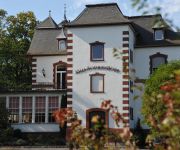
Villa Sophienhöhe
Zur Löv Gaststätte-hotel
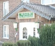
Zur Wasserburg
Landhotel Floris Nichtraucherhotel
Schmidt
Videos from this area
These are videos related to the place based on their proximity to this place.
Mein Camaro bei BBK-Exhaust Zülpich.mov
Individueller handgefertigter Edelstahlauspuff. Die Montage an meinem Camaro SS Automatik. Am Ende gibt es ein Soundfile.
Bachstraße Kerpen und Kerpen Langenich
Durch die Bachstraße ging es dann weiter nach Westen. Parallel zur Stiftsstraße. Wenig Verkehr, aber einige Radfahrer und Fußgänger. Weiter nach Langenich, das doch noch ein Stück von...
Stadtlauf Kerpen 2014 Start 5km
Start des 5km Lauf in der Innenstadt in Kerpen am 2014-04-21 http://www.stadtlauf-kerpen.de/
PCC Plessa in Nörvenich - Prunksitzung 14.01.1995
PCC Plessa in Nörvenich - Prunksitzung 14.01.1995.
Nörvenich - Tornado Fly Out JBG31
Nörvenich - Tornado Fly Out beim JBG31"B" Am 18.6.2010 wurde im Rahmen eines Fototages die sonderlackierte Maschine des JBG 31 „B" zum Fly Out vorgestellt. Der Tornado 45+46 trug die Daten...
Videos provided by Youtube are under the copyright of their owners.
Attractions and noteworthy things
Distances are based on the centre of the city/town and sightseeing location. This list contains brief abstracts about monuments, holiday activities, national parcs, museums, organisations and more from the area as well as interesting facts about the region itself. Where available, you'll find the corresponding homepage. Otherwise the related wikipedia article.
Kelz Airfield
Kelz Airfield is a former World War II military airfield in Germany. It was located about 2 miles north of Vettweiß (Nordrhein-Westfalen); approximately 315 miles southwest of Berlin. The airfield was built by the United States Army Air Forces during March 1945 as a temporary Advanced Landing Ground as part of the Western Allied invasion of Germany. It was closed in July 1945 and dismantled.


