Safety Score: 3,0 of 5.0 based on data from 9 authorites. Meaning we advice caution when travelling to Germany.
Travel warnings are updated daily. Source: Travel Warning Germany. Last Update: 2024-08-13 08:21:03
Delve into Rheindorf
The district Rheindorf of Butterheide in Cologne District (North Rhine-Westphalia) is a district located in Germany about 294 mi west of Berlin, the country's capital town.
In need of a room? We compiled a list of available hotels close to the map centre further down the page.
Since you are here already, you might want to pay a visit to some of the following locations: Leverkusen, Cologne, Odenthal, Solingen and Bergisch Gladbach. To further explore this place, just scroll down and browse the available info.
Local weather forecast
Todays Local Weather Conditions & Forecast: 9°C / 48 °F
| Morning Temperature | 8°C / 46 °F |
| Evening Temperature | 7°C / 44 °F |
| Night Temperature | 5°C / 41 °F |
| Chance of rainfall | 3% |
| Air Humidity | 71% |
| Air Pressure | 1013 hPa |
| Wind Speed | Moderate breeze with 9 km/h (6 mph) from East |
| Cloud Conditions | Overcast clouds, covering 92% of sky |
| General Conditions | Light rain |
Monday, 18th of November 2024
5°C (42 °F)
5°C (40 °F)
Moderate rain, moderate breeze, overcast clouds.
Tuesday, 19th of November 2024
11°C (51 °F)
3°C (37 °F)
Moderate rain, fresh breeze, overcast clouds.
Wednesday, 20th of November 2024
3°C (38 °F)
2°C (35 °F)
Rain and snow, moderate breeze, overcast clouds.
Hotels and Places to Stay
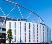
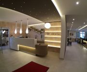
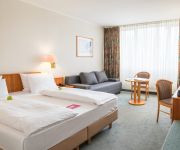
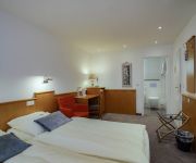
Lindner Hotel Bay Arena
Kristal
Best Western Leoso Leverkusen
Kasino
MAXIM
Manforter Hof
Fortune
Villa Fürstenberg
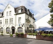
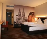
Sechzehn
Stadthotel
Videos from this area
These are videos related to the place based on their proximity to this place.
Schützenfest Rheinkassel Langel 2013
Zum 545. Schützenfest der St. Hubertus Schützenbruderschaft Rheinkassel Langel Kasselberg von 1468 e. V. Feierten mit ihrem Festzug den Höhepunkt ihr Schützenfest. mit ca. 50 Aktive Schützen...
Schützenfest Rheinkassel Langel Kasselberg 2013
Zum 545 Schützenfest der St. Hubertus Rheinkassel Langel Kasselberg Einzug in Festzelt am Kuhlenweg die Festgesellschaft mit allen Zugteilnehmer der Festzug bei warmen Wetter.
WGL, Leverkusen-Rheindorf, Warthestraße
Leverkusen-Rheindorf, Warthestraße Neubau WGL Wohnungsgesellschaft Leverkusen GmbH.
Rheindorf braucht den Schallschutz (10.06.2012)
Rheindorf braucht den Schallschutz (10.06.2012) Rüdiger Scholz zum erfordlichen Schallschutz nach Bau des RRX http://www.schallschutz-rheindorf.de http://www.leverkusen.com/schallschutz.
Hausabriß in Rheindorf (09.01.2014)
Aufgenommen an der Wupperstraße http://www.leverkusen.com/presse/db/presse.php?view=00027218.
Lostrommel der Germania Rheindorf (11.08.2014)
http://www.leverkusen.com/presse/db/presse.php?view=00030038.
Neubau Jugendhaus Leverkusen-Rheindorf (Teil 1)
Neubau Jugendhaus Leverkusen-Rheindorf, CDU-Vorstellungen (Teil 1) Reden Andreas Eckloff, Irmgard Goldmann, Reinhard Buchhorn.
Videos provided by Youtube are under the copyright of their owners.
Attractions and noteworthy things
Distances are based on the centre of the city/town and sightseeing location. This list contains brief abstracts about monuments, holiday activities, national parcs, museums, organisations and more from the area as well as interesting facts about the region itself. Where available, you'll find the corresponding homepage. Otherwise the related wikipedia article.
Battle of Worringen
The Battle of Worringen was fought on June 5, 1288, near the town of Worringen (also spelled Woeringen), which is now the northernmost borough of Cologne. The battle was fought for the possession of the Duchy of Limburg, and was one of the largest battles in Europe in the Middle Ages.
Federal Office for the Protection of the Constitution
The Federal Office for the Protection of the Constitution – German: Bundesamt für Verfassungsschutz (BfV) – is the Federal Republic of Germany's domestic intelligence agency.
BayArena
The BayArena is a football stadium in Leverkusen, North Rhine-Westphalia, Germany, which has been the home ground of Bundesliga club Bayer Leverkusen since 1958. It is not a UEFA 5-star stadium, however is in the process of being one. It is iconic due to a few reasons (listed below).
Wupper
The Wupper is a right tributary of the River Rhine in the state of North Rhine-Westphalia, Germany. Rising near Marienheide in western Sauerland it runs through the mountainous region of the Bergisches Land in Berg County and enters the Rhine at Leverkusen, south of Düsseldorf. Its upper course is called the Wipper. On its course of about 113 km, the Wupper passes through the city of Wuppertal where the suspension railway runs for 10 kilometres above the river.
Bayer Cross Leverkusen
The Bayer Cross in the German city of Leverkusen is the largest illuminated advertisement in the world. The advertisement is for Bayer, the multinational pharmaceutical company based in Leverkusen. The advertisement, installed in 1958, shows the emblem of the company Bayer. It hangs on two 118-metre steel towers and possesses a diameter of 51 metres and a weight of 300 tons. It takes 1,712 40-Watt bulbs to light the display. In 2003, the Bayer cross was overhauled completely.
Leverkusen-Bürrig water tower
Water Tower Leverkusen-Bürrig is a 72.45 metre high water tower built in 1978 in Leverkusen-Bürrig. It has a water reservoir for 4000 cubic metres with a diameter of 42 metres. The Water Tower Leverkusen-Bürrig should be transformed by special markings in world's largest compass. It has also an observation deck for visitors.
Opladen
Opladen, now a district of Leverkusen, used to be the capital of the Rhein-Wupper-Kreis (Rhine-Wupper-District) up to 1975. Opladen station is located 10 m. N.E. from Cologne on the railway to Wuppertal. It's is also on the Autobahn A3. Pop. (1905) 6338, (1975) 42,000. It has an Evangelical and several Roman Catholic churches. It used to have dyeing works, manufactures of dynamite, indigo products, publishing companies and a railway plant.
Smidt-Arena
Smidt-Arena (formerly Wilhelm Dopatka Halle) is an indoor sporting arena located in Leverkusen, Germany. The capacity of the arena is 3,500 people. It was home to the Bayer Giants Leverkusen basketball team.
Summerjam
For the annual American hip hop concert, see Summer Jam. Summerjam FestivalLocation(s) Fühlingen, Cologne, GermanyYears active 1985 - presentDate(s) 3 days (first weekend in July)Genre Reggae, dancehallWebsite www. summerjam. de The Summerjam is Europe's biggest reggae festival. It takes places annually in July at the Fühlinger See, a lake in Cologne, Germany. It is visited by 25.000 to 30.000 people. Two stages and two tents are located on an island, the camping area surrounds the lake.
Chorweiler
Chorweiler is the Sixth city district of Cologne, Germany. Large portion of the district of Chorweiler were incorporated into the city of Cologne in 1922, the quarter of Chorweiler was created in the 1970s. The district has the lowest population density in Cologne and many areas are very rural. The District of Chorweiler borders with the Cologne boroughs of Nippes and Ehrenfeld to the South, Rhein-Erft-Kreis to the West, Rhein-Kreis Neuss to the North, and the Rhine to the East.
Köln-Volkhovener Weg station
Köln-Volkhovener Weg is a railway station situated at Chorweiler, Cologne in western Germany. It is served by the S11 line of the Rhine-Ruhr S-Bahn.
Köln-Chorweiler station
Köln-Chorweiler is a combined subway and railway station situated at Chorweiler, Cologne in western Germany. It is served by the S11 line of the Rhine-Ruhr S-Bahn and line 15 of Cologne Stadtbahn.
Köln-Chorweiler Nord station
Köln-Chorweiler Nord is a railway station situated at Chorweiler, Cologne in western Germany. It is served by the S11 line of the Rhine-Ruhr S-Bahn.
Leverkusen Mitte station
Leverkusen Mitte (Bahnhof Leverkusen Mitte) is a railway station on the Cologne–Duisburg railway, located in Leverkusen, Germany. It is served by regional trains of Deutsche Bahn and the S6 line of the Rhine-Ruhr S-Bahn.
Bayerwerk station
Bayerwerk is a railway station on the Cologne–Duisburg railway, situated in Leverkusen in western Germany. It is served by the S6 line of the Cologne S-Bahn. It is named after the nearby Bayer chemical production plants.
Leverkusen-Küppersteg station
Leverkusen-Küppersteg is a railway station on the Cologne–Duisburg railway, situated in Leverkusen in western Germany. It is served by the S6 line of the Cologne S-Bahn.
Köln-Blumenberg station
Köln-Blumenberg is a railway station on the Lower Left Rhine Railway, situated in Cologne in western Germany. It is served by the S11 line of the Cologne S-Bahn.
Langenfeld (Rheinland) station
Langenfeld (Rheinland) station is located in the city of Langenfeld in the German state of North Rhine-Westphalia. It is on the Cologne–Duisburg line and is classified by Deutsche Bahn as a category 5 station. It is served by Rhine-Ruhr S-Bahn lines S 6 every 20 minutes and by a few services of S 68 (which start or finish in Langenfeld) in the peak hour.
Langenfeld-Berghausen station
Langenfeld-Berghausen station is located in the city of Langenfeld in the German state of North Rhine-Westphalia. It is on the Cologne–Duisburg line and is classified by Deutsche Bahn as a category 5 station. It is served by Rhine-Ruhr S-Bahn lines S 6 every 20 minutes and by a few services of S 68 in the peak hour.
Leverkusen-Rheindorf station
Leverkusen-Rheindorf station is located in the district of Rheindorf in the city of Leverkusen in the German state of North Rhine-Westphalia. It is on the Cologne–Duisburg line and is classified by Deutsche Bahn as a category 5 station. It is served by Rhine-Ruhr S-Bahn line S 6 every 20 minutes.
Opladen station
Opladen station is in the suburb of Opladen of the city of Leverkusen in the German state of North Rhine-Westphalia. It is on the Gruiten–Köln-Deutz railway, which was opened on 25 September 1867 from Ohligs by the Bergisch-Märkische Railway Company (BME). It was extended to Mülheim BME station on 8 April 1868. The station was also opened on 25 August 1867. The original station building was demolished in 1965 and replaced by the current building built in 1968.
Dhünn (Wupper)
Dhünn (Wupper) is a river of North Rhine-Westphalia, Germany.
Leverkusen-Schlebusch station
Leverkusen-Schlebusch station is a through station in the district of Schlebusch of the city of Leverkusen in the German state of North Rhine-Westphalia. It was opened on 25 August 1867 on the Gruiten–Köln-Deutz railway, which was completed between the former Bergisch-Märkische Railway Company (BME) station in Mülheim and Opladen by the BME on 1 May 1868. It has three platform tracks and it is classified by Deutsche Bahn as a category 5 station.
RTHC Bayer Leverkusen
Ruder Tennis Hockey Club Bayer Leverkusen (RTHC Bayer Leverkusen e.V. ) is a German rowing, field hockey and tennis club, one of the projects supported by Bayer 04 Leverkusen and Bayer AG and with 2500 members is one of the largest sports clubs in Leverkusen. To take care of the number of athletes are 18 full-time employees and 20 coaches and trainers. The sports facilities of RTHC Bayer Leverkusen are at three locations.
Bayer-Hochhaus
Bayer-Hochhaus is a 32-storey, 122 m, skyscraper in Leverkusen, Germany. When completed in 1963, it was the tallest building in Germany for nine years until 1972 when City-Hochhaus Leipzig was built. {{#invoke: Gallery | gallery}}


