Safety Score: 3,0 of 5.0 based on data from 9 authorites. Meaning we advice caution when travelling to Germany.
Travel warnings are updated daily. Source: Travel Warning Germany. Last Update: 2024-08-13 08:21:03
Explore Boseroth
The district Boseroth of in Cologne District (North Rhine-Westphalia) with it's 600 inhabitants Boseroth is located in Germany about 292 mi south-west of Berlin, the country's capital.
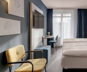
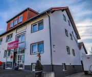
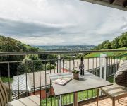
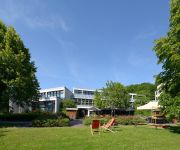
If you need a place to sleep, we compiled a list of available hotels close to the map centre further down the page.
Depending on your travel schedule, you might want to pay a visit to some of the following locations: Hennef, Rheinbreitbach, Windhagen, Bruchhausen and Vettelschoss. To further explore this place, just scroll down and browse the available info.
Local weather forecast
Todays Local Weather Conditions & Forecast: 2°C / 35 °F
| Morning Temperature | 0°C / 33 °F |
| Evening Temperature | 3°C / 38 °F |
| Night Temperature | 2°C / 36 °F |
| Chance of rainfall | 5% |
| Air Humidity | 90% |
| Air Pressure | 1005 hPa |
| Wind Speed | Fresh Breeze with 13 km/h (8 mph) from East |
| Cloud Conditions | Broken clouds, covering 77% of sky |
| General Conditions | Snow |
Saturday, 23rd of November 2024
4°C (40 °F)
5°C (40 °F)
Rain and snow, moderate breeze, overcast clouds.
Sunday, 24th of November 2024
12°C (53 °F)
11°C (52 °F)
Light rain, moderate breeze, overcast clouds.
Monday, 25th of November 2024
13°C (56 °F)
9°C (49 °F)
Light rain, moderate breeze, overcast clouds.
Hotels and Places to Stay
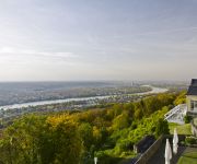
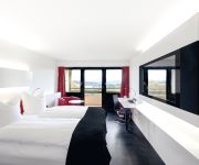
Steigenberger Grandhotel Petersberg
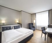
Dormero Hotel Bonn · Windhagen
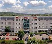
Euro Park Hotel
Seminaris
Avendi
Oelberg Garni
JUFA Hotel Königswinter/Bonn
Commundo Tagungshotel
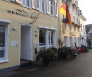
Weinhaus Hoff
Johnel
Videos from this area
These are videos related to the place based on their proximity to this place.
Adventsliedersingen im Haus Schlesien
Chore aus der Region im Haus Schlesien Königswinter. 21. Dezember 2013.
Let's Play Minecraft Cliche [720p] - Part 9 - Neue Base + Nahtoderfahrung...!
Öffne hier die Beschreibung ▽ | Playlist: http://bit.ly/1DeurFA | Schreib doch 'nen Kommentar! :) Wär cool: http://bit.ly/1DsaV8k ▫ Bitte bewerten! | Twitter: http://bit.ly/ZLvpu5...
Ofenkaul Trail - 03.08.2014 ( Siebengebirge )
Teilstück des Trails vorbei an den Höhleneingängen der Ofelnkaule.
Geisbergabfahrt in Richtung Milchhäuschen bzw. Bolverhahn
Abfahrt vom Geisberg in Richtung Milchhäuschen. Bin aber sauber am Häuschen vorbei ;-) und unterhalb des Bolvershahn gelandent. Trotzdem lustiger Trail....
Siebengebirg's Rundflug Mai 2012
Rundflug von Bonn-Hangelar über Bonn Bad-Godesberg zum Drachenfels und zurück über die Löwenburg und den Petersberg.
Haus Schlesien
HAUS SCHLESIEN wurde im Jahr 1978 mit dem Ziel gegründet, in Kooperation mit vergleichbaren Einrichtungen in Polen und Tschechien das schlesische Kulturerbe zu bewahren. Die Sammlungen ...
Videos provided by Youtube are under the copyright of their owners.
Attractions and noteworthy things
Distances are based on the centre of the city/town and sightseeing location. This list contains brief abstracts about monuments, holiday activities, national parcs, museums, organisations and more from the area as well as interesting facts about the region itself. Where available, you'll find the corresponding homepage. Otherwise the related wikipedia article.
Rhein-Sieg-Kreis
The Rhein-Sieg-Kreis is a Kreis (district) in the south of North Rhine-Westphalia, Germany. Neighboring districts are Rheinisch-Bergischer Kreis, Oberbergischer Kreis, Altenkirchen, Neuwied, Ahrweiler, Euskirchen, Rhein-Erft-Kreis, the urban district of Cologne. Nearly completely surrounded by the district is the city of Bonn.
Drachenfels Railway
The Drachenfels Railway or Drachenfelsbahn is a rack railway line in the North Rhine-Westphalia region of Germany. The line runs from Königswinter to the summit of the Drachenfels mountain at an altitude of 289 m . Besides the two terminal stations, an intermediate station serves the Schloss Drachenburg. The Drachenfels Railway is one of only four rack railways still operational in Germany, along with the Bavarian Zugspitze Railway, the Stuttgart Rack Railway and the Wendelstein Railway.
Siebengebirge
The Siebengebirge (lit. "seven hills" in German) is a German upland range to the East of the Rhine, southeast of Bonn, consisting of more than 40 hills. It is located in the municipalities of Bad Honnef and Königswinter. It is of volcanic origin and came into being between 28 and 15 million years ago. Much of the territory covered by the Siebengebirge belongs to the Naturpark Siebengebirge, which is under environmental protection. The highest peak is the Ölberg at 460 metres.
Drachenfels (Siebengebirge)
The Drachenfels is a mountain 321 metres in the Siebengebirge mountain range between Königswinter and Bad Honnef in Germany.
Hotel Petersberg
Hotel Petersberg is a hotel and official guest house of the Federal Republic of Germany, termed the "Bundesgästehaus" (the official title being Gästehaus der Verfassungsorgane der Bundesrepublik Deutschland). It is located on the Petersberg, a prominent mountain of the Siebengebirge near Bonn, Germany. With a height of 331 metres, it overlooks the cities of Königswinter, on the right bank of the Rhine river, and Bonn on the opposite side.
Nonnenwerth
Nonnenwerth is an island near Bad Honnef in the Rhine, upriver from Cologne, administratively part of Remagen in Rhineland-Palatinate.
Heisterbach Abbey
Heisterbach Abbey (Kloster Heisterbach; also Petersthal, formerly Petersberg) was a Cistercian monastery in the Siebengebirge near Oberdollendorf in North Rhine-Westphalia, Germany.
Rodderberg
The Rodderberg is an extinct volcano in the east of the municipality of Wachtberg near Bonn, Germany. The last eruption was 250,000 years ago. It is situated just above the Rhine-valley. Together with the Drachenfels directly opposite, the Rodderberg narrows the Rhine-valley. This gorge portion is the southern limit of the lowland-bay of Cologne. The Rodderberg offers views to the Siebengebirge, the Rhine-valley and up to the Cologne Cathedral, about 50 km away.
CJD Christophorusschule Königswinter
The CJD Christophorusschule Königswinter is a state recognized private, alternative school located in Rhein-Sieg-Kreis, and is run by the Christliches Jugenddorfwerk Deutschlands (Christian Youth Village Foundation of Germany – CJD). The school consists of a secondary school and a high school, which correspond to the state equivalents. The Christophorusschule has about 1,350 male and female students (including 360 in the secondary school), and about 95 teachers for instruction.
Rolandseck station
Rolandseck station in Rolandseck near Remagen, Germany, built in 1856, is considered an important part of the cultural heritage of the Rhineland and a significant early Germany railway building. It is the northernmost railway station on the West Rhine railway in Rhineland-Palatinate.
Rederscheid
Rederscheid is a village in the municipality of Windhagen in the district of Neuwied, Rhineland-Palatinate, Germany. The village has about 500 inhabitants in 100 households. Rederscheid was incorporated into Windhagen on November 8, 1970.
Breite Heide
Breite Heide is a locality in the municipality Rheinbreitbach in the district of Neuwied in Rhineland-Palatinate, Germany.
Frohnen
Frohnen is a locality in the municipality Windhagen in the district of Neuwied in Rhineland-Palatinate, Germany.
Hallerbach
Hallerbach is a locality in the municipality Windhagen in the district of Neuwied in Rhineland-Palatinate, Germany.
Schweifeld
Schweifeld is a locality in the municipality Windhagen in the district of Neuwied in Rhineland-Palatinate, Germany.
Köhlershohn
Köhlershohn is a locality in the municipality Windhagen in the district of Neuwied in Rhineland-Palatinate, Germany.
Niederwindhagen
Niederwindhagen is a locality in the municipality Windhagen in the district of Neuwied in Rhineland-Palatinate, Germany.
Oberwindhagen
Oberwindhagen is a locality in the municipality Windhagen in the district of Neuwied in Rhineland-Palatinate, Germany.
Allner See
Allner See is a lake in Rhein-Sieg-Kreis, North Rhine-Westphalia, Germany. At an elevation of 63,5 m, its surface area is 0.10 km².
Schloss Drachenburg
Schloss Drachenburg is a private Villa in Palace style constructed in the late 19th century. In only two years 1882 till 1884 it was completed on the Drachenfels hill in Königswinter, a German town at the Rhine River near the city of Bonn. Baron Stephan von Sarter (1833–1902) a broker and banker planned to live there, but never did. Today the Palace is in the possession of the State Foundation of North Rhine-Westphalia. It is served by an intermediate station on the Drachenfels Railway.
Bröl
The Bröl (also called the Brölbach or the Homburgische Bröl) is a 45.1 km long right tributary of the Sieg River in North Rhine-Westphalia, Germany. The river flows through the districts of Rhein-Sieg-Kreis and Oberbergischer Kreis. The river's source is in the town of Waldbröl at an elevation of 368 meters above sea level. It flows in a southwest direction through the Bergisches Land and past the Homburg Castle.
Hennef (Sieg) station
Hennef (Sieg) station is located on the Sieg Railway in the town of Hennef (Sieg) in the German state of North Rhine-Westphalia. It was opened in 1859 for passenger and freight traffic by the Cologne-Minden Railway Company along with the Sieg Railway.
Bonn-Mehlem station
Bonn-Mehlem station is a through station in the Bonn district of Lannesdorf in the German state of North Rhine-Westphalia. It has three platform tracks and is located on the Left Rhine line south of Bonn Hauptbahnhof. The station also is served by buses and has parking spaces. It is classified by Deutsche Bahn as a category 4 station.
Hennef im Siegbogen station
Hennef Im Siegbogen station is a through station in the town of Hennef in the German state of North Rhine-Westphalia. The station was opened on 11 December 2012 on a section of the Sieg Railway, opened by the Cologne-Minden Railway Company (German: Cöln-Mindener Eisenbahn-Gesellschaft, CME) between Hennef (Sieg) and Eitorf on 1 August 1860. It has two platform tracks and is classified by Deutsche Bahn as a category 5 station.
Blankenberg (Sieg) station
Blankenberg (Sieg) station is a through station in the town of Hennef in the German state of North Rhine-Westphalia. The station was opened in 1860/61 on a section of the Sieg Railway, opened by the Cologne-Minden Railway Company (German: Cöln-Mindener Eisenbahn-Gesellschaft, CME) between Hennef (Sieg) and Eitorf on 1 August 1860. It has two platform tracks and is classified by Deutsche Bahn as a category 6 station.




!['Let's Play Minecraft Cliche [720p] - Part 9 - Neue Base + Nahtoderfahrung...!' preview picture of video 'Let's Play Minecraft Cliche [720p] - Part 9 - Neue Base + Nahtoderfahrung...!'](https://img.youtube.com/vi/AmVkJ9r8GZc/mqdefault.jpg)


