Safety Score: 3,0 of 5.0 based on data from 9 authorites. Meaning we advice caution when travelling to Germany.
Travel warnings are updated daily. Source: Travel Warning Germany. Last Update: 2024-08-13 08:21:03
Discover Suhrendorf
Suhrendorf in Mecklenburg-Vorpommern is a city in Germany about 134 mi (or 216 km) north of Berlin, the country's capital city.
Local time in Suhrendorf is now 01:34 PM (Friday). The local timezone is named Europe / Berlin with an UTC offset of one hour. We know of 10 airports in the vicinity of Suhrendorf, of which 4 are larger airports. The closest airport in Germany is Barth Airport in a distance of 19 mi (or 31 km), South-West. Besides the airports, there are other travel options available (check left side).
There are several Unesco world heritage sites nearby. The closest heritage site in Germany is Historic Centres of Stralsund and Wismar in a distance of 11 mi (or 18 km), South. We discovered 3 points of interest in the vicinity of this place. Looking for a place to stay? we compiled a list of available hotels close to the map centre further down the page.
When in this area, you might want to pay a visit to some of the following locations: Stralsund, Zingst, Greifswald, Neubrandenburg and Trelleborg. To further explore this place, just scroll down and browse the available info.
Local weather forecast
Todays Local Weather Conditions & Forecast: 9°C / 48 °F
| Morning Temperature | 5°C / 41 °F |
| Evening Temperature | 11°C / 52 °F |
| Night Temperature | 11°C / 51 °F |
| Chance of rainfall | 0% |
| Air Humidity | 91% |
| Air Pressure | 1020 hPa |
| Wind Speed | Moderate breeze with 13 km/h (8 mph) from East |
| Cloud Conditions | Broken clouds, covering 74% of sky |
| General Conditions | Broken clouds |
Saturday, 16th of November 2024
9°C (47 °F)
9°C (47 °F)
Light rain, fresh breeze, overcast clouds.
Sunday, 17th of November 2024
7°C (45 °F)
7°C (44 °F)
Light rain, fresh breeze, overcast clouds.
Monday, 18th of November 2024
5°C (41 °F)
3°C (37 °F)
Light rain, fresh breeze, overcast clouds.
Hotels and Places to Stay
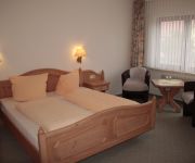
Landhotel Schafshorn
Videos from this area
These are videos related to the place based on their proximity to this place.
Rollstuhl Hiddensee
Mit dem Rollstuhl die Sonneneninsel Hiddensee erkunden. Los geht es mit der barrierefreien Fähre MF Vitte von Schaprode - Hiddensee. Da der Fährverkehr dem öffentlichen Nahverkehr angehört...
Schiffsausflug von Stralsund zur Insel Hiddensee / A boat trip from Stralsund to Hiddensee Island
besucht wurde der südliche Inselteil: die Orte Neuendorf mit Plogshagen, Süderleuchtturm, NSG Dünenheide und die "Inselhauptstadt" Vitte. There was visited the southern part of the island:...
Jugendtours-Feriendorf Insel Rügen
Das Jugendtours-Feriendorf Ummanz / Insel Rügen mit einer Kapazität von 280 Betten liegt mitten im Nationalpark Vorpommersche Boddenlandschaft. Ideal für Klassenfahrten, Trainingscamps,...
Videos provided by Youtube are under the copyright of their owners.
Attractions and noteworthy things
Distances are based on the centre of the city/town and sightseeing location. This list contains brief abstracts about monuments, holiday activities, national parcs, museums, organisations and more from the area as well as interesting facts about the region itself. Where available, you'll find the corresponding homepage. Otherwise the related wikipedia article.
Ummanz
The island of Ummanz lies in the Baltic Sea, off the west coast of the island of Rügen, and belongs, like the latter, to the county of Vorpommern-Rügen in the German state of Mecklenburg-Western Pomerania. Ummanz is around 20 square kilometres in area and thus, after Rügen, the second largest island in the former county of Rügen. It is part of the Western Pomerania Lagoon Area National Park.
Schaproder Bodden
The Schaproder Bodden is a bodden on the Baltic Sea coast between the island of Hiddensee in the west and the islands of Rügen and Ummanz in the east. To the north the Schaproder Bodden is linked to the Vitter Bodden by the so-called Trog between the Fährinsel and the Stolper Haken of Rügen island. To the south the bodden transitions into the Kubitzer Bodden.
Heuwiese
Heuwiese is an uninhabited German Baltic Sea island that lies about two kilometres south of Ummanz and west of Germany's largest island, Rügen. It has a maximum extend of 900 metres (from northwest to southeast) and is about 40 hectares in area. The island, which is over 1 metre high is a bird reserve that lies within the West Pomerania Lagoon Area National Park.


