Safety Score: 3,0 of 5.0 based on data from 9 authorites. Meaning we advice caution when travelling to Germany.
Travel warnings are updated daily. Source: Travel Warning Germany. Last Update: 2024-08-13 08:21:03
Touring Stavenhof
Stavenhof in Mecklenburg-Vorpommern is a town located in Germany about 83 mi (or 133 km) north of Berlin, the country's capital place.
Time in Stavenhof is now 10:45 AM (Friday). The local timezone is named Europe / Berlin with an UTC offset of one hour. We know of 11 airports nearby Stavenhof, of which 5 are larger airports. The closest airport in Germany is Neubrandenburg Airport in a distance of 16 mi (or 26 km), East. Besides the airports, there are other travel options available (check left side).
There are several Unesco world heritage sites nearby. The closest heritage site in Germany is Historic Centres of Stralsund and Wismar in a distance of 43 mi (or 70 km), North. Need some hints on where to stay? We compiled a list of available hotels close to the map centre further down the page.
Being here already, you might want to pay a visit to some of the following locations: Neubrandenburg, Greifswald, Grosswoltersdorf, Stralsund and Sonnenberg. To further explore this place, just scroll down and browse the available info.
Local weather forecast
Todays Local Weather Conditions & Forecast: 9°C / 48 °F
| Morning Temperature | 4°C / 39 °F |
| Evening Temperature | 10°C / 50 °F |
| Night Temperature | 10°C / 49 °F |
| Chance of rainfall | 0% |
| Air Humidity | 88% |
| Air Pressure | 1022 hPa |
| Wind Speed | Moderate breeze with 10 km/h (6 mph) from East |
| Cloud Conditions | Scattered clouds, covering 36% of sky |
| General Conditions | Scattered clouds |
Saturday, 16th of November 2024
9°C (47 °F)
8°C (47 °F)
Light rain, moderate breeze, broken clouds.
Sunday, 17th of November 2024
6°C (44 °F)
5°C (41 °F)
Moderate rain, fresh breeze, overcast clouds.
Monday, 18th of November 2024
3°C (38 °F)
3°C (38 °F)
Light rain, fresh breeze, overcast clouds.
Hotels and Places to Stay
Schloss Kittendorf
Schloss Bredenfelde
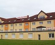
Reutereiche
Reuterhof
Videos from this area
These are videos related to the place based on their proximity to this place.
Schloss Ivenack - Innenansicht 2013
Schloss Ivenack 2013 Nach langer Zeit standen die Türen mal wieder offen. Das Schloss wird hier nur von innen gezeigt! Dem Zuschauer erwarten betörend schöne und zu gleich erschreckende...
Ostern 2013 Copter über Ivenack bei Stavenhagen
http://www.gelbemaus.de Videotestflug bei sehr starkem Wind, es wird so langsam besser.
Modellflugzeug U can fly über Ivenack bei Stavenhagen
Ein schöner Abend in MV http://www.Gelbemaus.de.
Cam Flug über Ivenack mit dem U can fly
http://www.Gelbemaus.de Die erste Sonne seid Wochen da musste doch glatt nen Flieger in die Luft. Es ist noch ganz schön frisch ;O)
Eine Runde mit dem U can fly durch die Dämmerung in Ivenack bei Stavenhagen mit Cam
http://www.Gelbemaus.de.
zweiter Flug neuer Hexa Copter 650 NAZA
http://www.PROVERAG.de Setup: - 650 Carbon Rahmen - 700kv Stein M100 Motoren - 12x6 Carbon Luftschrauben - 6A 4S Akku - 30A SimonK Regler - Abfluggewicht 2,3kg.
Videos provided by Youtube are under the copyright of their owners.
Attractions and noteworthy things
Distances are based on the centre of the city/town and sightseeing location. This list contains brief abstracts about monuments, holiday activities, national parcs, museums, organisations and more from the area as well as interesting facts about the region itself. Where available, you'll find the corresponding homepage. Otherwise the related wikipedia article.
Stavenhagen (Amt)
Stavenhagen is an Amt in the Mecklenburgische Seenplatte district, in Mecklenburg-Vorpommern, Germany. The seat of the Amt is in Stavenhagen. The Amt Stavenhagen consists of the following municipalities: Bredenfelde Briggow Grammentin Gülzow Ivenack Jürgenstorf Kittendorf Knorrendorf Mölln Ritzerow Rosenow Stavenhagen
Ivenacker See
Ivenacker See is a lake in the Mecklenburgische Seenplatte district in Mecklenburg-Vorpommern, Germany. At an elevation of 39.5 m, its surface area is 0.97 km².


