Safety Score: 3,0 of 5.0 based on data from 9 authorites. Meaning we advice caution when travelling to Germany.
Travel warnings are updated daily. Source: Travel Warning Germany. Last Update: 2024-08-13 08:21:03
Explore Maxfelde
Maxfelde in Mecklenburg-Vorpommern is located in Germany about 87 mi (or 140 km) north of Berlin, the country's capital.
Local time in Maxfelde is now 09:59 AM (Friday). The local timezone is named Europe / Berlin with an UTC offset of one hour. We know of 11 airports in the wider vicinity of Maxfelde, of which 5 are larger airports. The closest airport in Germany is Neubrandenburg Airport in a distance of 21 mi (or 34 km), South-East. Besides the airports, there are other travel options available (check left side).
There are several Unesco world heritage sites nearby. The closest heritage site in Germany is Historic Centres of Stralsund and Wismar in a distance of 40 mi (or 64 km), North. If you need a place to sleep, we compiled a list of available hotels close to the map centre further down the page.
Depending on your travel schedule, you might want to pay a visit to some of the following locations: Neubrandenburg, Stralsund, Greifswald, Guestrow and Zingst. To further explore this place, just scroll down and browse the available info.
Local weather forecast
Todays Local Weather Conditions & Forecast: 9°C / 48 °F
| Morning Temperature | 4°C / 39 °F |
| Evening Temperature | 10°C / 50 °F |
| Night Temperature | 10°C / 49 °F |
| Chance of rainfall | 0% |
| Air Humidity | 88% |
| Air Pressure | 1022 hPa |
| Wind Speed | Moderate breeze with 10 km/h (6 mph) from East |
| Cloud Conditions | Scattered clouds, covering 36% of sky |
| General Conditions | Scattered clouds |
Saturday, 16th of November 2024
9°C (47 °F)
8°C (47 °F)
Light rain, moderate breeze, broken clouds.
Sunday, 17th of November 2024
6°C (44 °F)
5°C (41 °F)
Moderate rain, fresh breeze, overcast clouds.
Monday, 18th of November 2024
3°C (38 °F)
3°C (38 °F)
Light rain, fresh breeze, overcast clouds.
Hotels and Places to Stay
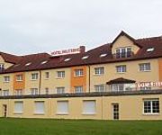
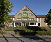
P1 Hotel und Ferienpark
Reuterhof
Reutereiche
Videos from this area
These are videos related to the place based on their proximity to this place.
Luftaufnahme auf die Gielower Mühle mit Sicht auf Malchin und Duckow
http://www.Gelbemaus.de Musik von http://www.ende.tv.
Hochwasser an der Peene 2011
im Oberlaufe der Peene; Gielower Mühle, in der nähe vom Jägerhof Malchin.
Luftaufnahme mit dem Hexacopter am Kummerower See mit Sicht auf Gravelotte und Verchen
http://www.Gelbemaus.de.
Videos provided by Youtube are under the copyright of their owners.


