Safety Score: 3,0 of 5.0 based on data from 9 authorites. Meaning we advice caution when travelling to Germany.
Travel warnings are updated daily. Source: Travel Warning Germany. Last Update: 2024-08-13 08:21:03
Explore Schlüte
Schlüte in Lower Saxony is located in Germany about 211 mi (or 340 km) west of Berlin, the country's capital.
Local time in Schlüte is now 04:46 PM (Friday). The local timezone is named Europe / Berlin with an UTC offset of one hour. We know of 7 airports in the wider vicinity of Schlüte, of which 3 are larger airports. The closest airport in Germany is Lemwerder Airport in a distance of 7 mi (or 12 km), South-East. Besides the airports, there are other travel options available (check left side).
There are several Unesco world heritage sites nearby. The closest heritage site in Germany is Town Hall and Roland on the Marketplace of Bremen in a distance of 16 mi (or 26 km), South-East. If you need a place to sleep, we compiled a list of available hotels close to the map centre further down the page.
Depending on your travel schedule, you might want to pay a visit to some of the following locations: Schwanewede, Brake (Unterweser), Lemwerder, Ovelgonne and Uthlede. To further explore this place, just scroll down and browse the available info.
Local weather forecast
Todays Local Weather Conditions & Forecast: 3°C / 37 °F
| Morning Temperature | -1°C / 31 °F |
| Evening Temperature | 1°C / 35 °F |
| Night Temperature | 0°C / 32 °F |
| Chance of rainfall | 0% |
| Air Humidity | 87% |
| Air Pressure | 996 hPa |
| Wind Speed | Moderate breeze with 12 km/h (8 mph) from North-East |
| Cloud Conditions | Broken clouds, covering 77% of sky |
| General Conditions | Rain and snow |
Saturday, 23rd of November 2024
3°C (37 °F)
4°C (39 °F)
Rain and snow, moderate breeze, overcast clouds.
Sunday, 24th of November 2024
10°C (50 °F)
10°C (51 °F)
Moderate rain, moderate breeze, overcast clouds.
Monday, 25th of November 2024
12°C (54 °F)
8°C (46 °F)
Light rain, fresh breeze, overcast clouds.
Hotels and Places to Stay
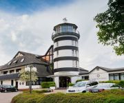
Fährhaus Farge Ringhotel
Weserblick
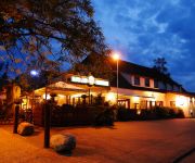
Burgdorfs Hotel & Restaurant
Videos from this area
These are videos related to the place based on their proximity to this place.
U-Boot-Bunker Valentin in Farge, Begleitung eines Seminars
MUS hat bisher immer nur Berichte von schönen Geschichten gebracht. Wir hatten uns abgesprochen, keine Reportagen oder Berichte über unschöne oder böse Ereignisse zu veröffentlichen....
Valentin U-Boot bunkier (Bremen Farge - Rekum).avi
PL Bunkier był budowany w latach 1943-45. Ukończono go w 85%. Jest to największy w Niemczech oraz drugi, co do wielkości wybudowany bunkier przez Niemców. Miała być to stocznia końcowa...
U-Boot-Bunker Valentin Bremen-Farge
Filmschwenk über das größte Loch im Bunkerdach mit herabhängenden Stahlbetonträgern. Der U-Boot-Bunker Valentin in Bremen-Farge wurde innerhalb von 23 Monaten gebaut. Er zeugt von ...
Mach!bar - Tag der offenen Tür
Mach!bar - Tag der offenen Tür am 26. April 2014 in Berne. Mehr tolle Eindrücke und Bilder gibt es hier: https://www.flickr.com/photos/ejo-wesermarsch/sets/72157644303082736/
Schlauchboottour 20.04.2014 / Weser Bremen
Mit dem Rib Schlauchboot auf der Weser, 20.04.2014, ca. 30 Km/h Wind... Dass der Bug ständig in den Himmel zeigt liegt an den Wellen und an der Tatsache, daß zusätzlich zu Fahrtwind noch...
Berne / Wesermarsch Ortsdurchfahrt auf der Bundesstraße B 212 (26.11.2011)
Auf der B212 durch Berne in der Wesermarsch.
Weser Stahl
Die WESER STAHL am 7.11.2010 auf der Weser bei Berne, Richtung Bremen fahrend. Länge: 192m, Breite: 32m, Baujahr: 1999, Flagge: Zypern.
Videos provided by Youtube are under the copyright of their owners.
Attractions and noteworthy things
Distances are based on the centre of the city/town and sightseeing location. This list contains brief abstracts about monuments, holiday activities, national parcs, museums, organisations and more from the area as well as interesting facts about the region itself. Where available, you'll find the corresponding homepage. Otherwise the related wikipedia article.
Submarine pen
A submarine pen (U-Boot-Bunker in German) is a bunker which is designed to protect submarines from air attack. The term is generally applied to submarine bases constructed during World War II, particularly in Germany and the occupied countries which were also known as U-boat pens (after the phrase "U-boat" to refer to German submarines).
Elsfleth station
Elsfleth is the name of the railway station serving the town of Elsfleth in the German state of Lower Saxony. The line is electrified with passenger services provided by Class 425 regional EMUs operated by Deutsche Bahn AG. The station is expected to be integrated into the Bremen S-Bahn network once it becomes operational.
Berne station
Berne is the name of the railway station serving the municipality of Berne in the German state of Lower Saxony. The line is electrified with passenger services provided by Class 425 regional EMUs operated by Deutsche Bahn AG. The station is expected to be integrated into the Bremen S-Bahn network once it becomes operational.


