Safety Score: 3,0 of 5.0 based on data from 9 authorites. Meaning we advice caution when travelling to Germany.
Travel warnings are updated daily. Source: Travel Warning Germany. Last Update: 2024-08-13 08:21:03
Delve into Räbke
Räbke in Lower Saxony with it's 679 habitants is a town located in Germany about 109 mi (or 176 km) west of Berlin, the country's capital town.
Time in Räbke is now 07:05 PM (Thursday). The local timezone is named Europe / Berlin with an UTC offset of one hour. We know of 11 airports closer to Räbke, of which 5 are larger airports. The closest airport in Germany is Braunschweig Wolfsburg Airport in a distance of 16 mi (or 26 km), North-West. Besides the airports, there are other travel options available (check left side).
There are several Unesco world heritage sites nearby. The closest heritage site in Germany is Collegiate Church, Castle and Old Town of Quedlinburg in a distance of 31 mi (or 50 km), South-East. In need of a room? We compiled a list of available hotels close to the map centre further down the page.
Since you are here already, you might want to pay a visit to some of the following locations: Frellstedt, Supplingen, Warberg, Wolsdorf and Supplingenburg. To further explore this place, just scroll down and browse the available info.
Local weather forecast
Todays Local Weather Conditions & Forecast: 3°C / 37 °F
| Morning Temperature | 1°C / 33 °F |
| Evening Temperature | 1°C / 34 °F |
| Night Temperature | 0°C / 32 °F |
| Chance of rainfall | 0% |
| Air Humidity | 72% |
| Air Pressure | 996 hPa |
| Wind Speed | Fresh Breeze with 14 km/h (8 mph) from East |
| Cloud Conditions | Broken clouds, covering 68% of sky |
| General Conditions | Light snow |
Friday, 22nd of November 2024
2°C (36 °F)
2°C (35 °F)
Rain and snow, fresh breeze, broken clouds.
Saturday, 23rd of November 2024
4°C (38 °F)
3°C (38 °F)
Overcast clouds, moderate breeze.
Sunday, 24th of November 2024
11°C (52 °F)
8°C (47 °F)
Moderate rain, fresh breeze, overcast clouds.
Hotels and Places to Stay
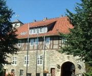
Burg Warberg
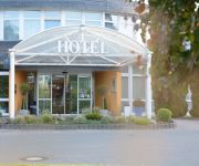
Avalon Hotelpark Königshof
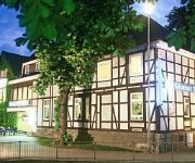
Kärntner Stub`n
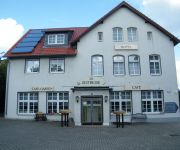
Zeitreise
Videos from this area
These are videos related to the place based on their proximity to this place.
1984 - Impressionen von Emmerstedt
Emmerstedt war bis 1973 eine Selbständige Gemeinde und ist jetzt ein Ortsteil von Helmstedt und liegt in Niedersachsen an der Grenze zu Sachsen-Anhalt, zwischen Braunschweig und Magdeburg....
Schöninger Landmarkt 2012
Auf dem Schöninger Landmarkt stellten auch 2012 mehr als 60 Händler aus der Region ihre Waren aus. Zu den diesjährigen Highlights gehörte auch eine Vorführung des Geflügelzüchtervereins...
Eisparty des JFZ - 11.02.2012 - Schöningen unkommentiert
Bitte mindestens in 720p (HD) anschauen. Produziert für Mein-Schoeningen.de. Einbettung auf anderen Websiten erlaubt. Als neue Medien-Rubrik für Mein-Schoeningen.de präsentieren wir ihnen...
Die Wallgärtner August - September 2012 - Schöningen unkommentiert
Bitte mindestens in 720p (HD) anschauen. Produziert für Mein-Schoeningen.de. Einbettung auf anderen Websiten erlaubt. Mein-Schoeningen.de präsentiert ihnen die Video-Reihe „Schöningen...
Schloßfest der SPD - 07.07.2012 - Schöningen unkommentiert
Bitte mindestens in 720p (HD) anschauen. Produziert für Mein-Schoeningen.de. Einbettung auf anderen Websiten erlaubt. Als neue Medien-Rubrik für Mein-Schoeningen.de präsentieren wir ihnen...
Schöninger Osterfeuer - 30.03.2013 - Schöningen unkommentiert
Bitte mindestens in 720p (HD) anschauen. Produziert für Mein-Schoeningen.de. Einbettung auf anderen Websiten erlaubt. Mein-Schoeningen.de präsentiert ihnen die Video-Reihe „Schöningen...
Landmarkt der CWG - 29.04.2012 - Schöningen unkommentiert
Bitte mindestens in 720p (HD) anschauen. Produziert für Mein-Schoeningen.de. Einbettung auf anderen Websiten erlaubt. Als neue Medien-Rubrik für Mein-Schoeningen.de präsentieren wir ihnen...
Videos provided by Youtube are under the copyright of their owners.
Attractions and noteworthy things
Distances are based on the centre of the city/town and sightseeing location. This list contains brief abstracts about monuments, holiday activities, national parcs, museums, organisations and more from the area as well as interesting facts about the region itself. Where available, you'll find the corresponding homepage. Otherwise the related wikipedia article.
Schunter
The Schunter is a river in Lower Saxony, Germany, with a length of 58 km, right tributary of the Oker. It originates in the Elm hills near Räbke west of Helmstedt, flows northward to Süpplingenburg, then turns westward and joins the Oker at Schwülper, downstream of Braunschweig (Brunswick). Another municipality on the Schunter is Lehre. The river was first mentioned as Schuntra in a 781 deed. The name may be of Slavic origin as sukątora means "with many angles".
Nord-Elm
Nord-Elm is a federation of municipalities in Helmstedt, Lower Saxony. It is named after the Elm, on the northern edge of which it is located. Nord-Elm has an area of 63 km² and a population of 6,200 (2003); its capital is Süpplingen. It was founded in 1969. Member municipalities: Frellstedt Räbke Süpplingen Süpplingenburg Warberg Wolsdorf {{#invoke:Coordinates|coord}}{{#coordinates:52.2333333333|N|10.9166666667|E|source:dewiki_region:DE-NI_type:adm2nd|||| |primary |name= }}
Elm-Lappwald Nature Park
The Elm-Lappwald Nature Park is a nature park in southwest Lower Saxony, east of Brunswick in central Germany. It is dominated by the forested hill ranges of the Elm, Lappwald and Dorm as well as the region known as the Helmstedt Bowl (Helmstedter Mulde). Reitling valley in the Elm


